Maps of Jurbarko rajono savivaldybė

19. Wischwill. (Germany)
1 : 100000 Reichsamt fur Landesaufnahme
Composite: 19. Wischwill. (Germany)
1 : 100000 Reichsamt fur Landesaufnahme
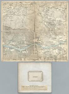
Meßtischblatt 09101 : Schmalleningken, 1939
1 : 250000 Schmalleningken. - Hrsg. 1915, einzl. Nachtr. 1927, redakt. Änd. 1938. - 1:25000. - [Berlin]: Reichsamt für Landesaufnahme, 1939. - 1 Kt.
Meßtischblatt 09100 : Wischwill, 1941
1 : 250000 Wischwill. - Aufn. 1913, hrsg. 1915, letzt. Nachtr. 1940, Aus. - 1:25000. - [Berlin]: Reichsamt für Landesaufnahme, 1941. - 1 Kt.
Meßtischblatt 08101 : Forst Schmalleningken, 1939
1 : 250000 Forst Schmalleningken. - Hrsg. 1915, redakt. Änd. 1939. - 1:25000. - [Berlin]: Reichsamt für Landesaufnahme, 1939. - 1 Kt.
Meßtischblatt 08100 : Leibgirren, 1939
1 : 250000 Leibgirren. - Hrsg. 1915, redakt. Änd. 1939. - 1:25000. - [Berlin]: Reichsamt für Landesaufnahme, 1939. - 1 Kt.
Sect. 5. Jura (Das Jura Becken (Schalaunen)), uit: Geologische Karte der Provinz Preussen
1 : 100000 Annotatie: Incompleet; Voor aanwezige bladen zie bladoverzicht; Met inzetkaarten; Annotatie geografische gegevens: Coördinaten gebaseerd op nulmeridiaan van Ferro (Hierro) Berlin : Neumann
Meßtischblatt 0999 : Baltupönen, 1939
1 : 250000 Baltupönen. - Aufn. 1913, hrsg. 1915, letzt. Nachtr. 1939/40. - 1:25000. - [Berlin]: Reichsamt für Landesaufnahme, 1939. - 1 Kt.
Meßtischblatt 0899 : Szugken, 1939
1 : 250000 Szugken. - Hrsg. 1915, redakt. Änd. 1939. - 1:25000. - [Berlin]: Reichsamt für Landesaufnahme, 1939. - 1 Kt.
Regni Borussiae Episcopatus Warmiensis Palatinatus Mariaeburgensis et Culmensis cum Territorio Dantiscano et Ichnographia Urbis Regiomontis].
Mollova mapová sbírka
Composite: 33. Pillkallen. (34. Schirwindt). (Germany)
1 : 100000 Reichsamt fur Landesaufnahme
10. Medischkehmen. (18. Tilsit). (Germany)
1 : 100000 Reichsamt fur Landesaufnahme
Composite: 10. Medischkehmen. (18. Tilsit). (Germany)
1 : 100000 Reichsamt fur Landesaufnahme
Messtischblatt 10102-10103 : Grenzhöhe, 1927 Grenzhöhe
1 : 250000 Grenzhöhe. - Hrsg. 1915, bericht. 1927. - 1:25000. - [Berlin]: Reichsamt für Landesaufnahme, 1927. - 1 Kt.
Messstichblatt 10101 : Tulpeningen, 1938 Tulpeningen
1 : 250000 Tulpeningen. - Hrsg. 1915, bericht. 1927, redakt. Änd. 1938. - 1:25000. - [Berlin]: Reichsamt für Landesaufnahme, 1938. - 1 Kt.
Messtischblatt 10100 : Haselberg, 1940 Haselberg
1 : 250000 Haselberg. - Aufn. 1913, hrsg. 1915, letzt. Nachtr. 1939, Aus. - 1:25000. - [Berlin]: Reichsamt für Landesaufnahme, 1940. - 1 Kt.
Meßtischblatt 49, neue Nr. 0799 : Laugszargen, 1939
1 : 250000 Laugszargen. - Hrsg. 1915, redakt. Änd. 1939. - 1:25000. - [Berlin]: Reichsamt für Landesaufnahme, 1939. - 1 Kt.
Generalkarte von Zentraleuropa

Regni Borussiae Episcopatus Warmiensis Palatinatus Mariaeburgensis et Culmensis cum Territorio Dantiscano et Ichnographia Urbis Regiomontis].
Mollova mapová sbírka
Winterschlacht in Masuren
1 : 2000000 Masuren Schlacht, Weltkrieg <1914-1918>
Sect. 5: Königsberg, uit: Geologische Karte des Deutschen Reichs in 27 Blaettern / [von] Richard Lepsius ; Red. von C. Vogel
1 : 500000 Annotatie: Blad 18 ontbreekt; Een aantal bladen op linnen; Een aantal bladen gereviseerd 1913-1914; Annotatie geografische gegevens: Met schaalstokken o.a. in kilometers; Legenda Carl Vogel 1828-1897 Gotha : Justus Perthes
Provinz Ostpreussen
1 : 1250000 Ostpreußen
Litauisch und Masurisch
Ostpreußen Litauisch, Masurisch
Ost-Preussen.
1 : 935000 Flemming, Carl
Plan einer trigonometrischen Ausmessung welche in den Jahren 1796 und 1797 in Ostpreussen und Lithauen ausgeführt worden
1 : 800000 Landes-Industrie-Comptoir

Übersichtskarte von Mittel - Europa

Provinz Ost - Preussen

Riga, Libau, Memel, Kowno
1 : 750000 Kaunas (Litva) K. u. k. Militärgeographisches Institut