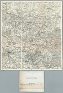
Maps of Pagėgių savivaldybė

10. Medischkehmen. (18. Tilsit). (Germany)
1 : 100000 Reichsamt fur Landesaufnahme
Composite: 10. Medischkehmen. (18. Tilsit). (Germany)
1 : 100000 Reichsamt fur Landesaufnahme
Meßtischblatt 0998 : Ragnit, 1939
1 : 250000 Ragnit. - Aufn. 1913, hrsg. 1915, letzt. Nachtr. 1939. - 1:25000. - [Berlin]: Reichsamt für Landesaufnahme, 1939. - 1 Kt.
Meßtischblatt 0997 : Tilsit, 1927
1 : 250000 Tilsit. - Hrsg. 1915, einzl. Nachtr. 1927. - 1:25000. - [Berlin]: Reichsamt für Landesaufnahme, 1927. - 1 Kt.
Meßtischblatt 0999 : Baltupönen, 1939
1 : 250000 Baltupönen. - Aufn. 1913, hrsg. 1915, letzt. Nachtr. 1939/40. - 1:25000. - [Berlin]: Reichsamt für Landesaufnahme, 1939. - 1 Kt.
Meßtischblatt 0898 : Willkischken, 1941
1 : 250000 Willkischken. - Aufn. 1913, hrsg. 1915, letzt. Nachtr. 1940, Aus. - 1:25000. - [Berlin]: Reichsamt für Landesaufnahme, 1941. - 1 Kt.
Meßtischblatt 0897 : Pogegen, 1940
1 : 250000 Pogegen. - Aufn. 1913, hrsg. 1915, letzt. Nachtr. 1940. - 1:25000. - [Berlin]: Reichsamt für Landesaufnahme, 1940. - 1 Kt.
Meßtischblatt 0899 : Szugken, 1939
1 : 250000 Szugken. - Hrsg. 1915, redakt. Änd. 1939. - 1:25000. - [Berlin]: Reichsamt für Landesaufnahme, 1939. - 1 Kt.
Meßtischblatt 0798 : Uszkullmen, 1939
1 : 250000 Uszkullmen. - Hrsg. 1915, redakt. Änd. 1939. - 1:25000. - [Berlin]: Reichsamt für Landesaufnahme, 1939. - 1 Kt.
Meßtischblatt 0797 : Nattkischken, 1939
1 : 250000 Nattkischken. - Hrsg. 1915, redakt. Änd. 1939. - 1:25000. - [Berlin]: Reichsamt für Landesaufnahme, 1939. - 1 Kt.
Meßtischblatt 49, neue Nr. 0799 : Laugszargen, 1939
1 : 250000 Laugszargen. - Hrsg. 1915, redakt. Änd. 1939. - 1:25000. - [Berlin]: Reichsamt für Landesaufnahme, 1939. - 1 Kt.
Sect. 5. Jura (Das Jura Becken (Schalaunen)), uit: Geologische Karte der Provinz Preussen
1 : 100000 Annotatie: Incompleet; Voor aanwezige bladen zie bladoverzicht; Met inzetkaarten; Annotatie geografische gegevens: Coördinaten gebaseerd op nulmeridiaan van Ferro (Hierro) Berlin : Neumann
Sect. 4. Tilsit (Das Memel Delta (Schalaunen)), uit: Geologische Karte der Provinz Preussen
1 : 100000 Annotatie: Incompleet; Voor aanwezige bladen zie bladoverzicht; Met inzetkaarten; Annotatie geografische gegevens: Coördinaten gebaseerd op nulmeridiaan van Ferro (Hierro) Berlin : Neumann
Meßtischblatt 32, neue Nr. 0697 : Ackmonischken, 1939
1 : 250000 Ackmonischken. - Hrsg. 1915, redakt. Änd. 1939. - 1:25000. - [Berlin]: Reichsamt für Landesaufnahme, 1939. - 1 Kt.
Tilsit 8, uit: Special-Karte von Mittel-Europa / nach amtlichen Quellen bearbeitet von W. Liebenow
1 : 300000 titelvariant: W. Liebenow's Mittel-Europa; Annotatie: Titel boven de bladen: W. Liebenow's Mittel-Europa Johannes Wilhelm Liebenow 1822-1897 Frankfurt a. M. : Ludwig Ravenstein
Composite: 31. Skaisgirren. (Germany)
1 : 100000 Reichsamt fur Landesaufnahme
19. Wischwill. (Germany)
1 : 100000 Reichsamt fur Landesaufnahme
Meßtischblatt 08100 : Leibgirren, 1939
1 : 250000 Leibgirren. - Hrsg. 1915, redakt. Änd. 1939. - 1:25000. - [Berlin]: Reichsamt für Landesaufnahme, 1939. - 1 Kt.
Meßtischblatt 09100 : Wischwill, 1941
1 : 250000 Wischwill. - Aufn. 1913, hrsg. 1915, letzt. Nachtr. 1940, Aus. - 1:25000. - [Berlin]: Reichsamt für Landesaufnahme, 1941. - 1 Kt.
Messtischblatt 1099 : Altenkirch, 1939 Altenkirch
1 : 250000 Altenkirch. - Aufn. 1913, hrsg. 1915, letzt. Nachtr. 1939. - 1:25000. - [Berlin]: Reichsamt für Landesaufnahme, 1939. - 1 Kt.
Messtischblatt 1098 : Hohensalzburg, 1938 Hohensalzburg
1 : 250000 Hohensalzburg. - Hrsg. 1915, einz. Nachtr. 1927, redakt. Änd. 193. - 1:25000. - [Berlin]: Reichsamt für Landesaufnahme, 1938. - 1 Kt.
Messtischblatt 1097 : Schillen, 1938 Schillen
1 : 250000 Schillen. - Hrsg. 1915, einz. Nachtr. 1927, redakt. Änd. 193. - 1:25000. - [Berlin]: Reichsamt für Landesaufnahme, 1938. - 1 Kt.
Generalkarte von Zentraleuropa

Potentissimo BORUSSORUM REGI FRIDERICO WILHELMO, Majestate, Fortitudine Clementia Augustissimo
1 : 200000 Kaliningrad-oblast (Rusko) Betgen, Johann F. Homanniani Heredes
Regni Borussiae Episcopatus Warmiensis Palatinatus Mariaeburgensis et Culmensis cum Territorio Dantiscano et Ichnographia Urbis Regiomontis].
Mollova mapová sbírka

Sect. 5: Königsberg, uit: Geologische Karte des Deutschen Reichs in 27 Blaettern / [von] Richard Lepsius ; Red. von C. Vogel
1 : 500000 Annotatie: Blad 18 ontbreekt; Een aantal bladen op linnen; Een aantal bladen gereviseerd 1913-1914; Annotatie geografische gegevens: Met schaalstokken o.a. in kilometers; Legenda Carl Vogel 1828-1897 Gotha : Justus Perthes
Provinz Ostpreussen
1 : 1250000 Ostpreußen
Litauisch und Masurisch
Ostpreußen Litauisch, Masurisch