Maps of San Mateo County

Composite: Map Of The Region Adjacent To The Bay Of San Francisco.
1 : 126720 Geological Survey of California
Shell San Francisco and Vicinity.
1 : 300960 Shell Oil Company
San Francisco Bay showing San Andreas Rift.
1 : 198000 California. State Earthquake Investigation Commission
California: San Francisco Bay Cities -- Political.
1 : 63360 Thomas Bros. Maps
Wichtigsten Hafen und Rheden, Goldregion von Californien.
Hartmann, Carl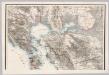
North Sheet: Map Of The Region Adjacent To The Bay Of San Francisco.
1 : 126720 Geological Survey of California
Port of San Francisco.
1 : 360000 La Perouse, Jean-Francois de Galaup, comte de, 1741-1788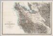
South Sheet: Map Of The Region Adjacent To The Bay Of San Francisco.
1 : 126720 Geological Survey of California
San Francisco and vicinity, California / R.B. Marshall, chief geographer
1 : 62500 Annotatie geografische gegevens: Opname: 1892-1913, bebouwing herz. in 1913-1914 Marshall, R. B. [Washington, D.C. : U.S. Geological Survey]
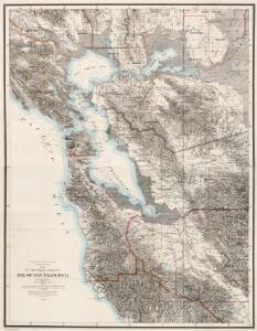
San Mateo, Santa Cruz, Santa Clara, Alameda, and Contra Costa Counties.
1 : 253440 Blum, George W.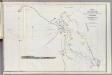
Farallones, San Francisco Bay.
1 : 151500 Stuart, F. D. (Fred. D.)
Port de St. Francois.
1 : 420000 La Perouse, Jean-Francois de Galaup, comte de, 1741-1788
Port de St. Francois.
1 : 420000 La Perouse, Jean-Francois de Galaup, comte de, 1741-1788
Port De San Francisco Dans La Haute Californie.
Duflot de Mofras, Eugene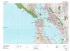
San Francisco
1 : 100000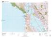
San Francisco
1 : 100000
Composite: San Francisco Bay Area Structure Sections. 1914.
1 : 62500 Merriam, John C.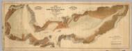
Map exhibiting the salt marsh ... lands adjacent to the bays of San Francisco and San Pablo.
1 : 50000 California. Board of State Harbor Commissioners for San Francisco Harbor
San Francisco and vicinity, California
1 : 62500 U.S. Geological Survey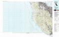
Palo Alto
1 : 100000
Palo Alto
1 : 100000
Alameda County map.
1 : 126720 Thompson & West
San Pablo Bay, Carquines Straits.
1 : 455000 Stuart, F. D. (Fred. D.)
Santa Cruz
1 : 125000
Santa Cruz
1 : 125000
Santa Cruz
1 : 125000
Santa Cruz
1 : 125000
Santa Cruz
1 : 125000
Santa Cruz
1 : 125000
Santa Cruz
1 : 125000