Maps of India
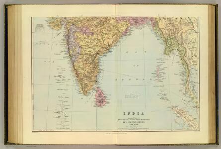
India South.
1 : 5448960 Stanford, Edward
India S.
1 : 4457000 Johnston, Alexander Keith, 1804-1871
Asia (Southern sheet).
1 : 14606000 Fisher, Richard Swainson
Composite: India.
1 : 4457000 Johnston, Alexander Keith, 1804-1871
Vorder Indien.
1 : 6100000 Weiland, C. F. (Carl Ferdinand), d. 1847
Vorder-Indien
Neuer Handatlas über alle Theile der Erde Kiepert, Heinrich Verlag von Dietrich Reimer
Vorder - Indien

Hindostan.
1 : 12672000 Burr, David H., 1803-1875
Composite: l'Inde.
1 : 3100000 Anville, Jean Baptiste Bourguignon d, 1697-1782
Hind, Hindoostan or India
A new general atlas of modern geography, consisting of a complete collection of maps of the four quarters of the globe Wyld, James James Wyld
Hind, Hindoostan, or India.
1 : 5650000 Faden, William, 1750?-1836
Hindostan or India.
1 : 9000000 Carey, Mathew
Map of Hindostan or India.
1 : 9500000 Carey, Mathew
Hindostan or India.
1 : 14572800 Carey, Mathew
Map of Hindostan or India.
1 : 10264320 Carey, Mathew
Map of Hindostan or India.
1 : 10264320 Carey, Mathew
Carte de l'Indostan servant à indiquer les possessions françaises en Asie
1 : 10000000 par A.M. Perrot gravé par les frères Malo Paris : Duprat-Duverger
Sinus Gangeticus; Vulgo Golfo De Bengala Nova descriptio. [Karte], in: Het vijfde Deel Des Grooten Atlas : Vervatende De Water-Weereld, S. 92.
1 Karte aus Atlas Jansson, Jan Jansson, Jan
Volker-Karte der Indischen Welt.
1 : 9400000 Berghaus, Heinrich
Sinus Gangeticus; vulgo Golfo de Bengala nova descriptio
1 : 4500000 Annotatie: Zeekaart; Kaart uitg. in de periode vanaf ca. 1650 tot ca. 1680; Origineel is Blad 190 in atlas factice; Annotatie geografische gegevens: Schaalstokken op de kaart: 45 Milliaria Germanica communia (=7,5 cm), en: 60 Milliaria Gallica communia (=7,5 cm); Westen boven Johannes Janssonius 1588-1664 [Amstelodami] : [Apud Ioannem Ianssonium]
Indien & Inner-Asien In 2 Blattern. (Sudliches Blatt)
1 : 7500000 Petermann, A.
Völker-Karte der Indischen Welt
Zweiter Band, enthaltend in vier Abtheilungen die Vertheilung der Organismen: 5. Pflanzen-Geographie, 6. Thier-Geographie, 7. Anthropographie, 8. Ethnographie Humboldt, Alexander von Verlag von Justus Perthes
India.
1 : 8400000 Sharpe, J.
Sinus Gangeticus: Vulgo Golfo De Bengala Nova descriptio. [Karte], in: Novus atlas absolutissimus, Bd. 9, S. 115.
1 Karte aus Atlas Janssonius Offizin
Hindostan.
1 : 17200000 Bowen, Frances
Carte de la Inde
1 : 9300000 Herbin de Halle, Etienne de.
[Vorder-Indien oder Ango-Indische Reich]
Hand-Atlas über alle Theile der Erde und über das Weltgebäude Stieler, Adolf Justus Perthes
Vorder-Indien oder das Indo-Britische Reich
Hand-Atlas über alle Theile der Erde nach dem neuesten Zustande und über das Weltgebäude Stieler, Adolf bei Justus Perthes
Bay of Bengal
Indian Ocean. Bay of Bengal. Compiled from the latest Government Surveys, 1880. London : Admiralty