Maps of Languedoc-Roussillon

France Flle. S.E.
1 : 1000000 Vivien St Martin, L.
Carte de la République française, 4
1 Blatt : 42 x 51 cm P.G. Chanlaire
Carte de la France, 4
1 Blatt : 61 x 83 cm de Belleyme
France S.E.
1 : 1615000 Migeon, J.
Carte de la France, 4
1 Blatt : mehrfarbig ; 61 x 82 cm de Belleyme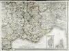
Carte de la France, 4
1 Blatt : 61 x 83 cm de Belleyme
[Frankreich in 4 Blättern, Südöstliches Frankreich]
Hand-Atlas über alle Theile der Erde und über das Weltgebäude Stieler, Adolf Justus Perthes
Frankreich SO.
1 : 1700000 Handtke, Friedrich H.
IX, uit: General-Karte von Mittel-Europa in 12 Blättern, im Masse 1:1.200.000 / entworfen, bearb. und hrsg. von Josef Schlacher
1 : 1200000 Annotatie: Blad 6 ontbreekt; Annotatie geografische gegevens: 21 maatstokken op blad 9; Legenda op blad 9 Wien : K.K. Militär Geografisches Institut
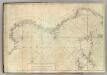
Carte De La Mer Mediterranee. III.
Roux, Joseph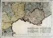
Neueste Generalkarte von Frankreich, 6
1 Blatt : 55 x 78 cm F.A. Schrämbl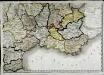
Carte de la république de France, no. 6
1 Blatt : 42 x 58 cm s.n.

Sixieme feuille contenant le Languedoc, le Dauphiné, la Provence et le Roussillon
1 Blatt : 38 x 55 cm Bourgoin
Galliæ antiquæ descriptio geographica, 5
2 Blätter : zusammen 22 x 112 cm s.n.
[Frankreich in 4 Blättern, Blatt 4]
Handatlas über alle Theile der Erde und über das Weltgebäude Stieler, Adolf Justus Perthes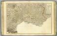
SE France.
1 : 700000 Faden, William, 1750?-1836
[Frankreich, Blatt 4]
Adolf Stieler's Handatlas über alle Theile der Erde und über das Weltgebäude Stieler, Adolf Justus Perthes
Frankreich In 4 Blattern, Blatt 4.
1 : 1500000 Vogel, C.
Postkarte von Frankreichs südoestlichen Departements oder von Languedoc, Provence, Delphinat und Savoyen
Dauphiné (Francie) Müller, Franz im von Reillyschen Landkarten und Kunstwerke Verschleiss Komptoir
Le royaume de France, 5
1 Blatt : 48 x 42 cm Jaillot
Carte de la France (SE)
1 : 345600 Cassini family
Théatre de la guerre en Italie ou le cours du Rhone
1 Karte : Kupferdruck ; 54 x 68 cm Poirson; Jean; Macquet; Tardieu chez Jean M.d d'estampes rue S. Jean de Beauvais n.o 4
Théatre de la guerre en Italie ou le cours du Rhone
1 Karte : Kupferdruck ; 54 x 68 cm Poirson; Jean; Macquet; Tardieu chez Jean M.d d'estampes rue S. Jean de Beauvais n.o 4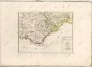

France - south-eastern section; Corsica; Marseille.
1 : 1000000 John Bartholomew & Co.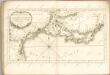

Provincia [...] Provence. [Karte], in: Le théâtre du monde, ou, Nouvel atlas contenant les chartes et descriptions de tous les païs de la terre, Bd. 2, S. 152.
1 Karte aus Atlas Blaeu, Willem Janszoon und Blaeu, Joan Blaeu, Willem Janszoon