Maps of Honduras

Central America
1 : 3800000 Mitchell, Samuel Augustus
Central America
1 : 3800000 Mitchell, Samuel Augustus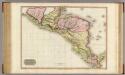
Spanish dominions in North America, southern part.
1 : 2400000 Pinkerton, John, 1758-1826
Central America.
1 : 5000000 Rand McNally and Company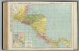
Central America.
1 : 2648000 Rand McNally and Company
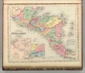
Map of Central America including the states of Guatemala, Salvador, Honduras, Nicaragua & Costa-Rica, the territories of Belise & Mosquito, with parts of Mexico, Yucatan & New Granada : shewing the proposed routes between the Atlantic & Pacific oceans by way of Tehuantepeque, Nicaragua & Panama
1 : 2100000 Baily, John, fl. 1811-1850 Saunders and Stanford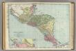
Central America.
1 : 2471000 Rand McNally and Company
Central America.
1 : 5600000 Schlitz Brewing Company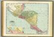
Central America.
1 : 2500000 Rand McNally and Company
Central America. Dominion of Canada and Newfoundland.
1 : 4440000 Hammond, C.S.
Central America.
1 : 5200000 Colton, G.W.
Central America.
1 : 3801600 Tallis, J. & F.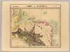
Partie du Guatemala. Amer. Sep. 72.
1 : 1641836 Vandermaelen, Philippe, 1795-1869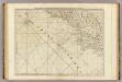
Part of the provinces of Costa Rica and Nicaragua with the lagunas.
1 : 1560000 Jefferys, Thomas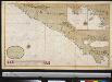
Een gedeelte van de Zuijd Zee aen de kust van Guatimala van R. Haztatlan tot P. de Borica
Central America Gerard van Keulen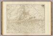
The Bay of Honduras.
1 : 1560000 Jefferys, Thomas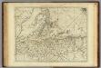
Bay of Honduras.
1 : 1500000 Jefferys, Thomas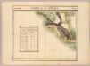
Partie du Guatemala. Amer. Sep. 76.
1 : 1641836 Vandermaelen, Philippe, 1795-1869
Karte des Isthmus von Nicaragua und Panamá in Mittel-America mit den verschiedenen Canal-Projecten zur Verbindung des Atlantischen u. Stillen Oceans nach J. Baily und den besten Quellen
zgst. von A. v. Bülow gest. in d. Lith. Anstalt v. H. Delius Berlin : Duncker
Guatemala : from official and other sources, prepared in the Bureau of the American republics, William Woodville Rockhill, director
1 : 792000 Hendges, M Andrew B. Graham, photo-litho.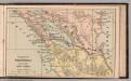
Isthmus of Nicaragua
1 : 3700000 Bradstreet Company
Ruatan or Rattan
1 : 140000
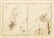
PROVIDENCIA, Caribbean Sea (Island) 1840 (1912)
[O.P. Island and Coral Bank (Catalina Harbour). Surveyed in ... 1835. [Admiralty Chart]
O.P. Island and Coral Bank (Catalina Harbour)
O.P. Island and Coral Bank (Catalina Harbour). Surveyed in ... 1835. [Admiralty Chart] London
Mosquito Coast. Courtown Cays
Mosquito Coast. Courtown Cays. [Admiralty Chart]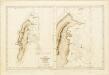
Ile de Saint André (Côte des Mosquitos).
Océan Atlantique ... Ile de Saint André (Côte des Mosquitos). Levée en 1834 par le Comdt. R. Owen ... [Échelle,] 1 : 63,000. [Paris]
Puerto Caballos
1 : 69700 Jeffers Dietrich Reimer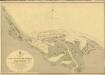
San Juan del Norte or Greytown
San Juan del Norte or Greytown. Surveyed ... 1888-90. Natural scale, 1 : 18,609. London : Admiralty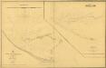
Central America. Greytown Harbour
Central America. Greytown Harbour. Surveyed by J. Richards, assisted by W.K. Bush ... 1853. (Greytown Harbour surveyed by ... W.H. Petch ... January 1856.) Natural scale, 1 : 9,100. [London] : Admiralty