Maps of Guiana Shield

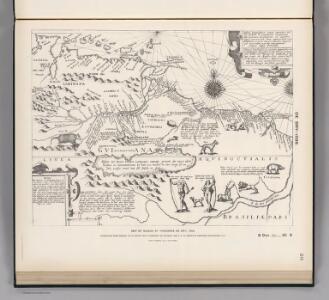
Facsimile: Guiana by de Bry.
De Bry, Theodore
Facsimile: Part of British Empire in South America.
1 : 6000000 Popple, Henry
Guyana coast.
1 : 3000000 Thompson, Edward, Capt.
Facsimile: Part of Chart of the Guiana Coast by Thompson.
1 : 3000000 Faden, William, 1750?-1836
Carte de St. Domingue
1 : 2500000 Herbin de Halle, Etienne de.
Kaart van Guiana, Engelsch, Nederlandsch en Fransch / naar de beste bronnen en eigen opnemingen geteekend in 1888 door W.L. Loth, gouvernements-landmeter in Suriname ; uitgegeven met goedkeuring van Zijne Excellentie Mr. H.J. Smidt, gouverneur der kolonie Suriname
1 : 1000000 Annotatie geografische gegevens: Legenda Amsterdam : J.H. de Bussy
De kust van Guiana
Suriname Johannes van Keulen
British Guayana.
1 : 2800000 Tallis, J. & F.

Carte des colonies Française et Hollandaise de la Guyane
1 : 2923974 Mentelle, E. (Edme), 1730-1815 P.G. Chanlaire, Rue Geoffoy-Langevin, No. 328 ; et. E. Mentelle, Galerie du Museum No. 19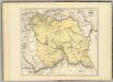
Carta del Canton de Upata, Provincia de Guayana.
1 : 1300000 Codazzi, Agustin, 1793-1859
A Map of the Colony of Surinam
1 : 3800000
Guyane Française
Vidal de La Blache, Paul
Facsimile: Surinam by Popple.
1 : 3787000 Popple, Henry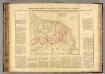
Guyanes.
1 : 3100000 Buchon, J. A. C.; Carey, H. C.; Lea, I.
Partie, Colombie. Amer. Merid. 6.
1 : 1641836 Vandermaelen, Philippe, 1795-1869
Guyanes. Amer. Merid. 7.
1 : 1641836 Vandermaelen, Philippe, 1795-1869
De kusten van Gujana in Westindia van Suriname tot Rio Oronoque, waerin tussen Cossewijne en Corretijne de riv. van Inikelke legt die bij ons onbekent was en in mijn groote caert van Suriname moet geteekent worden; voor de rest is omtrent de strekking van de riviere goede aenmerkingh
Suriname Gerard van Keulen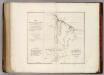
Map of British Guiana.
1 : 1520640 Arrowsmith, John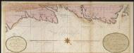
De kust van Guijana tussen R. Cupanama en Rio Oronoque
Guyana Gerard van Keulen
Kaart van Suriname / naar de opmetingen van J.F.A. Cateau van Rosevelt en J.F.A.E. van Lansberge ; aangevuld tot 1898 met die van, en geteekend door W.L. Loth
1 : 500000 Cateau van Rosevelt, J. F. A.; Lansberge, J. F. A. E. van; Loth, W. L. Amsterdam : De Bussy
Carte de la Guïane Françoise ou de Gouvernement de Caïenne : depuis le Cap de Nord, jusqu'a la Rivière de Maroni iclusivement
1 : 1700000 Anville, Jean Baptiste Bourguignon d', 1697-1782 [s.n.]
Grand View of European Occupation, 1597-1803 (1814).
1 : 2027520 Venezuela-British Guiana Boundary Commission
European Occupation in 1626.
1 : 2027520 Venezuela-British Guiana Boundary Commission
European Occupation in 1724.
1 : 2027520 Venezuela-British Guiana Boundary Commission
European Occupation in 1674.
1 : 2027520 Venezuela-British Guiana Boundary Commission
European Occupation in 1756.
1 : 2027520 Venezuela-British Guiana Boundary Commission
European Occupation in 1796.
1 : 2027520 Venezuela-British Guiana Boundary Commission
European Occupation in 1648.
1 : 2027520 Venezuela-British Guiana Boundary Commission