Maps of Darling Range
Western Australia.
1 : 970000 Roe, John Septimus
Australia Occidentale ed Isola di Van-Dieman.
1 : 1800000 Marzolla, Benedetto
W. Australia, Tasmania.
1 : 1770000 Society for the Diffusion of Useful Knowledge (Great Britain)
Chart of Swan River : from a survey by Capt. James Sterling R.N (1827)
Perth : H.J. Pether, Government Lithographer W[est] A[ustralia]
Perth : 1838 / H.J. Pether, Government Lithographer, W[est] A[ustralia]
Perth : H.J. Pether
Western Australia, Swan River.
1 : 2750000 Tallis, J. & F.
The S.W. Coast of New Holland.
1 : 905000 Vancouver, George, 1757-1798
[West-Australien, Tasmania früher genannt Van Diemen's Land, Neu-Seeland]
Hand-Atlas über alle Theile der Erde und über das Weltgebäude Stieler, Adolf Justus Perthes
Neu-Seeland
Adolf Stieler's Handatlas über alle Theile der Erde und über das Weltgebäude Stieler, Adolf Justus Perthes
Map of Western Australia : shewing pastoral leases in green, the total area of which is 96,508,549 acres, to accompany Annual report for 1901
1 : 3200000 [S.l. : s.n.]
Map of Western Australia, 1904
1 : 4680000 Západní Austrálie H.J. Petcher
West-Australien. Tasmania. Neu-Seeland. Der Isthmus Von Auckland.
1 : 5000000 Petermann, A.
Western Australia.
1 : 4088064 Stanford, Edward
Australia.
1 : 5068800 Arrowsmith, John
Australia - western section.
1 : 6000000 John Bartholomew & Co.
Australia in 1839.
1 : 12700000 Society for the Diffusion of Useful Knowledge (Great Britain)
Australien
Hand-Atlas über alle Theile der Erde und über das Weltgebäude Stieler, Adolf Justus Perthes
239-240. Australia. The World Atlas.
1 : 7500000 USSR (Union of Soviet Socialist Republics).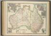
Australia.
1 : 6198300 Johnston, W. & A.K.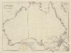
Australia from surveys made by order of the British Government combined with those of d'Entrecasteaux, Baudin, Freycinet &c.&c
1 : 5000000 by John Arrowsmith London : Arrowsmith
Map shewing the route and discoveries of the Calvert Exploring Expedition in Western Australia : equipped by Albert F. Calvert F.R.G.S. London, commanded by L.A. Wells of S.A. Survey Department, 1896-7 / comp. by L.A. Wells ; drawn by W.F.H.
1 : 1500000 Annotatie: Vermoedelijk afkomstig uit: Journal of the Calvert Scientific Exploring Expedition, 1896-7 ... - Perth : Watson, 1902 Wells, L. A.; W. F. H. [S.l. : s.n.]
Australien.
1 : 10000000 Petermann, A.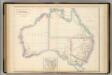
Australia.
1 : 8350000 Hughes, William
Australia and Tasmania
1 : 14900000 Wood Brothers
Australland.
1 : 12500000 Flemming, Carl
Australia.
1 : 12000000 Colton, G.W.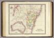
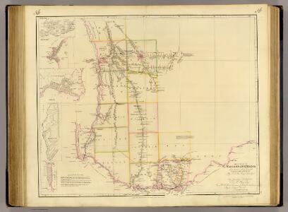
Colony of New South Wales.
1 : 2400000 Teesdale, Henry
Australia.
1 : 14000000 Colton, G.W.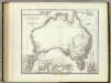
Austral-Continent.
1 : 10000000 Weiland, C. F. (Carl Ferdinand), d. 1847