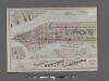
Maps of Woodmere
Street Indexed map of the Borough of Queens, also showing the Congressional Districts.
From Queens
Street Indexed map of the Borough of Queens, also showing the Congressional Districts.
From Queens
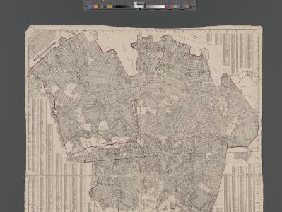
Outline and Index Map of the Borough of Queens, City of New York.
from Atlas of the city of New York, borough of Queens, Long Island City, Newtown, Flushing, Jamaica, Far Rockaway, from actual surveys and official plans / by George W. and Walter S. Bromley.
Index: Borough of Manhattan. Scale 1800 feet to the Inch. LEGEND, [Battery Park - 158th Street].
from Atlas of the city of New York, borough of Manhattan. From actual surveys and official plans / by George W. and Walter S. Bromley.
Map of Queens Borough, City of New York.
From Queens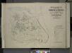
Index map to Vol. 3; Atlas of the Borough of Queens Third Ward city of New York. Published by E. Belcher Hyde; 97 Liberty St., Brooklyn Borough. 1904.
from Third ward: Flushing.
New York City, County, and vicinity.
From Manhattan
Hagstrom's Map of Queens, city of New York. House number and subway guide.
From Queens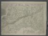
Map of New-York Bay and Harbor and the environs / founded upon a trigonometrical survey under the direction of F. R. Hassler, superintendent of the Survey of the Coast of the United States ; triangulation by James Ferguson and Edmund Blunt, assistants ;
from New York harbor
Index map to Volume Two Atlas of the Borough of Queens 1st and 2nd Wards City of New York, Published by E. Belcher Hyde, 5 Beekman St. (Temple Court) Manhattan. 97 Liberty St., Brooklyn Borough. 1908.
from First and second wards: Long Island City and Newtown.
Index Map to Vol. 2, Atlas of the Borough of Queens, 1st and 2nd Wards City of New York Published by E. Belgher Hyde. 5 Beekman St. Temple Court Manhattan, 97 Liberty St. Brooklyn Borough. 1908
from Long Island City.
Map of Newtown Long Island. Designed to exhibit the localities referred to in the "Annals of Newtown."
From Queens
General map of the city of New York, consisting of boroughs of Manhattan, Brooklyn, Bronx, Queens and Richmond : consolidated into one municipality by act of the legislature of the state of New York (Chapter 378 of the laws of 1897) : showing in addition
from Whole
Newtown, Queens Co. L.I.
from Atlas of Long Island, New York. From recent and actual surveys and records.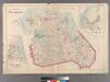
Plate 29: Town of Flushing. - Douglaston. - Bay Side.
from Atlas of Queens Co., Long Island, New York / compiled from official records, private plans & actual surveys by and under the direction of Chester Wolverton.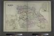
Flushing, Queens Co. L.I. - Douglaston, Town of Flushing, Queens Co. - Hinsdale, Town of Flushing, Kings Co.
from Atlas of Long Island, New York. From recent and actual surveys and records.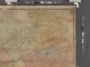
Map of Kings and part of Queens Counties, Long Island, N.Y. / [cartographic material]
From Counties
Index Map to Volume Two / by and under the supervision of Hugo Ullitz.
From v. 2
Jamaica.- Part of Hempstead, Tn. of Hempstead, Queens Co.
from Atlas of Long Island, New York. From recent and actual surveys and records.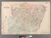
Plate 28: Town of Jamaica.
from Atlas of Queens Co., Long Island, New York / compiled from official records, private plans & actual surveys by and under the direction of Chester Wolverton.
Geologic map and sections of Manhattan Island, State of New York
From Manhattan
The Flushing and North Side Railroad, with its leased branches.
from Atlas of Long Island, New York. From recent and actual surveys and records.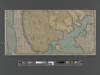
New handy map of the borough of the Bronx.
From Bronx
Map showing the old high water lines along the shores of Brooklyn & New York together the the pier lines as established by law.
From Manhattan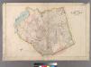
Plate 30: Town of Newtown.
from Atlas of Queens Co., Long Island, New York / compiled from official records, private plans & actual surveys by and under the direction of Chester Wolverton.
Plate 24: Northern part of Town of Yonkers, adjacent to the River.
from Atlas of New York and vicinity : from actual surveys / by and under the direction of F. W. Beers, assisted by A. B. Prindle & others
Long I. Sound, Westchester, Queens.
1 : 31680 Vermeule, C. C. (Cornelius Clarkson), 1858-1950
Map of New York City south of 118th street.
From Manhattan
Map of part of New York City, showing underground mains of the Edison Electric Illuminating Co. of New York.
From Manhattan