Maps of Jersey City

Jersey City, V. 1, Double Page Plate No. 23 [Map bounded by Newark Bay, Greenville Ave., Linden Ave., Ocean Ave., W. 58th St.] / compiled under the direction of and published by G.M. Hopkins Co.
From V. 1
Jersey City, V. 1, Double Page Plate No. 34 [Map bounded by Newark Bay, Jersey City, Avenue E, E. 42nd St., W. 42nd St.] / compiled under the direction of and published by G.M. Hopkins Co.
From V. 1
Jersey City, V. 1, Double Page Plate No. 22 [Map bounded by Woodlawn Ave., Ocean Ave., Greenville Ave., Newark Bay, West Side Ave.] / compiled under the direction of and published by G.M. Hopkins Co.
From V. 1
Jersey City, V. 1, Double Page Plate No. 25 [Map bounded by Ocean Ave., bay view Ave., New York Bay, Linden Ave.] / compiled under the direction of and published by G.M. Hopkins Co.
From V. 1
Jersey City, V. 1, Double Page Plate No. 35 [Map bounded by Newark Bay, E. 42nd St., W. 42nd St., Avenue E, E. 24th St., W. 24th St.] / compiled under the direction of and published by G.M. Hopkins Co.
From V. 1
Jersey City, V. 1, Double Page Plate No. 21 [Map bounded by Orient Ave., Ocean Ave., Woodlawn Ave., West Side Ave.] / compiled under the direction of and published by G.M. Hopkins Co.
From V. 1
Jersey City, V. 1, Double Page Plate No. 28 [Map bounded by Hackensack River, Boyd Ave., West Side Ave., Newark Bay] / compiled under the direction of and published by G.M. Hopkins Co.
From V. 1
Jersey City, V. 1, Double Page Plate No. 40 [Map bounded by E. 40th St., New York Bay, E. 21st St.] / compiled under the direction of and published by G.M. Hopkins Co.
From V. 1
Hoboken, Jersey City.
1 : 19200 Beers, F. W. (Frederick W.)
Jersey City
1 : 24000
Jersey City
1 : 24000
Jersey City
1 : 24000
Jersey City
1 : 24000
Jersey City
1 : 24000
King's bird's-eye view of Brooklyn
From Brooklyn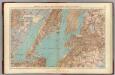
Brooklyn, N.Y. Bay, Jersey City, Hoboken, Bayonne, Newark Bay.
1 : 31680 Vermeule, C. C. (Cornelius Clarkson), 1858-1950
Watson's New Map Of New-York And Adjacent Cities.
1 : 18600 Watson, Gaylord
Map of property situated in the 12th ward of the city of New York belonging to the estate of John Taylor : to be sold at auction by Jas. Bleecker & Sons at the Merchts. Exchange at 12 o'clock on Tuesday the 1st April 1834.
from Manhattan
Goulding's Directory Map of New York City, including the two recently annexed wards, engraved from the latest and most accurate surveys.
From Manhattan
Handy map of Brooklyn.
From Brooklyn
New York City map. Including an index to the streets of New York and Brooklyn.
From Manhattan
City & county map of New York, Brooklyn, Williamsburgh, Jersey City & the adjacent waters.
From Manhattan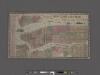
New York City Map. Extracted from Phelps' strangers and citizens' guide to New York City, with maps and engravings.
From Manhattan
Map of New-York Bay and Harbor and the environs / founded upon a trigonometrical survey under the direction of F. R. Hassler, superintendent of the Survey of the Coast of the United States ; triangulation by James Ferguson and Edmund Blunt, assistants ;
from New York harbor
Map of the consolidated city of Brooklyn, for Bishop's manual of the corporation.
From Brooklyn
City of New Manhattan : proposed May 1911, revised May 1930 / T. Kennard Thomson, consulting engineer, New York City.
from Manhattan
Map of the Borough of Manhattan, New York City, centering on the campus of Columbia University.
From Manhattan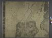
General map of the city of New York, consisting of boroughs of Manhattan, Brooklyn, Bronx, Queens and Richmond : consolidated into one municipality by act of the legislature of the state of New York (Chapter 378 of the laws of 1897) : showing in addition
from Whole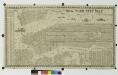
New York city map.
From Manhattan
![Jersey City, V. 1, Double Page Plate No. 23 [Map bounded by Newark Bay, Greenville Ave., Linden Ave., Ocean Ave., W. 58th St.] / compiled under the direction of and published by G.M. Hopkins Co.](https://images-0.georeferencer.com/images/iiif/949349229200/full/,300/0/native.jpg)

