Maps of East
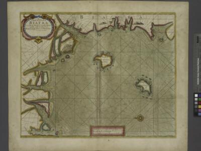
A chart of coast of BIAFRA from Foche Island to Corisco Island together with the Islands of FERNANDO POO and PRINCES
from The sea-atlas : containing an hydrographical description of most of the sea-coasts of the known parts of the world.
Kolonien (Schutzgebiete) des Deutschen Reichs
1 : 6000000 Afrika jihozápadní F.A. Brockhaus Geogr.-artist. Anstalt
Localisatin of ethnic groups. Southern section. Sheet XI

Golfe du Guinee. Afrique 36.
1 : 1641836 Vandermaelen, Philippe, 1795-1869
Vorläufige übersicht von Zintgraff's Reise von Kamerun nach dem Benuë
1 : 3500000 Kamerun C.L. Keller
Map of the south-western part of Cameroon (containing the Basel Mission area)
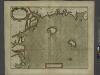
Een gedeelte van de kust van Gunea van Accara tot C. Formosa vertoonende de Bogt van Benin
Ghana Gerard van Keulen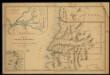
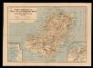
Mapa de la Guinea Española / formado y publicado por el Depósito de la Guerra
1 : 500000 1 Mapa, col. Finestra: Plano del Rio Muni y sus afluentes Depósito de la Guerra (Espaya)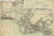
Map of the Gold Coast, Ashanti and Northern Territories
Map of the Gold Coast, Ashanti and Northern Territories, GSGS 2593. Great Britain. General Staff. Geographical Section. [London] : [GSGS, War Office]
Nigeria

The Lower Niger to the Confluence
Route sketch of H. Ramsay's expedition in the southern Cameroon regions

Mapa del Muni : Guinea continental española
1 mapa. Publicat dins: Anuario general de España. Datat a partir de 1900 aproximadament. Pompido, M. Publicado por `Anuarios Bailly-Baillère y Riera reunidos ́. Barcelona (ed. A)
Karte des Kamerun-Gebiets
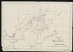
Sketch of the Bassa region.
Autenrieth
Karte des Gebiets zwischen Bali und Nyasoso, zum Reisebericht Br. Dorsch's
Dorsch, H.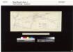
The northern Bulu region according to the survey by First Lieutenant von Glisczinski, Lieutenant Nolte und Dr. Bennett in 1897 and 1898. Designed and drawn by Max Moisel. (Mittheilungen aus den deutschen Schutzgebieten)

Stationsgebiet Mangamba, entworfen nach der Karte von Dr. Esch - Die Flussgebiete des Mongo u. Unteren Wuri.
Dinkelacker, E.
Carta da Ilha do Principe
1 : 100000 Portugal. Comissão de Cartografia das Colónias [Lisbonne] : Commissão de Cartographia
Carte de Fernando Póo según Pellon / adicionada por los P.F. Misioneros Hijos del I.C. de María
1 Mapa. Pellón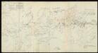
Skizzen aus meinen Reisen in Basa.
Nuevo mapa de la isla de Fernando Póo, vicariato Apostólico
1 Mapa, col. Finestra: Plano de Sta. Isabel Sucesores de Henricy y Ca.
Mission au Dahomey (21 novembre-28 décembre 1889). Itinéraire suivi par M. Bayol de Kotonou à Abomey
1 : 200000 [Paris] : service géographique des colonies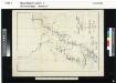
The Cameroon Basin and its feeding rivers. Sheet no. 2. The Wuri & Abo..

[kein Titel]
J. Ittmann
Karte der Pflanzungsgesellschaften (nach Moisel).

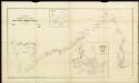
Old Calabar River; from sketch surveys 1869-90.
Old Calabar River; from sketch surveys 1869-90. Natural Scale, 1 : 137,400. [Admiralty Chart] London
Arquipélago de S. Tomé e Príncipe Ilha de S. Tomé
1 : 80000 Hydrographic Map Instituto Hidrográfico Portugal Instituto Hidrográfico Portugal
Karte der Insel Fernando Póo
1 : 200000 Baumann, Oscar Eduard Hölzel