Maps of Lower Saxony

Bez titulu: Železniční trati v severním Německu

[Vestfálsko a okolí]
Vestfálsko (Německo)
Possessions du roi de Prusse a l'ouest du Weser
1 : 1730000 Neuchâtel (Švýcarsko) Mentelle, Edme Tardieu, Pierre François
Nordwest-Deutschland
1 : 2000000 Německo severozápadní Kocen, Blaž E. Hölzel
Die Herzogthuemer Saxonia und Lotharingia inferior; dann Thuringia, Osterland, Massia &c.
1 : 1900000 Spruner von Merz, Karl
Westphalen
Allgemeiner Atlas [Walch, Johannes] im Verlag bei Johannes Walch
Circulus Westphalicus in suas provincias et ditiones accurate distinctus et recentissime delineat
1 : 1000000 cura et caelo Matth. Seutteri S.C.M.G. G. Matthaeus Seüter jun. sculpsit. Aug. Vind : [Matthäus Seutter]
The North West Part of Germany
1 : 2500000 Mollova mapová sbírka Moll, Herman Moll, Hermann
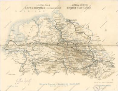
Eisenbahnkarte von Nordwest-Deutschland
1 : 2000000 Německo severozápadní Geograph. Anstalt von Wagner & Debes
NW Deutschland, Niederlande, Belgien.
1 : 5500000 Brudin, J. L.; Stieler, Adolf
Nordwestliches Deutschland, Niederlande und Belgien

Circulus Westphaliae cum omnibus suis subjacentibus provinciis novissima delineatio
1 : 1000000 1 Karte : Kupferdruck ; 49 x 56 cm Danckerts, Justus [Danckerts]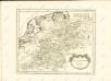

Nordwestliches Deutschland, Niederlande und Belgien
1 : 3441000 Belgie Justus Perthes
Germany.
1 : 1500000 Colton, G.W.
Königreich Westphalen samt dem Herzogthume Mecklenburg
1 : 2230000 Meklenbursko (Německo)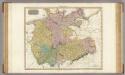
Germany north of the Mayn.
1 : 1180000 Pinkerton, John, 1758-1826
Circulus Westphalicus
1 : 1000000 Mollova mapová sbírka Seutter, Matthäus Seutter, Matthäus
Circulus Westphaliae cum Omnibus Suis Subjacentibus Provinciis Novissima Delineatio
1 : 1000000 Mollova mapová sbírka Ottens, Josua Ottens, Josua
Nordwestliches Deutschland, Niederlande und Belgien
Schul-Atlas über alle Theile der Erde nach dem neuesten Zustande, und über das Weltgebäude Stieler, Adolf Justus Perthes
Germany (Deutschland)
1 : 1776000 Hannover (Německo) Walker, C. Baldwin & Cradock
Nordwestliches Deutschland, Niederlande und Belgien
Schul-Atlas über alle Theile der Erde nach dem neuesten Zustande, und über das Weltgebäude Stieler, Adolf bei Justus Perthes
German Empire 1.
1 : 1774080 Letts, Son & Co.
The north west part of Germany.
1 : 2500000 Moll, Herman, d. 1732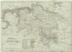
Koenigreich Hannover
1 : 1126000 Hannover (Německo) Tranquillo Mollo
Nordwestliches Deutschland
Neuer Handatlas über alle Theile der Erde Kiepert, Heinrich Verlag von Dietrich Reimer
Karte von Deutschland in IV Blättern
1 : 825000 Nordwest-Blatt Sotzmann, Daniel Friedrich im Verlage der A. G. Schneider und Weigels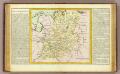
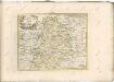
Westphalie.
1 : 1400000 Clouet, J. B. L. (Jean-Baptiste Louis), b. 1730