Maps of Libeň

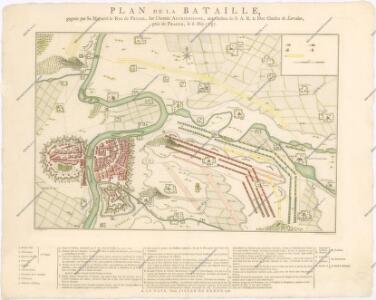
Plan de la Bataille... le 6 May 1757
Accurate Vorstellung der zwischen den oesterreichischen und preussischen Armeen geschehenen Bataille bey Prag, den 6. May 1757
Praha (Česko)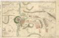
Accurate Vorstellung der zwischen den Oesterreichischen und Preussischen Armeen ... Bataille bey Prag...

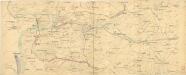
Mapa politického a školního okresu Karlínského

[Praha a okolí]
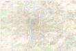
Praha-oblast (Česko)
Les environs de Prague
1 : 31000 Praha (Česko)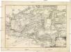
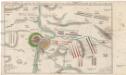
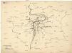
Bataille de Praag, en Bohéme, gagnée par le roi de Prusse, sur l'armée des impériaux, commandée par le prince Charles de Lorraine, le 6. may, 1757
1 : 39000 Praha (Česko)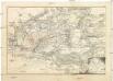
Bataille de Praag, en Bohéme, gagnée par le roi de Prusse, sur l'armée des impériaux, commandée par le prince Charles de Lorraine, le 6. may, 1757
1 : 39000 Praha (Česko)
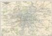
Plán velké Prahy
1 : 19000 Praha (Česko) Grgurič, Václav Sádlo, Jiří A. Storch syn
Bataille de Prague
1 : 62300 Praha (Česko) Therbu Coentgen, Heinrich Hugo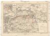
Plan der Schlacht bei Prag am 6ten Mai 1757
1 : 25000 Štěrboholy (Praha, Česko) Hoen, Maximilian von L.W. Seidel & Sohn
Schlacht bei Prag, den 6-ten May 1757

Orientační plán hlavního města Prahy s okolím

Hlavní město Praha
1 : 55000 Praha (Česko)
Praha : názorné plány a rejstřík
[Praha - projekt podzemní a nadzemní dráhy].
Praha (Česko) Poláček, K. Wallenfels, F.
[Praha - projekt podzemní dráhy]
Praha (Česko)
[Gradkartenblatt]
1 : 25000 Praha (Česko : oblast) Vojenský zeměpisný ústav
Plán Velké Prahy
1 : 19000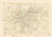
Plán sběrného okruhu a dopravních spojů pro motorová vozidla
Orientační plán hlavního města Prahy
1 : 14000
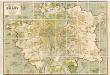
Přehledná mapa Velké Prahy : [s průvodcem a popisem všech obcí v ní zahrnutých] : [odpolední výlety po okolí pražském]
1 : 34725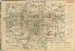
Auto-Praha : automobilní plán Velké Prahy a příručka pro automobilisty
1 : 50000
Orientační plán Prahy a obcí sousedních přehledka

Přehledná mapa velké Prahy
Plán sítě elektrických drah, trolejbusů a autobusů hlavního města Prahy
Praha : plán města
1 : 20000
Veřejné dopravní prostředky hlavního města Prahy
Bez titulu: Plán železniční dopravy v Praze a okolí