Maps of Highland

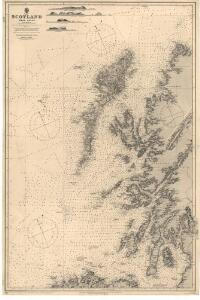
Scotland: West coast.
Great Britain. Hydrographic Office
ÆBUDÆ INSULÆ | Sive | HEBRIDES; | Quæ Scotiæ ad occasum prætenduntur, [...] THE WESTERNE ILES | OF SCOTLAND.
lustratæ et descriptæ a | Timotheo Pont. [Amsterdam : Joan Blaeu]
A general chart of the west coast and western islands of Scotland from Cantire to Cape Wrath and Butt of the Lewis.
Mackenzie, Murdoch (Senior), 1712-1797 Terry, G.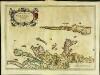
Æbudæ insulæ sive Hebrides
1 Karte : Kupferdruck ; 37 x 52 cm Blaeu; Pont Joan Blaeu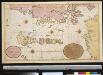
De West cust van Schotlandt, de Noord cust Irlandt en de Lewijs Eijlanden int groodt met al de bijleggende eijlanden
Scotland Gerard van Keulen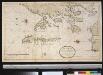
De West kust van Schot Landt de Noord kust van IJrland en de Lewijs Eijlanden na een Engels caertie gelegt
Scotland Gerard van Keulen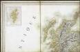
Carte des iles britanniques ou Royaume-Uni de la Grande Bretagne et d'Irlande, 1
2 Blätter : je 50 x 39 cm
Scotia Regnum
1 : 1300000 Amstelodami : apud Joannem Janssonium
To the Honorable Sr. Charles Wager, this Draught of Part of the Highlands of Scotland / is humblely Presented by... Mark Tiddeman.
Tiddeman, Mark, fl. ca. 1730
Scotland.
1 : 760320 Arrowsmith, John
Scotland.
1 : 1584000 Colton, G.W.
Scotland.
1 : 1110000 Sharpe, J.
Pascaart van de noortcust van Yrland als meede de westcust van Schotland / by Johannes van Keulen.
Keulen, Johannes van, 1654-1715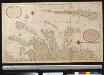
Nieuwe afteekening van de West kust van Schotlant en de Lewijs Eijlanden met alle de tussen leggende eijlanden
Scotland Gerard van Keulen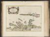
Aebudae Insulae sive Hebrides ; quae Scotiae ad occasum praetenduntur / lustratae et descriptae a Timotheo Pont. Western Isles of Scotland.
Pont, Timothy, 1560?-1614? Blaeu, Joan, 1596-1673
Tabula Leogi et Haraiae, ac Skiae vel Skianae Insularum. [Karte], in: Novus atlas absolutissimus, Bd. 8, S. 169.
1 Karte aus Atlas Janssonius Offizin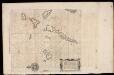
Pascaarte, verthoonende in wat ghestalte de Eylanden (Hebrides ghenaemt) achter de noordwesthoek van Schotlandt gheleghen zÿn = Carte marine de les Isles Hebrides situez vers norouest arriere l'Escoss
Blaeu, Willem Janszoon, 1571-1638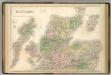
Scotland.
1 : 610000 Hughes, William
A general map of Scotland and islands thereto belonging, 1
2 Blätter : 90 x 76 cm s.n.
A new chart of the West coast of Scotland from the Mull of Galloway to Dunan Point in Sky.
Huddart, Joseph, 1740/1-1816 Laurie, Robert Whittle, James
Carte particuliere de la cote occidentale d'Escosse, depuis le Cape Wrath jusqu'a la Pointe d'Ardnamurchan.
Depot Generale de la Marine, Paris
A new chart of the West coast of Scotland from the point of Ardnamurchan to Cape Wrath.
Huddart, Joseph, 1740/1-1816 Laurie, Robert Whittle, James

Lochabria, omnesque Insulae versus Occidentem sitae, ut Uisto, Mulla, aliaeque. [Karte], in: Novus atlas absolutissimus, Bd. 8, S. 172.
1 Karte aus Atlas Janssonius Offizin
A Map of the North West part of the Western Islands / by H. Moll.
Moll, Herman, d. 1732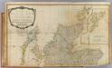
Scotland (north)
1 : 450000 Robert Laurie & James Whittle
Lochabria, omnesq[ue] insulæ versus occidentem sitæ, ut Visto, Mulla, aliæque
1 Karte : Kupferdruck ; 42 x 51 cm Valck; Schenk sumptibus Gerardi Valk et Petri Schenk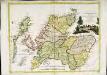
La Scozia settentrionale
1 Karte : Kupferdruck ; 30 x 39 cm Zatta; Zuliani; Pitteri presso Antonio Zatta
Western Isles.
Thomson, John, 1777- ca. 1840 Johnson, William, fl. 1806-1840
Western Isles.
Thomson, John, 1777- ca. 1840 Johnson, William, fl. 1806-1840