Maps of Wales
Flintshire II.NW - OS Six-Inch Map
1 : 10560 Topographic maps Ordnance Survey Ordnance Survey
Flintshire II.NW - OS Six-Inch Map
1 : 10560 Topographic maps Ordnance Survey Ordnance Survey
Flintshire II.NW - OS Six-Inch Map
1 : 10560 Topographic maps Ordnance Survey Ordnance Survey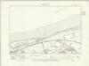
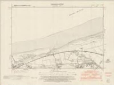
Flintshire II.NW - OS Six-Inch Map
1 : 10560 Topographic maps Ordnance Survey Ordnance Survey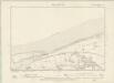
Flintshire II.NW - OS Six-Inch Map
1 : 10560 Topographic maps Ordnance Survey Ordnance Survey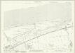
Flintshire II.5 (includes: Llanasa; Prestatyn) - 25 Inch Map
1 : 2500 Topographic maps Ordnance Survey Ordnance Survey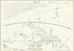
Flintshire II.6 (includes: Llanasa; Prestatyn) - 25 Inch Map
1 : 2500 Topographic maps Ordnance Survey Ordnance Survey
Flintshire II.2 (includes: Llanasa; Prestatyn) - 25 Inch Map
1 : 2500 Topographic maps Ordnance Survey Ordnance Survey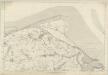
Flintshire II - OS Six-Inch Map
1 : 10560 Topographic maps Ordnance Survey Ordnance Survey
Golden Grove
1 : 31680 .This drawing is formally titled and includes an area-calculation table. Trigonometrical stations are indicated by dots with radiating pencil lines marking the angular measurements taken from these points. Trigonometrically surveyed heights are marked in red ink at the summits of hills. Primary triangulation stations are labelled ABC and circled by a pecked line. Dawson, Robert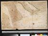
De rivier Dee of Chesterwater anders de rivier van Chester en Liverpoole int St. Joris Canaal beoosten t eijland Anglesij
England Gerard van Keulen
Denbigh - OS One-Inch Map
1 : 63360 Topographic maps Ordnance Survey Ordnance Survey
DENBIGH AC FLINT Sheet 37
This map of Denbigh and Flint is from the 1583 edition of the Saxton atlas of England and Wales.This atlas was first published as a whole in 1579. It consists of 35 coloured maps depicting the counties of England and Wales. The atlas is of great significance to British cartography as it set a standard of cartographic representation in Britain and the maps remained the basis for English county mapping, with few exceptions, until after 1750. During the reign of Elizabeth I map use became more common, with many government matters referring to increasingly accurate maps with consistent scales and symbols, made possible by advances in surveying techniques. Illustrating the increasing used of maps in government matters, Lord Burghley, Elizabeth I’s Secretary of State, who had been determined to have England and Wales mapped in detail from the 1550s, selected the cartographer Christopher Saxton to produce a detailed and consistent survey of the country. The financier of the project was Thomas Seckford Master of Requests at the Court of Elizabeth I, whose arms appear, along with the royal crest, on each map. Saxton, Christopher Ryther, Augustine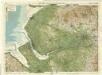
Liverpool & Manchester, Sheet 8 - Bartholomew's "Half Inch to the Mile Maps" of England & Wales
1 : 126720 Topographic maps Bartholomew, John George John Bartholomew & Co
Denbigiensis comitatus et comitatus Flintensis
1 Karte : Kupferdruck ; 36 x 48 cm Blaeu Joan Blaeu
DENBIGIENSIS | Comitatus et Comitatus | FLINTENSIS; | DENBIGH er FLINTSHIRE.
[Amsterdam : Joan Blaeu]
DENBIGH AC FLINT f.115
This is a map of Denbigh and Flint by Christopher Saxton dating from 1577. It forms part of an atlas that belonged to William Cecil Lord Burghley, Elizabeth I’s Secretary of State. Burghley used this atlas to illustrate domestic matters. This map is actually a proof copy of one which forms part of Christopher Saxton’s Atlas of England and Wales. This atlas was first published as a whole in 1579. It consists of 35 coloured maps depicting the counties of England and Wales. The atlas is of great significance to British cartography as it set a standard of cartographic representation in Britain and the maps remained the basis for English county mapping, with few exceptions, until after 1750. During the reign of Elizabeth I, map use became more common, with many government matters referring to increasingly accurate maps with consistent scales and symbols, made possible by advances in surveying techniques. Illustrating the increasing use of maps in government matters, Lord Burghley, who had been determined to have England and Wales mapped in detail from the 1550s, selected the cartographer Christopher Saxton to produce a detailed and consistent survey of the country. The financier of the project was Thomas Seckford, Master of Requests at the Court of Elizabeth I, whose arms appear, along with the royal crest, on each map. Burghley has annotated this map, adding place names to the map and notes about the shire towns of Denbigh in the margins. At the time England was under threat of invasion from Catholic Spain, a threat which culminated in the events of the Spanish Armada. Defence of the realm depended on a good geographic and topographic knowledge, explaining Burghley's use of maps and his annotation of them, particularly at locations along the coast. The map was engraved by Remigius Hogenbergius, one of a team of seven English and Flemish engravers employed to produce the copper plates for the atlas. Saxton, Christopher William Cecil, Lord Burghley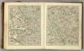
Sheets 40-41. (Cary's England, Wales, and Scotland).
1 : 360000 Cary, John, ca. 1754-1835
Denbigiensis Comitatus et Comitatus Flintensis; Denbigh et Flintshire. [Karte], in: Le théâtre du monde, ou, Nouvel atlas contenant les chartes et descriptions de tous les païs de la terre, Bd. 4, S. 374.
1 Karte aus Atlas Blaeu, Willem Janszoon und Blaeu, Joan Blaeu, Willem Janszoon
Denbigiensis Comitatus et Comitatus Flintensis; Denbigh et Flintshire. [Karte], in: Theatrum orbis terrarum, sive, Atlas novus, Bd. 4, S. 434.
1 Karte aus Atlas Blaeu, Joan Blaeu, Willem Janszoon
Denbigiensis Comitatus et Comitatus Flintensis; Denbigh et Flintshire. [Karte], in: Theatrum orbis terrarum, sive, Atlas novus, Bd. 4, S. 434.
1 Karte aus Atlas Blaeu, Joan Blaeu, Willem Janszoon
MONE INSULAE modo Anglesey et Caernaruan
This is a map of Anglesey and Caernarvon by Christopher Saxton dating from 1578. It forms part of an atlas that belonged to William Cecil Lord Burghley, Elizabeth I’s Secretary of State. Burghley used this atlas to illustrate domestic matters. This map is actually a proof copy of one which forms part of Christopher Saxton’s Atlas of England and Wales. This atlas was first published as a whole in 1579. It consists of 35 coloured maps depicting the counties of England and Wales. The atlas is of great significance to British cartography as it set a standard of cartographic representation in Britain and the maps remained the basis for English county mapping, with few exceptions, until after 1750. During the reign of Elizabeth I, map use became more common, with many government matters referring to increasingly accurate maps with consistent scales and symbols, made possible by advances in surveying techniques. Illustrating the increasing use of maps in government matters, Lord Burghley, who had been determined to have England and Wales mapped in detail from the 1550s, selected the cartographer Christopher Saxton to produce a detailed and consistent survey of the country. The financier of the project was Thomas Seckford, Master of Requests at the Court of Elizabeth I, whose arms appear, along with the royal crest, on each map. Burghley has annotated this map, adding place names to the map and notes about the shire towns of Denbigh in the margins. At this time England was under threat of invasion from Catholic Spain, a threat which culminated in the events of the Spanish Armada. Defence of the realm depended on a good geographic and topographic knowledge, explaining Burghley's use of maps and his annotation of them, particularly at locations along the coast. The map was engraved by one of a team of seven English and Flemish engravers employed to produce the copper plates for the atlas, although the individual name is not recorded. Saxton, Christopher Hogenbergius, Remigius
MONE INSULAE
This map of the isle of Man is from the 1583 edition of the Saxton atlas of England and Wales.This atlas was first published as a whole in 1579. It consists of 35 coloured maps depicting the counties of England and Wales. The atlas is of great significance to British cartography as it set a standard of cartographic representation in Britain and the maps remained the basis for English county mapping, with few exceptions, until after 1750. During the reign of Elizabeth I map use became more common, with many government matters referring to increasingly accurate maps with consistent scales and symbols, made possible by advances in surveying techniques. Illustrating the increasing used of maps in government matters, Lord Burghley, Elizabeth I’s Secretary of State, who had been determined to have England and Wales mapped in detail from the 1550s, selected the cartographer Christopher Saxton to produce a detailed and consistent survey of the country. The financier of the project was Thomas Seckford Master of Requests at the Court of Elizabeth I, whose arms appear, along with the royal crest, on each map. Saxton, Christopher Ryther, Augustine
Comitatus Caernarvoniensis; Vernacule Carnarvon-Shire. et Mona Insula Vulgo Anglesey. [Karte], in: Theatrum orbis terrarum, sive, Atlas novus, Bd. 4, S. 429.
1 Karte aus Atlas Blaeu, Joan Blaeu, Willem Janszoon
An accurate map of the county of Lancaster
1 Karte : Kupferdruck ; 67 x 51 cm Bowen; Hinton sold by I. Hinton at the Kings Arms in Newgate street
Comitatus Caernarvoniensis; Vernacule Carnarvon-Shire. et Mona Insula Vulgo Anglesey. [Karte], in: Theatrum orbis terrarum, sive, Atlas novus, Bd. 4, S. 429.
1 Karte aus Atlas Blaeu, Joan Blaeu, Willem Janszoon
Comitatus Caernarvoniensis; Vernacule Carnarvon-Shire, et Mona Insula Vulgo Anglesey. [Karte], in: Le théâtre du monde, ou, Nouvel atlas contenant les chartes et descriptions de tous les païs de la terre, Bd. 4, S. 369.
1 Karte aus Atlas Blaeu, Willem Janszoon und Blaeu, Joan Blaeu, Willem Janszoon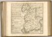

Lancashire
This map of Lancashire dates from 1598 and is by the cartographer and antiquarian William Smith. Smith was Rouge Dragon at the College of Heralds/College of Arms, an institution that specialised in genealogical work, increasingly more so during the Elizabethan age as the gentry class rose in importance. The Rouge Dragon is the name of one of the Pursuivants, a heraldic officer attendant on the heralds, often attached to a particular nobleman, named so because of their badges. The prominent coat of arms on this plan reveals Smith's heraldic interests. In 1588, Smith completed "The Particuler Description of England. With the portratures of certaine of the cheiffest citties & townes.1588". This work consisted of drawings of English cities and towns in a traditional birds eye view style, and drawings amalgamating bird's eye view and plan. In the years 1602-03, William Smith anonymously published maps of Chester, Essex, Hertfordshire Lancashire, (for which this may be preparatory work) Leicester, Norfolk, Northamptonshire, Staffordshire, Suffolk, Surrey, Warwickshire and Worcester. These were probably engraved in Amsterdam and were intended to form sheets of a new atlas. After the publication of Saxton’s county maps in the 1570s, cartographers attempted to improve on Saxton’s atlas and replicate its success. Unfortunately for Smith another cartographer, John Speed, was also preparing county maps at this time and competition proved too great, Speed being the victor. Here the ‘Countie stone’ is marked and labelled at the boundary point which separates Lancashire and Westmorland. A panel of text at bottom right provides a description of the County of Lancashire and Duchy of Lancaster. Smith, William
Lancastria palatinatvs anglis Lancaster [et] Lancas Shire
1 Karte : Kupferdruck ; 36 x 49 cm Valck; Schenk apud Gerardum Valk et Petrum Schenk