Maps of Bas-Rhin
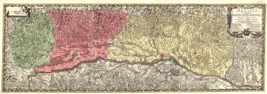
Alsatia Superior et Inferior III. Tabulis
1 : 120000 Mollova mapová sbírka Micheli du Crest, Jacques-Barthélemy Seutter, Matthäus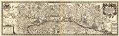
Alsatiae Svperioris et Inferioris accuratissima Geographica Descriptio
1 : 195000 Mollova mapová sbírka Sandrart, Jakob von Sandrart, Jacob von
[Elsass]
1 Karte auf 3 Blättern : Kupferdruck ; 36 x 113 cm Specklin s.n.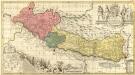
Vera totius Marchionatus Badensis
1 : 230000 Mollova mapová sbírka Valk, Gerhard Schenk, Peter I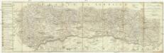
La province d'Alsace divisée en territoires et seigneuries
1 : 165000 Alsasko (Francie) Mayr, Johann
Suevia universa IX. tabulis delineata, 4
1 Blatt : s.n.
Ganz neue Vorstellung des Rhein_Stroms von Basel bis Coblenz...
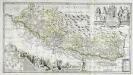
Vera totius marchionatus Badensis, et Hochbergensis
1 Karte auf 2 Blatt : Kupferdruck ; 43 x 80 cm Janssonius van Waesbergen; Pitt; Swart; Morell; Beuch excudebat Janssonio-Waesbergii Moses Pitt et Stephanus Swart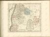

Département du Bas Rhin
1 : 260000 Bas-Rhin (Francie) Houdan, d' P.G. Chanlaire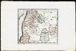
Die obere Markgrafschaft Baden oder die Markgrafschaft Hochberg, Landgrafschaft Sausenberg, und die Herrschaften Röteln und Baadenweiler mit den Herrschaften Hausen und Hohengeroldseck,...
Reilly, Franz Johann Joseph von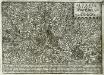
Alsatia inferior
1 Karte : Kupferdruck ; 17 x 27 cm Specklin; Quad Johannes Bussemacher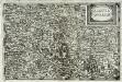
Alsatia inferior
1 Karte : Kupferdruck ; 14 x 22 cm Lambert Andreae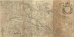
Alsatia Landgraviatus, cum Svntgoia et Brisgoia
1 : 250000 Mollova mapová sbírka Mercator, Gerhard Blaeu, Joan I.
Departement du Bas Rhin
1 Karte : Kupferdruck ; 16 x 15 cm au dépot de l'Atlas national rue de la Monnoye no. 5
Die obere Markgrafschaft Baaden oder die Markgrafschaft Hochberg
1 Karte : Kupferdruck ; 21 x 24 cm Reilly F. J. J. von Reilly
Accurata delineatio Brisgoviæ
1 Karte : Kupferdruck ; 56 x 48 cm Seutter; Drentwett Matthäus Seutter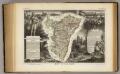
Dept. Du Bas Rhin.
1 : 455000 Levasseur, Victor.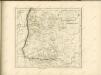

Provincia Brisgoia avst. ant
1 Karte : Kupferdruck ; 57 x 47 cm Homann Johann Baptist Homann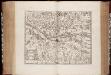
Territorium Argentoratense / apud Janssonio-Waesbergios, Mosem Pitt et Stephanum Swart
1 : 103000 Annotatie: Origineel is Blad 114 in atlas factice; Kaart toont het gebied rondom Straatsburg, deels gelegen in de Elzas en deels in Baden-Württemberg; In rechter bovenhoek: XLIV; Met wapens; Annotatie geografische gegevens: Schaalstok op de kaart: Milliaria Germanica communia; Oost boven Johannes Janssonius van Waesberge -1681?; Moses Pitt ca. 1654-1696; Stephanus Swart [Oxford : printed at the Theatre at Oxford]
Tribocci
1 Karte : Kupferdruck ; 39 x 49 cm Sanson; Robert de Vaugondy; Somer chés le Sr. Robert geog. du roi quai de l'horloge
Fernere Erweiterung unserer weiteren Kriegs Progressen von den 11ten Aug: biß 12ten Octob:
Mollova mapová sbírka Lidl, Johann Jakob Lidl, Johann Jacob
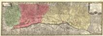
Alsatia tem Svperior, quam Inferior una cum Svndgovia
1 : 120000 Mollova mapová sbírka Homann, Johann Baptist Homann, Johann Baptista - dědici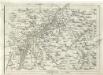
Geographica Provinciarum Sveviae Descriptio =
Mollova mapová sbírka Hurter, Johann Christoph Bodenehr, Johann Georg
Suevia Universa :
1 : 170000 Mollova mapová sbírka Michal, Jacques de Seutter, Matthäus Seutter, Matthäus
Territorium Argentoratense
1 Karte : Kupferdruck ; 36 x 48 cm Janssonius van Waesbergen; Pitt; Swart apud Janssonio-Waesbergios Mosem Pitt et Stephanum Swart
Territorium Argentoratense
1 Karte : Kupferdruck ; 36 x 48 cm Janssonius; Keere Ioannes Ianssonius excudit
Alasatia superior et inferior III. tabulis delineata, 2
1 Blatt : 62 x 59 cm s.n.