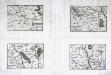
Maps of Doubs
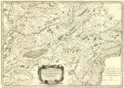
Partie du Dioec et Archche. de Besançon cujus Metropolis Visontio ou sont les Gr. Archidiacné. et celuy de Gray &c.
1 : 240000 Mollova mapová sbírka Sanson, Nicolas Somer, Jean Pruthenus Sanson, Nicolas
Sequani
1 Karte : Kupferdruck ; 39 x 56 cm Sanson; Robert de Vaugondy; Somer chez le S Robert geographe ordinaire du roy quai de l'Horloge du Palais
Département du Doubs
1 Karte : Kupferdruck ; 39 x 34 cm Capitaine s.n.
[Atlas départemental : La France et ses colonies] No. 24 Doubs
1 : 670000 publ. par Michel fils ainé [dressé par A. Lorrain, et gravé par H. Dandeleux] Versailles [etc.] : Barreswil et Andrieux
Besançon, Le Locle
1 : 100000 1 Karte par Aug. Jaccard [Wurster & Randegger], [Winterthur]
Topographische Karte der Schweiz
1 : 100000 25 Karten vermessen und hrsg. auf Befehl der Eidgenössischen Behörden ; aufgenommen unter der Aufsicht des Generals G.H. Dufour Eidg. Topographisches Bureau, [Genève], [später: Bern]
Blatt VI: Besançon, Le Locle, uit: Topographische Karte der Schweiz / vermessen und hrsg. ... unter Aufsicht des Generals G.H. Dufour
1 : 100000 Annotatie: Met plaatsnamenregister (bl. V), bladwijzer (bl. XXI) en hoogteregister (bl. XXV); Voor aanwezige bladen zie overzichtsblad Dufour, G. H. [Bern : Eidg. Topogr. Bureau]
Besançon
1 : 80000 Besançon (Francie) Bertrand, Marcel Alexandre Service de la carte géologique de la France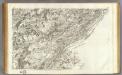
146 Besancon.
1 : 86400 Cassini family; Cassini, Cesar-Francois, 1714-1784
La comté de Neufchatel et partie des cantons de Leman et Fribourg
1 : 108000 Weiss, Johann Heinrich ; Scheuermann, Johann Jakob J. R. Meyer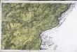
[Besançon]
1 Blatt : 62 x 91 cm s.n.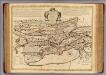
Neuchatel, Vallangin.
1 : 100000 L'Isle, Guillaume de, 1675-1726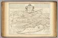
Neuchatel, Vallangin.
1 : 100000 Merveilleux, David Francois de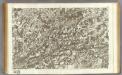
145 Vesoul.
1 : 86400 Cassini family; Cassini, Cesar-Francois, 1714-1784
[Vesoul]
1 Blatt : 61 x 92 cm Durand s.n.
115 Dole, Auxonne.
1 : 86400 Cassini family; Cassini, Cesar-Francois, 1714-1784
Govvernement de Beaulne
1 Karte : Kupferdruck ; 11 x 15 cm Sebastian Cramoisy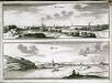
Besançon
1 Plan : Kupferdruck ; 21 x 28 cm Fer chez de Fer dans l'isle du Palais a la sphere royalle
[Kaart], uit: Plan de Besançon : avec notice historique et guide pour la visite de la ville et des environs
1 : 8000 Annotatie geografische gegevens: Water blauw Besançon : Girardot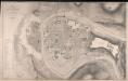
Plan De La Ville De Besançon
1 : 3000 Kirwan, J. J. Lemercier
[Plan de la bataille de Grandson]
1 : 2000 1 Karte Frédéric Dubois del. ; F. Hegi sculps. [Antiquarische Gesellschaft], [Zürich]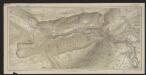
Carte des gorges de l'Areuse
1 : 15000 Borel, Maurice Imprimerie F. Gendre
Besançon
1 : 200000 1 Karte entworfen und bearbeitet von Woerl ; in Stein gestochen unter seiner Leitung 1835 ; Lithographie von B. Herder Herder, Freiburg im Breisgau
Superior Burgundiae Comitatus Vulgo la Franche Comte Complectens Praefecturas Amontii Dolae Avalli Quibus Adjacetus Comitatus Montis Balliardi
1 : 410000 Mollova mapová sbírka Valk, Gerhard Valck, Gerard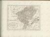

La Franche Comté
1 Karte auf 2 Blatt : Kupferdruck ; 78 x 55 cm Jaillot; Dezauche chez Dezauche successeur des S.rs Del'Isle et Buache 1.ers géographes du roi rue des Noyers
La Franche Comté
1 Karte auf 2 Blatt : Kupferdruck ; 78 x 53 cm Jaillot chez H: Iaillot joignant les grands Augustins aux 2 globes
La Franche Comté
1 Karte auf 2 Blatt : Kupferdruck ; 78 x 55 cm Jaillot chez H. Iaillot joignant les grands Augustins aux 2. globes