Maps of Poland


Germany, eastern border regions : administrative divisions
1 : 2570000 Inset: Major administrative divisions. "July 1, 1944, information is shown within the 1937 Germany boundary only." "No. 6275." United States. Office of Strategic Services. Research and Analysis Branch. [Washington, D.C.] : R & A, OSS
Carte de la monarchie prussienne, a l'orient du Weser
1 : 2300000 Prusko Mentelle, Edme Tardieu, Pierre François
[Nordöstliches Deutschland]
Schul-Atlas über alle Theile der Erde nach dem neuesten Zustande, und über das Weltgebäude Stieler, Adolf Justus Perthes
Prussia.
1 : 4360000 Higgins, W.M.
Polen u. Nachbarländer 963 bis 992
1 : 12000000 Polen
Polen unter Boleslaw Chrobry und bis 1139
1 : 12000000 Polen Bolesław I., Polen, König
Prussia And Saxony.
1 : 2661120 Colton, G.W.
Prussia.
1 : 4118400 Lucas, Fielding Jr.
Kaart van het oostelijk front
1 : 1900000 [S.l. : s.n.]
Politische Übersicht von Nord-Deutschland und Preussen
E. von Sydow's Schul-Atlas in sechs und dreissig Karten Sydow, Emil von bei Justus Perthes
VI. 1740 - 1786
Preußen
Die Preussische Monarchie
Preußen
IX. 1815 - 1861. Preußen nach dem Wiener Kongreß
Preußen Wiener Kongress (1814-1815 : Wien)
Polen und Preussen 1140 - 1240
1 : 6000000 Polen, Preußen (Ordensstaat)
Polen und Preussen 1240 - 1386
1 : 6000000 Polen, Preußen (Ordensstaat)
Preussische Staate.
1 : 1800000 Weiland, C. F. (Carl Ferdinand), d. 1847
Nordöstliches Central-Europa
Ostmitteleuropa
Monarchie Prussienne.
1 : 2400000 Picquet, C.
Germany, eastern border regions surface configuration
Relief shown by gradient tints. Includes most of western Poland. Includes location map. United States. Office of Strategic Services. Research and Analysis Branch. [Washington, D.C.] : R & A, OSS
Prussia and Mecklenburg / drawn & engraved by J.W. Lowry
Lowry, Joseph Wilson Day & Son

Germany. Deutschland II.
1 : 1760000 Society for the Diffusion of Useful Knowledge (Great Britain)
Des Preussischen Staats östlicher Theil, oder Ost- und West-Preussen und Posen
Stieler's Hand-Atlas Stieler, Adolf bei Justus Perthes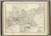
Empire of Germany (northern portion).
1 : 2032000 Johnston, Alexander Keith
Germany, E. sheet.
1 : 1400000 Rand McNally and Company
Charte des nordöstlichen Deutschlands nebst Preussen u. Polen
Preußen, Kongresspolen
[Neuer Atlas der ganzen Erde nach den neuesten Bestimmungen ... : XVI.] Charte von Preussischen Staate, Gebirgs- und Fluss-Charte des nördlichen Teutschlands
Neu entworfen und gezeichnet von F.W. Streit gest. v. H. Leutemann Leipzig : J.C. Hinrichssche Buchhandlung
Empire of Germany (northern portion).
1 : 2032000 Johnston, Alexander Keith