Maps of Libeň

Orientační plán hlavního města Prahy s okolím
1 : 5000
Orientační plán hlavního města Prahy s okolím

Orientační plán hlavního města Prahy s okolím
Auto-Praha : automobilní plán Velké Prahy a příručka pro automobilisty
1 : 50000
Wisoczan - c8937-1-004 - Kaiserpflichtexemplar der Landkarten des stabilen Katasters
1 : 2880
Wisoczan - c8937-1-001 - Kaiserpflichtexemplar der Landkarten des stabilen Katasters
1 : 2880
Wisoczan - c8937-1-002 - Kaiserpflichtexemplar der Landkarten des stabilen Katasters
1 : 2880
Wisoczan - c8937-1-003 - Kaiserpflichtexemplar der Landkarten des stabilen Katasters
1 : 2880
Orientační plán král. Hl. města Prahy

Prosek - c6119-1-001 - Kaiserpflichtexemplar der Landkarten des stabilen Katasters
1 : 2880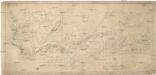
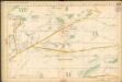
Situations-Plan des Reservat Jagel Terrains bey Prag gegen Chwala so weil dieses von gegenwärtigen Herrn Kommandirenden auf 6 Jahre gepachtet worden ist
1 : 15000 Trampusek, Franz Le Roy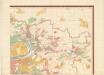
Orientierungsplan der Hauptstadt Prag
Jiřík, Rudolf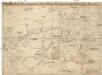
Graenzkarte der k. k. Reservatjagdbefugnisz bei Hrdlorzes, Vissoczan, Key, Hostawitz, Chwalla, Malleschitz, Lieben und Hlaupietin &
1 : 15000 Hloubětín (Praha, Česko) Guberth, Karl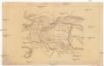
Situace nové spojovací tratě Vršovice - Libeň

Grundrisz der königlichen Hauptstadt Prag
1 : 4500 Praha (Česko) Jüttner, Josef Drda, Josef Jan Alois auf Veranlassung und Kosten des böhmischen Nationalmuseums
Grundrisz der königlichen Hauptstadt Prag
1 : 4500 Praha (Česko) Jüttner, Josef Drda, Josef Jan Alois auf Veranlassung und Kosten des böhmischen Nationalmuseums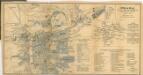
Praha, hlavní město republiky Československé
1 : 30000
Plan der Gegend vor dem Porziczerthore zum Gebrauche bei der Beurtheilung der Distanzen
Bubeneč (Praha, Česko) Wacha, V.
Hlavní město Praha s okolím

Plán Líbně a Vysočan se sousedními obcemi
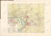
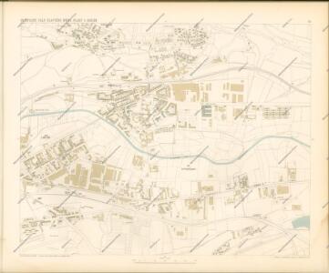
Plán VIII. části Prahy Libně a obcí sousedních
1 : 15000
Lieben - c3990-1-004 - Kaiserpflichtexemplar der Landkarten des stabilen Katasters
1 : 2880
Lieben - c3990-1-003 - Kaiserpflichtexemplar der Landkarten des stabilen Katasters
1 : 2880
Lieben - c3990-1-001 - Kaiserpflichtexemplar der Landkarten des stabilen Katasters
1 : 2880
Lieben - c3990-1-002 - Kaiserpflichtexemplar der Landkarten des stabilen Katasters
1 : 2880
Hlaupetin - c1883-1-001 - Kaiserpflichtexemplar der Landkarten des stabilen Katasters
1 : 2880
Hlaupetin - c1883-1-004 - Kaiserpflichtexemplar der Landkarten des stabilen Katasters
1 : 2880
Hlaupetin - c1883-1-003 - Kaiserpflichtexemplar der Landkarten des stabilen Katasters
1 : 2880
Hlaupetin - c1883-1-002 - Kaiserpflichtexemplar der Landkarten des stabilen Katasters
1 : 2880