Maps of Greater Sunda Islands

Overzichtskaart van het Eiland Sumatra / Topographische Inrichting
Topographische Inrichting, Batavia Batavia : Topographische Inrichting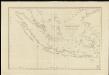
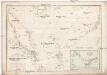
Carte des îles Sumatra, Java et Bornéo et des mers environnantes
1 : 3770000 dressée par M. Daussy, d'après les travaux du Capitaine Horsburgh et d'autres navigateurs gravé par Chassant ; écrit par J.M. Hacq [...] [Paris] : Dépot-général de la Marine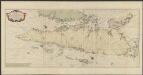
Zee-caart van het eyland Sumatra : met de straaten Malacca, Sincapoera, Banca en Sunda, en alle de daar onderhoorende eylanden, met derzelver bekende dieptens droogtens en ankergronden
1 : 1800000 Te Amsterdam : by Joannes van Keulen [...]
[Sumatra] / Top[ographisch] Bureau v/d Gen[erale] Staf
Topographisch Bureau van de Generale Staf Batavia Batavia : Top[ographisch] Bureau v/d Gen[erale] Staf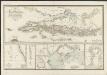
Karte von der Insel Sumatra
[H. Berghaus] Gotha : Perthes
Insula Borneo in Indonesia : Præfectura Apostolica Bornæi Hollandici : anno 1905 erecta eiusque regiones vicinæ et dismembrationes ecclesiasticæ
1 : 16500000 titelvariant: Præfectura Apostolica Bornæi Hollandici [S.l. : Vicario Apostolico de Pontianak]
Sumatra : bevolkingsdichtheid per onderafdeeling volgens uitkomsten der volkstelling in 1930 = density of population per subdivision in 1930
[S.l. : s.n.]
Overzichtskaart Algemeen Wegenplan Sumatra
[S.l. : s.n.]
Sumatra ein grosse Insel/ so von den alten Geographen Taprobana genennet worden
1 : 6000000 1 Karte : Holzschnitt ; 31 x 36 cm Münster, Sebastian [Sebastian Henricpetri]
Het Eiland Sumatra : benevens Bangka, Billiton en Riouw / gelithogr. door E. de Geest
Seyffardt's Boekhandel Amsterdam Amsterdam : Seyffardt's Boekhandel
Sumatra : aangevende de bestuursindeeling, de standplaatsen der ambtenaren, de dichtheid der bevolking per vierkante KM en de verspreiding der inheemsche bevokingsgroepen / [bewerkt door het Encyclopaedisch Bureau, 1916]
Encyclopaedisch Bureau Batavia [Semarang ; Soerabaja ; 's-Gravenhage : N.V. Boekhandel en Drukkerij v/h G.C.T. van Dorp & Co.]
Nieuwe kaart van het eyland Sumatra
1 : 3000000 verb. door François Valentijn [S.l.] : J. van Braam et G. Onder de Linden exc.
Sumatrae Et Insularum Locorumque Nonnullorum Circumiacentium Tabula Nova. [Karte], in: Novus atlas absolutissimus, Bd. 9, S. 124.
1 Karte aus Atlas Janssonius Offizin
Schets-Taalkaart van Sumatra / samengesteld door K.F. Holle, Adviseur-honorair voor Inlandsche zaken met behulp van inlichtingen verstrekt door de Ambtenaren van het Binnenlandsch Bestuur en met medewerking van het Topographisch Bureau te Batavia en Dr. J.L.A. Brandes, Ambtenaar voor de Indische taalkunde
Topographische Inrichting, Batavia Batavia : Top[ographische] Inrichting
Svmatræ et insularum locorumque nonnullorum circumiacentium tabula noua
1 : 3100000 Annotatie: Zeekaart; Origineel is Blad 191 in atlas factice; Annotatie geografische gegevens: Schaalstokken op kaart: 30 Milliaria Germanica (=7,3 cm), en: 40 Milliaria Gallica (=7,3 cm); Oosten boven Johannes Janssonius 1588-1664 [Amstelodami] : [Apud Ioannem Ianssonium]
[Kaart], uit: Vacantiereizen per K.P.M. naar Sumatra : reisroutes door Sumatra
1 : 3800000 [S.l. : s.n.] / (Batavia : Kolff)
Sumatra / [W.A.] Withington
[Lexington (Kentucky)] : [s.n.]
[Sumatra]
[S.l. : s.n.]
Nederlandsch-Indië / J.H. de Bussy
Amsterdam : J.H. De Bussy
Sumatra : aangevende het aantal inrichtingen voor Inlandsch onderwijs op 31 december 1913 / [Encyclopaedisch Bureau]
Encyclopaedisch Bureau Batavia [Batavia : encyclopaedisch Bureau]
Sumatra / C. Craandijk
J.Smulders en Co. Den Haag Den Haag : J. Smulders en Co
KARTE von der Insel Sumatra
1 : 1700000 Sumatra (Indonésie) Berghaus, Heinrich Karl Wilhelm Hebeler, B. Justus Perthes
Sumatra / De Koninklijke Nederlandsch Indische Motor Club
De Koninklijke Nederlandsch Indische Motor Club Semarang Semarang : De Koninklijke Nederlandsch Indische Motor Club
Sumatra : aangevende het aantal inrichtingen voor Inlandsch onderwijs op 31 december 1914
Topographische Inrichting, Batavia Batavia : Top[ographische] Inr[ichting]
Kaart van Sumatra
1 : 750000 [S.l. : s.n.]
Reduzirte Karte vom Chinesischen Meere, 1.stes oder Südliches Blatt
1 : 2300000 H. Berghaus gestochen von W. Jaeck u. W. Brose Gotha : Perthes
Overzichtskaart van het Eiland Sumatra : uitgave 1941 / Topografische Dienst
Topografische Dienst Batavia Batavia : Reproductiebedrijf Topografische Dienst
Borneo

Kaart van het eiland Sumatra
In steen gegrav. d. D. Heyse, te 's Hage ; gedrukt bij P.W.M. Trap, te Leyden te 's Hage : uitgave van K. Fuhri