Maps of Banten

Geologische overzichtskaart van den Nederlandsch Oost-Indischen Archipel : omgeving Straat Soenda / bewerkt door L.J.C. van Es Jr
Batavia : Hoofdbureau Mijnwezen
Batavia / Topografische Inrichting
Topografische Dienst Batavia Batavia : Topografische Inrichting
Batavia / Survey of India
Survey of India [S.l.] : Survey of India
Kaart van Straat Soenda : overgenomen van de Zeekaart van 1870 / get[ekend door] J.G. de Groot
Bruxelles : Institut National de Géographie
To Captain Krusenstern, of the Imperial Russian Navy, as a tribute for his laudable exertions to benefit navigation and maritime science
1 : 443750 this chart of the Strait of Sunda is inscribed by [...] James Horsburgh [London] : by James Horsburgh, hydrographer to the Hon.ble East India Co.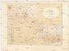
Kaart van Het Gedeelte Java en Sumatra
1 : 500000 Jáva (Indonésie) Eckstein, G. A. Gebroeders Van Cleef
Overzichtskaart van de residentie Bantam / Topogr[afische] Inrichting
Topografische Inrichting Batavia Batavia : Topogr[afische] Inrichting
Kaart van de Residentie Bantam : op de schaal van 1:20.000 (gedeeltelijk ook op schaal van 1:40.000) opgenomen ingevolge Gouvernements Besluit d.d. 6 juli 1866, No. 8, in de jaren 1878 t/m 1885 / Topographisch Bureau van de Generale Staf, Batavia
Topographisch Bureau van de Generale Staf Batavia [Batavia : Topographisch Bureau van de Generale Staf]
Overzichtskaart van den ontworpen spoorweg van Batavia naar Anjer : met zijtakken van Doerie naar Tangerang en van Tanahabang naar Weltevreden
Bataviaasch Nieuwsblad Batavia ; Weltevreden : G. Kolff & Co.
Batavia / prepared under the direction of the Chief of Engineers U.S. Army by the Army Map Service
Army Map Service Washington D.C. Washington D.C. : Army Map Service
Soekaboemi / prepared under the direction of the Chief of Engineers, U.S. Army by the Army Map Service
Army Map Service Washington D.C. Washington D.C. : Army Map Service
Laboehan / prepared under the direction of the Chief of Engineers U.S. Army by the Army Map Service
Army Map Service Washington D.C. Washington D.C. : Army Map Service
[Sukabumi]
1 : 200000 Joh. C. Stemler Cz.
[Sundastrasse]
1 : 200000 Joh. C. Stemler Cz.
[Tugu]
1 : 200000 Joh. C. Stemler Cz.
[Jakarta]
1 : 200000 Joh. C. Stemler Cz.
Kota-Agoeng / published by War Office = uitgegeven door War Office ; revised and photolithographed by War Office
War Office Washington D.C. [Washington D.C.] : War Office
Teloekbetoeng / published by War Office = uitgegeven door War Office ; revised and photolithographed by War Office
War Office Washington D.C. [Washington D.C.] : War Office
Kota·agoeng / [bew. door J. Zwierzycki]
Dienst van den Mijnbouw in Nederlandsch-Indië Batavia [Batavia] : Dienst van den Mijnbouw in Nederlandsch-Indië
Bengkoenat / [bew. door J. Westerveld]
Dienst van den Mijnbouw in Nederlandsch-Indië Batavia [Batavia] : Dienst van den Mijnbouw in Nederlandsch-Indië
Kaart van een gedeelte van Straat Soenda : ter berekening van de hoeveelheid uitgeworpen stoffen / get[ekend door] J.G. de Groot
Bruxelles : Institut National de Géographie
[Pamatanggawan] : bijgewerkt t/m April 1894 / [Topographisch Bureau]
Topographisch Bureau Batavia [Batavia : Topographisch Bureau]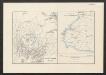
[Java und Madoera, geologische Detailkarten und Profile]
Blatt 16 Verbeek, R. D. M. Joh. C. Stemler Cz.
Kepoe Taigoeka (Poeloe Telandjang, Engano) : na raadpleging der kaarten van Edeling en Pruis van der Hoeven, der sterrenkundige plaatsbepalingen van Dr. J.A.C. Oudemans, en der beschrijvingen over dit eiland door Dr. A.C. Oudemans Jzn., mei 1884
Leiden : E.J. Brill
Geologische kaart van Krakatau : na de uitbarsting van 1883
Institut National de Géographie Bruxelles Bruxelles : Institut National de Géographie
Schetskaart Engano in 1909 / door J.H. Juda
Topographische Inrichting Batavia Batavia : Topographische Inrichting
[Bandjarnegeri] / opgenomen in 1908-1911 [door den Topographischen Dienst]
Topographische Inrichting Batavia Batavia : Topographische Inrichting
Bajah / bewerkt door W.C.B. Koolhoven
[Batavia : Topografische Dienst]
[Pematang Boentoeng] / opgenomen in 1908-1911 [door den Topographischen Dienst]
Topographische Inrichting Batavia Batavia : Topographische Inrichting


