Maps of Ushant
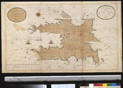
Het eijlant Heijsandt met alle desselfs geleegentheeden in t groot
France Gerard van Keulen
174 Quessant.
1 : 86400 Cassini family; Cassini, Cesar-Francois, 1714-1784
Nieuwe afteekening van de kust van Bretagne strekkende van Hijsand tot de Penmarkes inhoudende het Ras van Conquet en Fontenaij
France Johannes van Keulen
Composite 3: Carte de France.
1 : 86400 Cassini family; Cassini, Cesar-Francois, 1714-1784
A draught of the harbour of BREST and the Trade of ras fountaine shewing Islands, Sands, Rocks and Harbours, from port-sal and ushent to pennarks as it was surveyed by the order of the King of France at Brest
from The sea-atlas : containing an hydrographical description of most of the sea-coasts of the known parts of the world.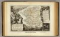
Dept. Du Finistere.
1 : 580000 Levasseur, Victor.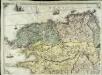
Carte géométrique de la province de Bretagne, 1
1 Blatt : chés l'auteur
13) IV.S.O. ''Brest'', uit: Carte géologique de France
1 : 500000 Annotatie: Voor aanwezige bladen zie bladoverzicht [S.l : s.n.]
Carte de la France, no. 3
1 Blatt : 59 x 41 cm s.n.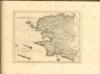

7) IV.N.O. ''Morlaix'', uit: Carte géologique de France
1 : 500000 Annotatie: Voor aanwezige bladen zie bladoverzicht [S.l : s.n.]
Duche de Bretaigne
1 : 791000 Bretaň (Francie) Hardy chez Henry Hondius
Duche de Bretaigne
1 Karte : Kupferdruck ; 35 x 48 cm Janssonius apud Ioannem Ianssonium
Britannia dvcatvs
1 Karte : Kupferdruck ; 37 x 51 cm Blaeu apud Guiljelmum Blaeu
Duche de Bretaigne
1 Karte : Kupferdruck ; 35 x 48 cm Mercator; Hondius; Tavernier chez Henry Hondius demeurant sur le Dam au grand atlas, chez Melchior Tavernier demeurant sur l'isle du Palais a la sphere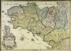
Carte generale de la province de Bretagne
1 Karte : Kupferdruck ; 49 x 68 cm s.n.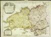
Le Duché de Bretagne
1 Karte : Kupferdruck ; 46 x 61 cm Crépy; Crépy chez Crepy rue St. Jacques a St. Pierre
Præfectura ducatus Britanniæ
1 Karte : Kupferdruck ; 46 x 58 cm Valck; Valck ex editione Ge.̊ et Le.̊ Valk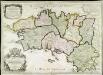
La Bretagne
1 Karte : Kupferdruck ; 45 x 63 cm Jaillot; Denis; Cordier; Basset; Basset chés Basset rue St. Jacques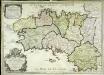
La Bretagne
1 Karte : Kupferdruck ; 44 x 63 cm Jaillot; Denis; Cordier; Basset; Basset chés Basset rue St. Jacques
Gouvernement general du Duché de Bretagne
1 Karte : Kupferdruck ; 45 x 59 cm Fer; Danet; Starckman; Guérard se vend chez Danet gendree de l'auteur sur le Pont Notre Dame a la sphere royale
La Bretagne
1 Karte : Kupferdruck ; 45 x 60 cm Jaillot A.-H. Jaillot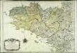
Carte geometrique de Bretagne
1 Karte : Kupferdruck ; 50 x 70 cm Ogée; Nyon; Arrivet; Picard; Dutertre chez l'auteur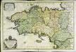
La Bretagne
1 Karte auf 2 Blättern : Kupferdruck ; 52 x 78 cm Sanson s.n.
Tabula ducatus Britanniæ Gallis
1 Karte : Kupferdruck ; 47 x 56 cm Homann editore Ioh. Bapt. Homanno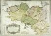
Gouvernement general de Bretagne, qui comprend aussy la gene.te de Nantes
1 Karte : Kupferdruck ; 49 x 67 cm Delafosse; Haussard; Denis; Basset; Basset chez Basset rue St. Jacques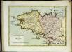
La Bretagne
1 Karte : Kupferdruck ; 19 x 27 cm Crépy chés Crepy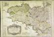
Gouvernement general de Bretagne, qui comprend aussy la gene.te de Nantes
1 Karte : Kupferdruck ; 49 x 67 cm Delafosse; Haussard; Basset; Basset chez Basset rue St. Jacques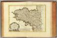
Bretagne.
1 : 930000 Bonne, Rigobert, 1727-1794
Tabula ducatus Britanniae Gallis le gouvernem.t general de Bretagne
1 : 631700 Bretaň (Francie) Homann, Johann Baptist Ioh. Bapt. Homann
Tabula ducatus Britanniae Gallis le gouvernem.t general de Bretagne
1 : 631700 Bretaň (Francie) Homann, Johann Baptist editore Ioh. Bapt. Homanno