Maps of Brittany
Bretagne.
1 : 930000 Bonne, Rigobert, 1727-1794
Duche de Bretaigne
1 : 791000 Bretaň (Francie) Hardy chez Henry Hondius
13) IV.S.O. ''Brest'', uit: Carte géologique de France
1 : 500000 Annotatie: Voor aanwezige bladen zie bladoverzicht [S.l : s.n.]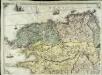
Carte géométrique de la province de Bretagne, 1
1 Blatt : chés l'auteur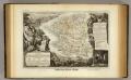
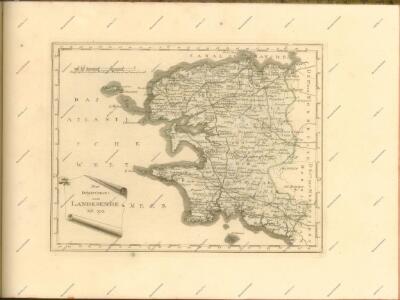
Dept. Du Finistere.
1 : 580000 Levasseur, Victor.
A draught of the harbour of BREST and the Trade of ras fountaine shewing Islands, Sands, Rocks and Harbours, from port-sal and ushent to pennarks as it was surveyed by the order of the King of France at Brest
from The sea-atlas : containing an hydrographical description of most of the sea-coasts of the known parts of the world.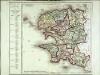
Département du Finisterre
1 Karte : Kupferdruck ; 48 x 48 cm Houdan au bureau de l'atlas national rue de la Harpe n.o 26, et au dépôt de cet atlas placé au cabinet bibliographique rue de la Monnoye n.o 5
Composite 3: Carte de France.
1 : 86400 Cassini family; Cassini, Cesar-Francois, 1714-1784
Carte de la France, no. 3
1 Blatt : 59 x 41 cm s.n.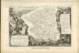
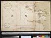
Nieuwe afteekening van de kust van Bretagne strekkende van Hijsand tot de Penmarkes inhoudende het Ras van Conquet en Fontenaij
France Johannes van Keulen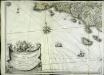
Carte géométrique de la province de Bretagne, 2
1 Blatt : chés l'auteur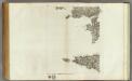
173 (175) Audierne, rade de Brest.
1 : 86400 Cassini family; Cassini, Cesar-Francois, 1714-1784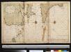
Nieuwe afteekening van de kust van Bretagne strekkende van Hijsand tot de Penmarkes inhoudende het Ras van Conquet en Fontenaij
France Johannes van Keulen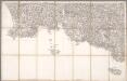
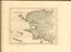
No. 172 [Finistère, Quimperlé, Rosporden], uit: Carte géométrique de la France dite "Carte de Cassini" ou "de l'Académie"
1 : 86400 titelvariant: Carte de Cassini; Annotatie: Incompleet; Voor aanwezige bladen zie overzichtsblad Cassini de Thury, C.-F. Paris : [s.n.]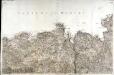
[Saint-Pol-de-Léon]
1 Blatt : 61 x 92 cm Aldring s.n.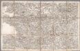
No. 171 [Brest], uit: Carte géométrique de la France dite "Carte de Cassini" ou "de l'Académie"
1 : 86400 titelvariant: Carte de Cassini; Annotatie: Incompleet; Voor aanwezige bladen zie overzichtsblad Cassini de Thury, C.-F. Paris : [s.n.]
[Partie de la côte de la Bretagne]
1 Karte : 22 x 33 cm de Fer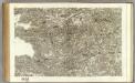
171 Carhaix, Brest.
1 : 86400 Cassini family; Cassini, Cesar-Francois, 1714-1784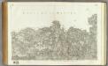
170 Saint-Pol-de-Leon.
1 : 86400 Cassini family; Cassini, Cesar-Francois, 1714-1784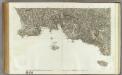
172 Quimperle, Ile de Groix, Quimper.
1 : 86400 Cassini family; Cassini, Cesar-Francois, 1714-1784
Composite 7: Carte de France.
1 : 86400 Cassini family; Cassini, Cesar-Francois, 1714-1784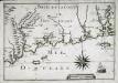
[Partie de la côte de la Bretagne]
1 Karte : 22 x 33 cm de Fer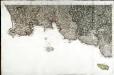
[Quimperlé - Isle de Groix - Quimper]
1 Blatt : 61 x 93 cm s.n.
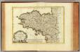
L'evesché de Vannes
1 Karte : Kupferdruck ; 43 x 56 cm Jaillot chez le Sr. Jaillot geographe du roy joignant les grands Augustins aux deux globes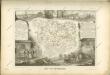

Département du Morbihan
1 Karte : Kupferdruck ; 34 x 39 cm Capitaine s.n.
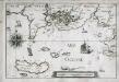
174 Quessant.
1 : 86400 Cassini family; Cassini, Cesar-Francois, 1714-1784