Maps of Kimle

III. vojenské mapování 4859/3
1 : 25000
Duna-Szerdehely und Hédervár
1 : 75000 Dunajská Streda, Hédervár Geripp: Oberjgr. Richter. Terrain: Wachtm. R. v. Palitschek
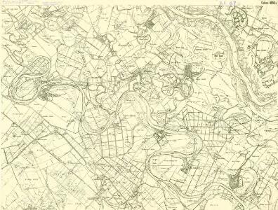
III. vojenské mapování 4859
1 : 75000
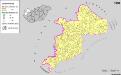
Dunajská Streda
1 : 75000 Dunajská Streda (Slovensko : oblast) Vojenský zeměpisný ústav
Dun. Streda a Hédervár
1 : 75000 Dunajská Streda (Slovensko : oblast) Vojenský zeměpisný ústav
Duna-Szerdahely und Hedervar.
from Spezialkarte der osterreichisch-ungarischen Monarchie.
Petronell - Raab
Mollova mapová sbírka Marsili, Luigi Ferdinando
Györ vármegye
1 : 240000 Györ-oblast (Maďarsko) Király, Georg
Mappa Comitatus Mosoniensis
Mollova mapová sbírka Kovács, János Nicolaï, Georg David Christoph
Die Herrschaft Ungarisch Altenburg
1 : 146000 Mosonmagyaróvár (Maďarsko) David, Johann
Magyaróvár
1 : 75000 Maďarsko Vojenský zeměpisný ústav
Einnahme von Raab am 28ten Juni 1849.
Györ-oblast (Maďarsko) Mortier, Pieter Jan Jiří
Moson vármegye
1 : 130000 Neziderské jezero (Maďarsko a Rakousko : oblast) Kováts, János Görög, Demeter Görög
C. Jauriniensis
Ungarn Komitat Raab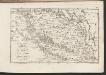
C. Posoniensis. Tab. II
Slowakei Komitat Preßburg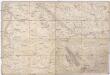
Special Karte von Ungarn
1 : 14400 Györ (Maďarsko : oblast) K.K. Militärisch-Geographisches Institut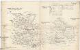
Oedenburger und Raaber Comitat
1 : 280000 Györ (Maďarsko : oblast)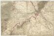
[Wien, Pressburg, Neusiedler See]
1 : 144000 Bratislava-oblast (Slovensko)
Mappa Comitatvs Posoniensis
1 : 240000 Mollova mapová sbírka Nicolaï, Georg David Christoph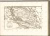

Uibersichts Karte der projectirten Tracen, der Wien-Raaber Eisenbahn sammt Nebenzweigen
1 : 430000 Győr (Maďarsko) M. Schönerer
Wien 147, uit: Special-Karte von Mittel-Europa / nach amtlichen Quellen bearbeitet von W. Liebenow
1 : 300000 titelvariant: W. Liebenow's Mittel-Europa; Annotatie: Titel boven de bladen: W. Liebenow's Mittel-Europa Johannes Wilhelm Liebenow 1822-1897 Frankfurt a. M. : Ludwig Ravenstein
Mappa Comitatvs Posoniensis
1 : 250000 Mollova mapová sbírka Bel, Matej Nicolaï, Georg David Christoph Bel, Matej
Komárom Vármegye
1 : 340000 Slovensko jižní
Übersichtskarte zu den Operationen vor u. nach der Schlacht bei Raab

Sbírka map a diagramů použitých na mírových konferencích v Paříži v letech 1919 - 1920

Generalkarte von Zentraleuropa
Siedlungsgebiet der Deutschen nach dem Nachbarschaftsindex für Westungarn 1941
Ungarn, Transdanubien, Deutsche, Siedlung Bottlik, Zsolt