Maps of Coastal Plain

萬國通鑑:美國東半圖
美国传教士撰的向中国人介绍世界地理概况的著作,后有世界地图册1份,共13幅世界、大洲和区域地图,其中一幅题为《中國地圖》的清朝内地地图。 Sheffield, Devello Zelotos 謝衛樓 福州 : 美華書局
Carte des Etats-Unis

Östliches Nordamerica
Neuer Handatlas über alle Theile der Erde Kiepert, Heinrich Verlag von Dietrich Reimer
United States.
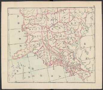
1 : 11400000 Tanner, Henry S.
United States.
1 : 11400000 Finley, Anthony
United States

Wyld's military map of the United States, the northern states, and the southern Confederate states, with the forts, harbours, arsenals, and military positions

United States

Carte Militaire des Etats - Unis (Partie Orientale).
1 : 5800000 Jouvet et Cie.
United States.
1 : 5000000 Arrowsmith, John
Map of the Atlantic States, showing distances from Washington (in bee line) by 50 mile circles

A map of the United States of North America: drawn from a number of critical researches / By A. Arrowsmith.
from Whole Aaron Arrowsmith,
Vereinigten Staaten von Nord America
Neuester Schul-Atlas Walch, Johann im Verlag bei Joh. Walch
US Population 1830, 1840.
1 : 10040000 Walker, Francis Amasa, 1840-1897
United States.
1 : 8000000 Tanner, Henry S.
United States.
1 : 8000000 Tanner, Henry S.
United States.
1 : 10140000 Finley, Anthony
Vereinigten Staaten v. N. America.
1 : 5140000 Weiland, C. F. (Carl Ferdinand), d. 1847
United States.
1 : 11200000 Worcester, Joseph E.
Map of the United States / by J.H. Young ; engraved by J.H. Young, D. Haines & F. Dankworth.
from Whole
United States.
1 : 8000000 Mitchell, Samuel Augustus
United States.
1 : 5068800 Arrowsmith, John
United States.
1 : 6200000 Hughes, William
Map of the Atlantic States, showing 50 mile distances from Washington
Map of the Atlantic States, showing 50 mile distances from Washington. L. Prang & Co.
Alden's Pictorial Map Of The United States Of North America.
1 : 2851200 Alden, Albert
Map Of The United States.
1 : 11000000 Barber, John Warner
Map of the Atlantic States, Showing Distances From Washington (In BeeLine) By 50 Mile Circles.
1 : 8236800 Prang, L. & Co.
Population - United States census, 1870. Density, Foreign, Colored, British American, Swedish and Norwegian.
1 : 15000000 Baskin, Forster and Company
Population - United States census, 1870. Density, Foreign, Colored, British American, Swedish and Norwegian.
1 : 14000000 Andreas, A. T. (Alfred Theodore), 1839-1900