Maps of Europe

Europa während des Zeitraums der Reformation und der Übermacht des Hauses Habsburg 1492 - 1618
1 : 15000000 Europa
Europa 2003 [Blattschnitt bis zum Ural]
Europa Kunz, Andreas ; Moeschl, Joachim Robert
Europa gegen Ende von Justinians Regierung (um 560 n. Ch. G.)
1 : 15000000 Europa, Mittelmeerraum, Justinian I., Byzantinisches Reich, Kaiser
Europa um 1740
1 : 15000000 Europa
Carte générale orographique et hydrographique de l'Europe, qui montre les principales ramifications des montagnes, fleuves et chemins avec les principales villes
1 : 4600000 dressée d'aprés les meilleures cartes des auteurs les plus acredités par le Général Baron Sorriot de L'Host gravée par Joseph List. Vienne, [s.n.]
Přehled kladu mapových listů měř. 1:200 000, 500 000, 1 000 000
Roman Empire at the Time of Christ.
1 : 12300000 Johnson, A.J.
Europae [Karte], in: Theatrum orbis terrarum, S. 22.
1 Karte aus Atlas Ortelius, Abraham

Roman Empire.
1 : 14495100 Fisher, Richard Swainson
Europa nach seinem politischen Zustande im Jahr 1828
Historisch-genealogisch-geographischer Atlas von Le Sage Las Cases, Emmanuel Auguste Dieudonné Marius Joseph de Johann Velten, Kunsthändler
Roman Empire at the Time of Christ.
1 : 12300000 Johnson, A.J.
Roman Empire at the Time of Christ.
1 : 12300000 Johnson, A.J.
Europa vom Westfälischen Frieden 1648 bis zur Zersplitterung der grossen spanischen Monarchie 1700 (Zeitraum der Übermacht Frankreichs)
1 : 15000000 Europa, Westfälischer Friede
Europa nach dem Wiener Congress 1815
1 : 15000000 Europa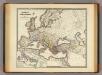
Imperium Romanorum inde a Constantini Magni tempore.
1 : 15500000 Menke, Th.
[Neuer Atlas der ganzen Erde nach den neuesten Bestimmungen ... : II.] Europa
Entworfen und gezeichnet von F.W. Streit H. Leutemann sc. Leipzig : J.C. Hinrichs'sche Buchhandlung
Europae [Karte], in: Theatrum orbis terrarum, S. 52.
1 Karte aus Atlas Ortelius, Abraham Vrients, Jan Baptista
Europa zur Zeit Napoleon's I. (um 1810)
1 : 15000000 Europa Napoleon I., Frankreich, Kaiser
Europa zur Zeit des dritten Kreuzzuges 1190
1 : 15000000 Europa Kreuzzug <1189-1192>
Europa Post Bellum Triginta Annorum. (1650-1700)
Europa Westfälischer Friede
Hauptverbindungslinien von Europa als Mittelpunkt des Welverkehrs
Geographischer Atlas über alle Theile der Erde Ziegler, Jakob Melchior Verlag von Joh. Wurster um Comp.
Europa zur Uebersicht der Flussgebiete und Höhenzüge
Hand-Atlas über alle Theile der Erde nach dem neuesten Zustande und über das Weltgebäude Stieler, Adolf bei Justus Perthes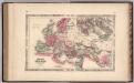
Roman Empire.
1 : 14630000 Johnson, A.J.
Kaart van Europa voor schoolgebruik bewerkt / door H. Blink
1 : 3000000 Annotatie: Met: Lengte en vermogen van eenige stroomen onderling vergeleken; Annotatie geografische gegevens: Schaalstok van 300 km; Legenda; 3 bijkaarten 1: Typisch voorbeeld van ligging en profil der fjorden in Noorwegen, 15,5 x 19,5 cm. 2: Simplonpas en St. Gothardspoorweg, schaal 3:500.000, 15,5 x 18,5 cm, resp. 24,5 x 9,5 cm. 3: Kaart van de Alpen, schaal 1:1.500.000, 34 x 49 cm Ten Brink, Meppel Meppel : H. ten Brink / (Groningen : J.H. van de Weijer)
Imperium Romanorum latissime patens
Evropa Spruner, Karl von Justus Perthes
Imperium Romanorum post divisionem occidentale & orientale
Evropa Spruner, Karl von Justus Perthes
Eisenbahn- und Dampfschiffrouten-Karte von Europa
1 : 3000000 Franz, J. Druck und Verlag von Carl Flemming
Karte von Europa und dem Mittelländischen Meere
1 : 4300000 Evropa Stülpnagel, Friedrich von Bär, Johann Christoph Justus Perthes


