Maps of Europe

Eisenbahn- und Dampfschiffrouten-Karte von Europa
1 : 3000000 Franz, J. Druck und Verlag von Carl Flemming
Europa gegen Ende von Justinians Regierung (um 560 n. Ch. G.)
1 : 15000000 Europa, Mittelmeerraum, Justinian I., Byzantinisches Reich, Kaiser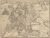
Europae [Karte], in: Theatrum orbis terrarum, S. 52.
1 Karte aus Atlas Ortelius, Abraham Vrients, Jan Baptista
Europa um 1740
1 : 15000000 Europa
Přehled kladu mapových listů měř. 1:200 000, 500 000, 1 000 000

Europa vom Westfälischen Frieden 1648 bis zur Zersplitterung der grossen spanischen Monarchie 1700 (Zeitraum der Übermacht Frankreichs)
1 : 15000000 Europa, Westfälischer Friede
Europa nach dem Wiener Congress 1815
1 : 15000000 Europa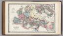
Roman Empire.
1 : 14495100 Fisher, Richard Swainson
Europa zur Zeit des dritten Kreuzzuges 1190
1 : 15000000 Europa Kreuzzug <1189-1192>
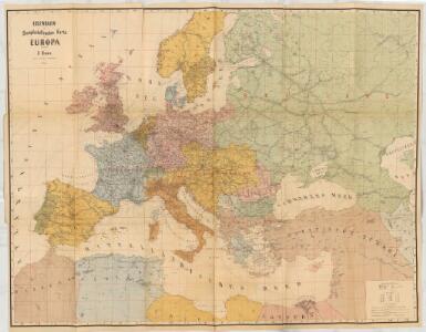
Hauptverbindungslinien von Europa als Mittelpunkt des Welverkehrs
Geographischer Atlas über alle Theile der Erde Ziegler, Jakob Melchior Verlag von Joh. Wurster um Comp.
Europa zur Uebersicht der Flussgebiete und Höhenzüge
Hand-Atlas über alle Theile der Erde nach dem neuesten Zustande und über das Weltgebäude Stieler, Adolf bei Justus Perthes
Europa zur Zeit Napoleon's I. (um 1810)
1 : 15000000 Europa Napoleon I., Frankreich, Kaiser
Europae [Karte], in: Theatrum orbis terrarum, S. 22.
1 Karte aus Atlas Ortelius, Abraham
Europa nach seinem politischen Zustande im Jahr 1828
Historisch-genealogisch-geographischer Atlas von Le Sage Las Cases, Emmanuel Auguste Dieudonné Marius Joseph de Johann Velten, Kunsthändler
Carte Geologique De L'Europe.
1 : 3800000 Dumont, Andre
Europa 2003 [Blattschnitt bis zum Ural]
Europa Kunz, Andreas ; Moeschl, Joachim Robert
Europa während des Zeitraums der Reformation und der Übermacht des Hauses Habsburg 1492 - 1618
1 : 15000000 Europa
Europa Post Bellum Triginta Annorum. (1650-1700)
Europa Westfälischer Friede
Europa
1 : 10000000 entworfen und gezeichnet von C. F. Weiland Weimar : Verlag des Geograph. Instituts
Europa um die Mitte des Vierzehnten Jahrhunderts
1 : 15000000 Europa
Das Deutschtum in Europa
1 : 36000000 Europa Ethnische Gruppe, Deutsche
Europa
Schul-Atlas in 36 Karten Völter, Daniel Verlag der J.M. Dannheimer'schen Buchhandlung
[Neuer Atlas der ganzen Erde nach den neuesten Bestimmungen ... : II.] Europa
Entworfen und gezeichnet von F.W. Streit H. Leutemann sc. Leipzig : J.C. Hinrichs'sche Buchhandlung
Ancient Roman empire
J. Dower Henry Teesdale & C
Europa, Staatenkarte
1 : 25000000 Europa
[Karte von Europa, Zur Übersicht der Wärme-Verbreitung in diesem Erdtheile]
Erster Band, enthaltend in vier Abtheilungen die Erscheinungen der anorganischen Natur: 1. Meteorologie und Klimatographie. 2. Hydrologie und Hydrographie. 3. Geologie. 4. Tellurischer Magnetismus Humboldt, Alexander von Verlag von Justus Perthes
Der europäische Raum
1 : 6000000 Afrika severní Richard Schwarz, Landkarten-Handlung und Geogr. Verlag
Europa Übersicht der politischen Verhältnisse und Hauptverkehrswege
1 : 20000000 Europa Verkehrsnetz
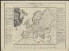
Machtverhältnisse der Europ. Staaten
1 : 14000000 Übersichtskarte Block, Maurice Justus Perthes