Maps of Scandinavia

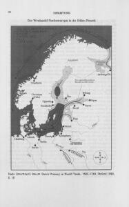
Der Westhandel Nordosteuropas in der Frühen Neuzeit
Europa (Nordost) Handel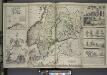
A new map of Denmark and Sweden. ...
from The world described, or, A new and correct sett of maps : shewing the kingdoms and states in all the known parts of the earth, with the principal cities, and most considerable towns in the world ... / ... by Herman Moll, geographer ...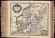
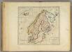
Tabula exactissima Regnorum Sueciae et Norvegiae, nec non Maris Universi Orientalis, terrarumq. adjacentium / summo studio ab Andrea Bureo Sueco in lucem edita ; noviter seria cura, singulariq. zelo, dedicatur humillimè Gustavo Adolpho ... a Nicolao Iohannide Piscatore ; Abraham Goos sculpsit
1 : 4700000 Annotatie: Origineel is Blad 141 in atlas factice; Annotatie geografische gegevens: Met 6 schaalstokken Claes Jansz. Visscher 1586/1587-1652; Andreas Bureus 1571-1646; Abraham Goos ca. 1589/90-1643 [Amsterdam : Nicolaus Johannis Piscator]
Spannungen in Nordeuropa
1 : 5000000 Evropa severní List & von Bressensdorf
Schonlandia XIII Nova Tabula [Karte], in: Geographia universalis vetus et nova complectens Claudii Ptolemaei Alexandrini enarrationis libros VIII, S. 335.
1 Karte aus Atlas Münster, Sebastian [und Ptolemaeus, Claudius]
Schweden und Norwegen oder Scandinavische Halbinsel Königr. Daenemark
Geographischer Atlas über alle Theile der Erde Ziegler, Jakob Melchior Verlag von Joh. Wurster um Comp.

Finnland und Skandinavien
1 : 4000000 Finsko Velhagen & Klasing
Sweden, Denmark, Norway and Finland.
1 : 6336000 Carey, Mathew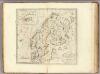
Sweden, Denmark, Norway and Finland.
1 : 8236800 Carey, Mathew
Sweden, Denmark, Norway and Finland.
1 : 8236800 Carey, Mathew
Neueste Karte von Schweden und Norwegen
Grosser Hand-Atlas über alle Theile der Erde in 170 Karten Meyer, J. Verlag des Bibliographischen Instituts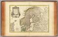
Suede, Danemarck et Norwege.
1 : 6900000 Janvier, Jean
Tabula exactissima Regnorum Sueciae et Norvegiae, nec non Maris Universi Orientalis [...] [Karte], in: Novus atlas absolutissimus, Bd. 1, S. 45.
1 Karte aus Atlas Janssonius Offizin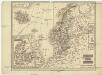
Schweden und Norwegen
1 : 11400000 Dánsko
Suecia, Dania, Et Norvegia, Regna Europae Septentrionalia. [Karte], in: Le théâtre du monde, ou, Nouvel atlas contenant les chartes et descriptions de tous les païs de la terre, Bd. 1, S. 55.
1 Karte aus Atlas Blaeu, Willem Janszoon und Blaeu, Joan Blaeu, Willem Janszoon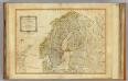
Northern States.
1 : 4400000 Robert Laurie & James Whittle
Carte generale de toute l'Europe, 2
1 Blatt : 56 x 46 cm J.M. Will
Sueciae, Norvegiae, et Daniae, Nova Tabula. [Karte], in: Novus atlas absolutissimus, Bd. 1, S. 42.
1 Karte aus Atlas Janssonius Offizin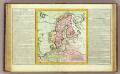
Suede, Dannemarck, Norwege.
1 : 8500000 Clouet, J. B. L. (Jean-Baptiste Louis), b. 1730
Vorstellvng der Sonnen- oder Erd, Finsternis den 25. Jul. 1748
Mollova mapová sbírka Lowitz, Georg Moriz Dorn, Sebastian Homann, Johann Baptista - dědici
The countries of northern Europe
Sweden, Denmark, Norway and Finland.
1 : 6600000 Carey, Mathew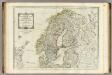
A new map of the Northern States containing the Kingdoms of Sweden, Denmark, and Norway.
1 : 4400000 Kitchin, Thomas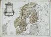
Les couronnes du Nord comprenant les royaumes de Suede Danemarck et Norwege
1 Karte : Kupferdruck ; 46 x 64 cm Janvier; Lattré; Choffard chés Lattré graveur rue Saint Jacques au coin de celle de la parcheminerie à la ville de Bordeaux
La Scandinavie.
1 : 4200000 Lapie, M. (Pierre), 1779-1850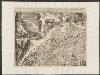
Suecia, Dania, Et Norvegia, Regna Europae Septentrionalia. [...] [Karte], in: Theatrum orbis terrarum, sive, Atlas novus, Bd. 1, S. 53.
1 Karte aus Atlas Blaeu, Joan Blaeu, Willem Janszoon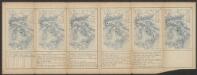
Schonlandia XIII Nova Tabula [Karte], in: Claud. Ptolemaeus. Geographia lat. cum mappis [...], S. 389.
1 Karte aus Atlas Münster, Sebastian [und Ptolemaeus, Claudius]
Sweden, Denmark, Norway and Finland.
1 : 6400000 Carey, Mathew