Maps of Siófoki járás

Balaton-Füred
1 : 75000 Balatonfüred, Umland
Siófok, Balatonkiliti-Vilmatelep
1 : 10000 M. Kir. Állami Térképészet
Balatonfüredfürdo
1 : 10000 M. Kir. Állami Térképszet
Tihanyi félsziget
1 : 20000 M. Kir. Állami Térképészet
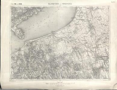
Balatonfured und Varos-Hidveg.
from Spezialkarte der osterreichisch-ungarischen Monarchie.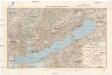
Balaton und Umgebung
1 : 200000 Balaton (Maďarsko : jezero : oblast) M. Kir. Állami Térképészet
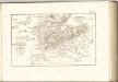
Veszprém vármegye térképe
1 : 400000 Veszprém (Maďarsko : oblast) Kogutowicz, Manó Magyar Földrajzi Intézet
Szalader com[it.] Schackmin Cvrassie Regiments
1 : 467000 Balaton-oblast (Maďarsko) Cir, V.
Stoni Beograd
1 : 200000 Székesfehérvár (Maďarsko) Generalštab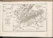
C. Szaladiensis. Tab. III
Ungarn Komitat Zala
Stuhlweissenburg 162, uit: Special-Karte von Mittel-Europa / nach amtlichen Quellen bearbeitet von W. Liebenow
1 : 300000 titelvariant: W. Liebenow's Mittel-Europa; Annotatie: Titel boven de bladen: W. Liebenow's Mittel-Europa Johannes Wilhelm Liebenow 1822-1897 Frankfurt a. M. : Ludwig Ravenstein
Somogy vármegye térképe
1 : 400000 Kaposvár (Maďarsko) Kogutowicz, Manó Magyar Földrajzi Intézet
Veszprémer Comitat
1 : 280000 Veszprém (Maďarsko : oblast)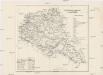
Veszprémer Comitat
1 : 280000 Veszprém-oblast (Maďarsko)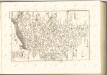
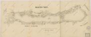
Balaton Tava

Comitat Somogy
1 : 300000
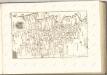
C. Veszprim
Ungarn Komitat Veszprém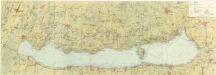
Balaton turistická mapa

Fejér vármegye térképe
1 : 380000 Fejér (Maďarsko) Kogutowicz, Manó Magyar Földrajzi Intézet
Fejér válmegye
1 : 370000 Fejér (Maďarsko) Chiapó, Benjamin Benedicti, Hieronymus
Comitat Stuhlweissenburg
1 : 300000
Comitat Stuhlweissenburg
1 : 280000 Székesfehérvár (Maďarsko)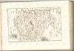

C. Albensis
Ungarn Fejér
C. Tolnensis
Ungarn Komitat Tolna