Maps of Normandy
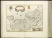
[16][16] Normandia Ducatus, uit: Atlas sive Descriptio terrarum orbis
Annotatie: Gedigitaliseerde versie. Amsterdam. Heiloo : Picturae (vervaardiger), 2015. tiff-bestand. Gedigitaliseerd: 07-01-2015; Origineel: Universiteitsbibliotheek Vrije Universiteit (XL.05127.-) ; Netherlands; Titelpagina ontbreekt Wit, Frederik de Amsterdam : Frederick de Wit
Postkarte von Frankreichs norwestlichen Departements oder der Normandie und Bretagne
Bretaň (Francie) Müller, Franz im von Reillyschen Landkarten und Kunstwerke Verschleiss Komptoir
Le Duché et gouvernement de Normandie
1 Karte : Kupferdruck ; 47 x 59 cm Jaillot A.-H. Jaillot
Le Duché et gouvernement de Normandie
1 Karte : Kupferdruck ; 47 x 59 cm Jaillot chez J. Cóvens et C. Mortier
Karte von Frankreich in XVI Blättern, No. 2 und [No. 6]
2 Blätter : 52 x 34 cm Königl. Preuss. Academischen Kunst und Buchhandlung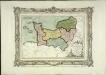
Carte des départemens de la Manche, du Calvados, de l'Orne, de l'Eure et de la Seine inférieure
1 Karte : Kupferdruck ; 22 x 32 cm, Bildgrösse 32 x 42 cm Brion de la Tour; Desnos chez le S. Desnos rue St. Jacques au globe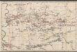
Le Duché et Gouvernement De Normandie divisée en Haute et Basse Normandie [...] [Karte], in: Atlas nouveau, contenant toutes les parties du monde [...], Bd. 1, S. 117.
1 Karte aus Atlas Sanson, Nicolas Jaillot, Alexis Hubert und Mortier, Pieter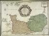
Le gouvernement general de Normandie
1 Karte : Kupferdruck ; 45 x 63 cm Desnos chez Desnos géographe ingénieur pour les globes spheres et instruments de mathématique rue St. Jacques au globe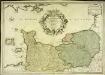
Le gouvernement general de Normandie
1 Karte : Kupferdruck ; 45 x 65 cm Fer; Danet; Starckman chez Danet gendre de l'auteur sur le pont Notre Dame a la Sphere royale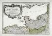
Premiere feuille contenant la Bretagne, la Normandie, le Maine et perche
1 Blatt : 39 x 56 cm Bourgoin
Le gouvernement de Normandie & une partie de l'Isle de France d'Orléanois & de Bretagne
1 : 540000 A Amsterdam : chez Joachim Ottens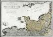
Neueste Generalkarte von Frankreich, 1
1 Blatt : 54 x 77 cm F.A. Schrämbl
8) IV. N.E. ''Cherbourg'', uit: Carte géologique de France
1 : 500000 Annotatie: Voor aanwezige bladen zie bladoverzicht [S.l : s.n.]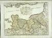
Duché et gouvernement de Normandie
1 Karte : Kupferdruck ; 37 x 50 cm Sanson; Cordier s.n.
Carte du gouvernement de Normandie avec celui du Maine et Perche
1 Karte : Kupferdruck ; 42 x 57 cm Bonne; Santini; Remondini chez Mr. Remondini
Li governi di Normandia del Maine, e Perche
1 Karte : Kupferdruck ; 29 x 39 cm Zatta; Zuliani presso Antonio Zatta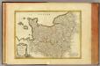
Normandie, Maine, Perche.
1 : 930000 Bonne, Rigobert, 1727-1794
Normandia Ducatus. [Karte], in: Novus atlas absolutissimus, Bd. 4, S. 109.
1 Karte aus Atlas Janssonius Offizin
Carte de France, 2
2 Blätter : Kupferdruck ; 53 x 45 cm Crepy
Normandia Ducatus. [Karte], in: Gerardi Mercatoris et I. Hondii Newer Atlas, oder, Grosses Weltbuch, Bd. 2, S. 65.
1 Karte aus Atlas Mercator, Gerhard und Hondius, Jodocus Jansson, Jan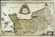
Le Duché et gouvernement de Normandie
1 Karte : Kupferdruck ; 55 x 87 cm Sanson; Jaillot chez H. Iaillot au deux Globes
Gouvernement de Normandie, et celui Maine-Perche
1 : 5920000 Maine (Francie) Bonne, Rigobert André
Gouvernement général de Normandie
1 Karte : Kupferdruck ; 47 x 57 cm Robert de Vaugondy G. et D. Robert de Vaugondy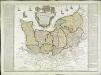
Carte de la province de Normandie qui comprend les gouvernements militaires de Normandie et du Havre de Grace
1 Karte : Kupferdruck ; 45 x 50 cm Nolin; Basset; Basset chez Basset rue St. Jacques
Normannia ducatus, tum superior ad ortum, tum inferior ad occasum, præfectura generalis
1 Karte : Kupferdruck ; 46 x 58 cm Valck; Valck Gerard und Leonardus Valck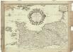
Le gouvernement general de Normandie, divisé en Haute et Basse
1 : 600000 Normandie (Francie) Fer, Nicolas de Danet, Guillaume Danet
Duche et gouvernement general de Normandie
1 Karte : Kupferdruck ; 48 x 59 cm Wit se vend chez J. Cóvens et C. Mortier
Duche et gouvernement general de Normandie
1 Karte : Kupferdruck ; 48 x 59 cm Wit F. de Wit
Duche et gouvernement general de Normandie
1 Karte : Kupferdruck ; 49 x 58 cm Seutter; Lotter M. Seutter
![[16][16] Normandia Ducatus, uit: Atlas sive Descriptio terrarum orbis](https://images-2.georeferencer.com/images/iiif/944701613950/full/,300/0/native.jpg)

