Maps of Pyrénées-Atlantiques

38) X.S.E. ''Bayonne'', uit: Carte géologique de France
1 : 500000 Annotatie: Voor aanwezige bladen zie bladoverzicht [S.l : s.n.]
Descriptions exacte et particvliere des costes, et haures de Bayonne, St. Jean de Lux labour
1 : 235000 Bayonne (Francie) Boisseau, Jean Iean boisseau
The sea coast of FRANCE from the bay of arcassin to bayon continued to gataria
from The sea-atlas : containing an hydrographical description of most of the sea-coasts of the known parts of the world.
Le Pais De Bearn. [Karte], in: Novus atlas absolutissimus, Bd. 4, S. 168.
1 Karte aus Atlas Janssonius Offizin
Le Pais De Bearn. [Karte], in: Gerardi Mercatoris et I. Hondii Newer Atlas, oder, Grosses Weltbuch, Bd. 2, S. 128.
1 Karte aus Atlas Mercator, Gerhard und Hondius, Jodocus Jansson, Jan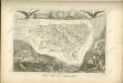

Mapa del m. n. y m. l. provincia de Guipuzcoa
1 Karte : Kupferdruck ; 36 x 36 cm López s.n.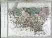
Departement des Basses Pyrenées
1 Karte : Kupferdruck ; 48 x 59 cm Houdan; Dumez chez Dumez directeur de l'Atlas national de France rue de la Harpe no. 26, et au dépôt dud.t atlas placé au cabinet bibliographique rue de la Monnoye no. 5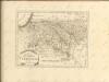

Dept. Des Bses. Pyrenees.
1 : 563000 Levasseur, Victor.

Le pais de Bearn
1 : 330000 Béarn (Francie) Hamersveldt, Everard S. van P. Schenk et G. Valk
Le pais de Bearn
1 : 320000 Béarn (Francie) Hamersveldt, Everard S. van
Le pais de Bearn
1 Karte : Kupferdruck ; 36 x 48 cm Janssonius; Hamersvelt apud Ioannem Ianssonium
Le pais de Bearn
1 Karte : Kupferdruck ; 36 x 47 cm Schenk; Valck; Hamersvelt apud G. Valk et P. Schenk
Le pais de Bearn
1 Karte : Kupferdruck ; 36 x 48 cm Hondius; Hamersvelt Henricus Hondius
Gouvernement de Bearn
1 Karte : Kupferdruck ; 30 x 42 cm Mentelle; Tardieu; Dubuisson Mentelle
Le pays de Bearn
1 Karte : Kupferdruck ; 11 x 15 cm Sebastian Cramoisy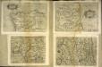
Gvipvscoa
1 Karte : Kupferdruck ; 15 x 22 cm Lambert Andreae
Principatus Benearnia. La Principaute De Bearn. [Karte], in: Theatrum orbis terrarum, sive, Atlas novus, Bd. 2, S. 126.
1 Karte aus Atlas Blaeu, Joan Blaeu, Willem Janszoon
Mapa de la provincia de Guipuzcoa / construido segun las noticias de sus naturales por Dn. Tomás Lopez
1 Mapa, b/n. Full 89 de: Atlas geográfico de España. Madrid, 1830 (1a ed. 1804). Editat pels fills de T. López Datació aproximada. López, Tomás en la calle de Atocha
Principatus Benearnia. La Principaute De Bearn. [Karte], in: Le théâtre du monde, ou, Nouvel atlas contenant les chartes et descriptions de tous les païs de la terre, Bd. 2, S. 141.
1 Karte aus Atlas Blaeu, Willem Janszoon und Blaeu, Joan Blaeu, Willem Janszoon
Principatus Benearnia. La Principaute De Bearn. [Karte], in: Novus Atlas, das ist, Weltbeschreibung, Bd. 2, S. 140.
1 Karte aus Atlas Blaeu, Joan Blaeu, Willem Janszoon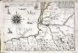
Partie de la capitainerie garde costes de Bayonne
1 Karte : 23 x 33 cm de Fer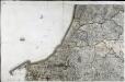
[Bayonne]
1 Blatt : 56 x 90 cm s.n.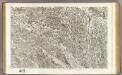
107 Aire, Orthez.
1 : 86400 Cassini family; Cassini, Cesar-Francois, 1714-1784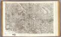
108 Pau, Bearn.
1 : 86400 Cassini family; Cassini, Cesar-Francois, 1714-1784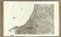
139 Bayonne.
1 : 86400 Cassini family; Cassini, Cesar-Francois, 1714-1784
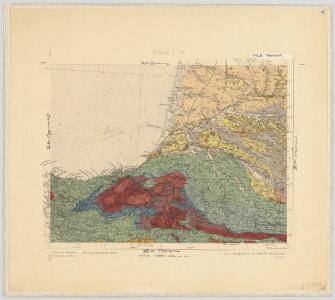
Guipúzcoa
1 : 200000 1 Mapa, b/n. Dins: Atlas de España y sus posesiones de ultramar Coello, Francisco ; Madoz, Pascual [Imprenta del Atlas de España]