Maps of Dax

Descriptions exacte et particvliere des costes, et haures de Bayonne, St. Jean de Lux labour
1 : 235000 Bayonne (Francie) Boisseau, Jean Iean boisseau
38) X.S.E. ''Bayonne'', uit: Carte géologique de France
1 : 500000 Annotatie: Voor aanwezige bladen zie bladoverzicht [S.l : s.n.]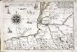
Partie de la capitainerie garde costes de Bayonne
1 Karte : 23 x 33 cm de Fer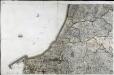
[Bayonne]
1 Blatt : 56 x 90 cm s.n.
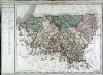
Mapa del m. n. y m. l. provincia de Guipuzcoa
1 Karte : Kupferdruck ; 36 x 36 cm López s.n.
139 Bayonne.
1 : 86400 Cassini family; Cassini, Cesar-Francois, 1714-1784
[Vieux-Boucau]
1 Blatt : 56 x 45 cm Aldring s.n.
Govvernement de Bayonne
1 Karte : Kupferdruck ; 11 x 15 cm Sebastian Cramoisy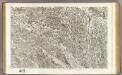
107 Aire, Orthez.
1 : 86400 Cassini family; Cassini, Cesar-Francois, 1714-1784
138 Vieux-Boucau.
1 : 86400 Cassini family; Cassini, Cesar-Francois, 1714-1784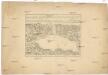
Plan du port du passage en Espagne
1 : 16000 Biskajský záliv (Francie a Španělsko) Fer, Nicolas de de Fer
Plan de lisle de la Conference
1 Vogelschauplan : Kupferdruck ; 41 x 51 cm Beaulieu S. de Pontault de Beaulieu
Plan of the town and port of San Sebastian in the bay of Biscay and province of Guipuscoa.- Plan of the port of passages in the bay ofbiscay and province of Guipuscoa
Tofiño de San Miguel, Vicente
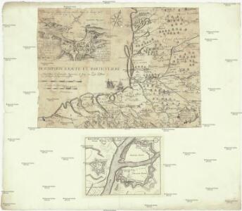
Plan de St. Jean de Luz avec les différents projets d'agrandissem.t du port

Plan de l'isle des Faisans, a present dite de la Conference
1 Plan : Kupferdruck ; 42 x 51 cm Beaulieu S. de Pontault de Beaulieu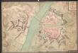
A colored plan of the "ville, citadelle, et château de Bayone"; drawn about 1700, on a scale of 33 toises to an inch.
A colored manuscript plan of the ville, citadelle, et château de Bayone, in Basses-Pyrénées in France; "drawn about 1700, on a scale of 33 toises to an inch."
Plano del Puerto de Lequeitio
Palmerola, J. ; Pérez y Pérez, E. ; Becerril, J.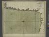
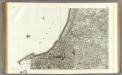
The sea coast of FRANCE from the bay of arcassin to bayon continued to gataria
from The sea-atlas : containing an hydrographical description of most of the sea-coasts of the known parts of the world.
Bovrdelois, pays de Medoc, et la prevoste de Born
1 Karte : Kupferdruck ; 36 x 48 cm Hondius; Hamersvelt; Mercator excudit Judocus Hondius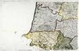
Carte de la France, no. 14
1 Blatt : 60 x 92 cm s.n.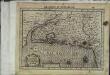
Bovrdelois, pais de Medoc et la prevoste de Born
1 Karte : Kupferdruck ; 17 x 24 cm Mercator Cloppenburgh
Bovrdelois, pays de Medoc, et la prevoste de Born
1 Karte : Kupferdruck ; 36 x 48 cm Janssonius; Hamersvelt excudit Joannes Janssonius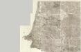
Composite 14: Carte de France.
1 : 86400 Cassini family; Cassini, Cesar-Francois, 1714-1784
Bovrdelois, pays de Medoc, et la prevost de Born
1 : 600000 Bordeaux (Francie) Hamersveldt, Everard S. van P. Schenk et G. Valk
Carte du Bovrdelois, du pais de Medoc, et de la prevosté de Born
2 Karten auf 1 Blatt : Kupferdruck ; zus. 39 x 51 cm Blaeu Guiljel. Blaeu exc
Le Pais De Bearn. [Karte], in: Novus atlas absolutissimus, Bd. 4, S. 168.
1 Karte aus Atlas Janssonius Offizin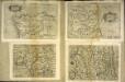
Gvipvscoa
1 Karte : Kupferdruck ; 15 x 22 cm Lambert Andreae
Le Pais De Bearn. [Karte], in: Gerardi Mercatoris et I. Hondii Newer Atlas, oder, Grosses Weltbuch, Bd. 2, S. 128.
1 Karte aus Atlas Mercator, Gerhard und Hondius, Jodocus Jansson, Jan