Maps of Bezirk Zwettl

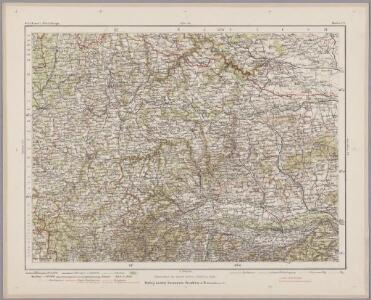
Znaim 132, uit: Special-Karte von Mittel-Europa / nach amtlichen Quellen bearbeitet von W. Liebenow
1 : 300000 titelvariant: W. Liebenow's Mittel-Europa; Annotatie: Titel boven de bladen: W. Liebenow's Mittel-Europa Johannes Wilhelm Liebenow 1822-1897 Frankfurt a. M. : Ludwig Ravenstein
Ob Mannharts Berg
1 : 640000 Mollova mapová sbírka Insprugger, Sebastianus Märtin, Johann Heinrich Voigt, Maria Theresia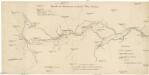
Übersicht der Canaltracen der Strecke Wien-Budweis
1 : 300000 Vídeň (Rakousko) Staff, A. Rosenberg, K.

Carte Topographique d'Allemagne.
1 : 220000 Mollova mapová sbírka Jaeger, Johann Wilhelm Abraham Berndt, Johann Christoph Jäger, Johann Wilhelm Abraham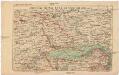
Localstrecke von Wien K. F. J. B. bis Krems mit Umgebung
Kremže (Rakousko) K. k. Österreichische Staatsbahnen
Das in dem Ertzhertzogtumb Vnter Osterreich
1 : 246000 Dolní Rakousko (Rakousko) Vischer, Georg Matthaeus Hoffmann, Jakob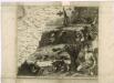
Müllerova mapa Čech XXIV
1 : 132000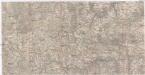
Special-Karte zu den Corps-Manövern bei Waidhofen a[n] [der Thaya] 1891
1 : 75000 Waidhofen an der Thaya (Rakousko)
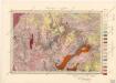
Umgebungskarte von Krems und Zwettl
1 : 75000 R. Lechner
Monumenta Cartographica Bohemiae II.: Müllerova mapa

Special-Karte zu den Corps-Manövern bei Waidhofen a[n] [der Thaya] 1981
1 : 75000 Waidhofen an der Thaya (Rakousko) K.u.k militär-geographisches Institut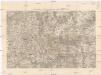
Special-Karte zu den Corps-Manövern bei Waidhofen a[n] [der Thaya] 1891
1 : 75000 Waidhofen an der Thaya (Rakousko) K.u.k militär-geographisches Institut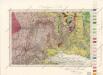
Umgebungen von Krems
Umgebungen von Göffritz

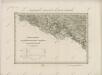
Ober Hallabrunn.
from Spezialkarte der osterreichisch-ungarischen Monarchie.
Horn (Nieder-Osterreich).
from Spezialkarte der osterreichisch-ungarischen Monarchie.
Wachau
1 : 100000 Weigl, August Kartografische Anstalt G. Freytag & Berndt
Geognostische Karte der Umgebungen von Krems und von Manhardsberge
1 : 71200 Kremže (Rakousko) Čížek, Johann
Umgebungen von Krems
Kremže (Rakousko : oblast)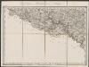
Umgebungen von Frainersdorf und Zlabings
1 : 144000 K.K. Militärisches Geographisches Institut
Znaim.
from Spezialkarte der osterreichisch-ungarischen Monarchie.
Drosendorf (Mahren).
from Spezialkarte der osterreichisch-ungarischen Monarchie.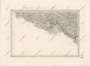
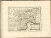
Special - Karte der Markgrafschaft Maehren und des Herzogthums Schlesien

Tulln.
from Spezialkarte der osterreichisch-ungarischen Monarchie.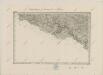
II. vojenské mapování 16
1 : 144000
Krems.
from Spezialkarte der osterreichisch-ungarischen Monarchie.
II. vojenské mapování 16
1 : 144000