Maps of West Sulawesi

Blad XV Kajoeng, uit: Residentie Wester-Afdeeling van Borneo / Topographisch Bureau
1 : 200000 titelvariant: Residentie Westerafdeeling van Borneo; Annotatie: Titelvariant: Residentie Westerafdeeling van Borneo; Voor aanwezige bladen zie overzichtsblad; Annotatie geografische gegevens: Opname: 1886-1895 Topographisch Bureau, Batavia Batavia : Topographisch Bureau
Bandjermasin / U.S. Army Map Service
U.S. Army Map Service Washington D.C. Washington D.C. : U.S. Army Map Service
Oost Borneo / samengesteld en gedrukt bij den Topografischen Dienst
Topografische Dienst Batavia Batavia : Topografische Dienst
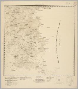
Tarakan / Survey of India
Survey of India [S.l.] : Survey of India
Makassar / Survey of India
Survey of India [S.l.] : Survey of India
Samarinda / Survey of India
Survey of India [S.l.] : Survey of India
Madjene / Survey of India
Survey of India [S.l.] : Survey of India
Sangkoelirang / Survey of India
Survey of India [S.l.] : Survey of India
Gouvernement Celebes en Onderh[origheden] (Zuidwest) / Topografische Dienst, Batavia
[S.l. : s.n.]
Afstandstabel van autowegen in Zuid-Selebes in km / Th. Paltrusch, directeur L. Werken
L. Werken [Batavia] : L. Werken
Blad IX Soekadana, blad d, uit: Residentie Wester-Afdeeling van Borneo : weg- en rivierkaart / Topographisch Bureau
1 : 50000 Annotatie: Voor aanwezige bladen zie overzichtsblad Topographisch Bureau, Batavia Batavia : Topographisch Bureau
Kaart van het Landschap Koetai
[S.l. : s.n.]
Kaart van het oostelijk gedeelte van Borneo : vanaf Mangka Liat tot de Koeran of Berouwrivier
Aardrijkskundig Genootschap Amsterdam : Stemler
Sabah

Bandjarmasin / Topografische Dienst
Topografische Dienst Batavia Batavia : Topografische Dienst
Bandjarmasin / samengesteld en gedrukt bij den Topografischen Dienst
Topografische Dienst Batavia Batavia : Topografische Dienst
Gouvernement Celebes en Onderh[origheden] / Topografische Dienst, Batavia
[S.l. : s.n.]
[Peta Kalimantan (Indonesian Borneo)

North Borneo / U.S. Army Map Service
U.S. Army Map Service Washington D.C. Washington D.C. : U.S. Army Map Service
North Borneo / Topografische Dienst
Topografische Dienst Batavia Batavia : Reproductiebedrijf Topografische Dienst
Schetskaart van Midden- en Zuid-Celebes / Topographische Inrichting
Topographische Inrichting Batavia Topographische Inrichting
Kaart van Zuid-West-Celebes : bevattende de Gouvernements-, de leenroerige en een gedeelte der bondgenootschappelijke landen behoorende tot het Gouvernement van Celebes en Onderh[origheden]
J.Smulders & Co. Den Haag Den Haag : Smulders & Co
Schetskaart van de autowegen in de Zelfbesturende Landschappen van Celebes
[S.l. : s.n.]
Kaart van het gebied der christelijke Toradjakerk op West Midden-Celebes : zendingsgebied van de Gereformeerde Zendingsbond in de Ned[erlands] Herv[ormde] Kerk en de Chr[istelijk] Geref[ormeerde] Kerken in Nederland
[S.l. : s.n.]
Kaart van Zuid-West-Celebes : bevattende de Gouvernements-, de leenroerige en een gedeelte der bondgenootschappelijke landen behoorende tot het Gouvernement van Celebes en Onderh[origheden] / Topographische Inrichting
Topographische Inrichting [Batavia] : Topographische Inrichting
Kaart van de Onderafdeeling Koetei de Afdeeling Koetei en N[oord] O[ost] Kust van Borneo
Den Haag : Smulders & Co
Schetskaart van Zuid-West-Celebes
[S.l. : s.n.]
Blad XIV Bija, uit: Residentie Wester-Afdeeling van Borneo / Topographisch Bureau
1 : 200000 titelvariant: Residentie Westerafdeeling van Borneo; Annotatie: Titelvariant: Residentie Westerafdeeling van Borneo; Voor aanwezige bladen zie overzichtsblad; Annotatie geografische gegevens: Opname: 1886-1895 Topographisch Bureau, Batavia Batavia : Topographisch Bureau
Kaart van Zuid Celebes : bevattende de Gouvernemts- en een gedeelte der leenroerige- en bondgenootschappelijke landen behoorende tot het Gouvernement van Celebes en Onderh[origheden] / [Topographische Inrichting]
Topographische Inrichting Batavia [Batavia : Topographische Inrichting]