Maps of Tarakan

[Peta Kalimantan (Indonesian Borneo)

Tarakan / prepared under the direction of the Chief of Engineers by the Army Map Service, US Army
US Army Washington D.C. . Army Map Service Washington D.C. : Army Map Service, US Army
Tawau / prepared under the direction of the Chief of Engineers by the Army Map Service, US Army
US Army Washington D.C. . Army Map Service Washington D.C. : Army Map Service, US Army
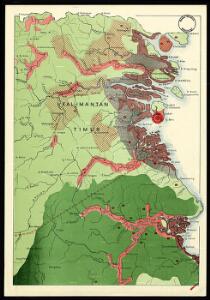
Eiland Tarakan : Opgenomen door den Topografische Dienst (Luchtfotogrammetrische Sectie) in 1935
Topografische Dienst Batavia Batavia : Reproductiebedrijf Topografische Dienst
T[angoen]g Simaja / published by Survey Directorate H.Q. SEALF ; prepared under the direction of the Chief of Engineers
Survey Directorate H.Q. SEALF Washington D.C. : Army Map Service
T[angoen]g Batoe / published by Survey Directorate H.Q. SEALF ; prepared under the direction of the Chief of Engineers
Survey Directorate H.Q. SEALF Washington D.C. : Army Map Service
Boeang / published by Survey Directorate H.Q. SEALF ; prepared under the direction of the Chief of Engineers
Survey Directorate H.Q. SEALF Washington D.C. : Army Map Service
Bakatan / published by Survey Directorate H.Q. SEALF ; prepared under the direction of the Chief of Engineers
Survey Directorate H.Q. SEALF Washington D.C. : Army Map Service
P[oelau] Fanny / published by Survey Directorate H.Q. SEALF ; prepared under the direction of the Chief of Engineers
Survey Directorate H.Q. SEALF Washington D.C. : Army Map Service
T[angoen]g Batoe Pasoe / published by Survey Directorate H.Q. SEALF ; prepared under the direction of the Chief of Engineers
Survey Directorate H.Q. SEALF Washington D.C. : Army Map Service
P[oelau] Boeka / published by Survey Directorate H.Q. SEALF ; prepared under the direction of the Chief of Engineers
Survey Directorate H.Q. SEALF Washington D.C. : Army Map Service
Djoewata / published by Survey Directorate H.Q. SEALF ; prepared under the direction of the Chief of Engineers
Survey Directorate H.Q. SEALF Washington D.C. : Army Map Service
S[oengai] Tenau / published by Survey Directorate H.Q. SEALF ; prepared under the direction of the Chief of Engineers
Survey Directorate H.Q. SEALF Washington D.C. : Army Map Service
Tarakan / published by Survey Directorate H.Q. SEALF ; prepared under the direction of the Chief of Engineers
Army Map Service US Army WAshington D.C. Washington D.C. : Army Map Service
K[on]g Djoewata / [Topografische Dienst]
Topografische Dienst Weltevreden (Batavia) [Weltevreden (Batavia) : Reproductiebedrijf Topografische Dienst]
Zuid-Tarakan : kuststrook van de S. Karoengan tot Tg. Batoe / Topografische Dienst
Topografische Dienst Weltevreden (Batavia) Weltevreden (Batavia) : Reproductiebedrijf Topografische Dienst
Zuid-Tarakan : Peningki-Karoengan complex / Topografische Dienst
Topografische Dienst Weltevreden (Batavia) Weltevreden (Batavia) : Reproductiebedrijf Topografische Dienst
Blad VII Siding, blad g, uit: Residentie Wester-Afdeeling van Borneo : weg- en rivierkaart / Topographisch Bureau
1 : 50000 Annotatie: Voor aanwezige bladen zie overzichtsblad Topographisch Bureau, Batavia Batavia : Topographisch Bureau
Blad XXV Boengan, blad i, uit: Residentie Wester-Afdeeling van Borneo : weg- en rivierkaart / Topographisch Bureau
1 : 50000 Annotatie: Voor aanwezige bladen zie overzichtsblad Topographisch Bureau, Batavia Batavia : Topographisch Bureau
Oost Borneo / samengesteld en gedrukt bij den Topografischen Dienst
Topografische Dienst Batavia Batavia : Topografische Dienst
Blad IX Soekadana, blad d, uit: Residentie Wester-Afdeeling van Borneo : weg- en rivierkaart / Topographisch Bureau
1 : 50000 Annotatie: Voor aanwezige bladen zie overzichtsblad Topographisch Bureau, Batavia Batavia : Topographisch Bureau
Tarakan / Survey of India
Survey of India [S.l.] : Survey of India
Blad VII Siding, blad b, uit: Residentie Wester-Afdeeling van Borneo : weg- en rivierkaart / Topographisch Bureau
1 : 50000 Annotatie: Voor aanwezige bladen zie overzichtsblad Topographisch Bureau, Batavia Batavia : Topographisch Bureau
Kaart van het oostelijk gedeelte van Borneo : vanaf Mangka Liat tot de Koeran of Berouwrivier
Aardrijkskundig Genootschap Amsterdam : Stemler
Kaart van een gedeelte van Borneo : met aanwijzing van de grens tusschen het Nederlandsche gebied en dat van het Britsche protectoraat / Top. Inrichting
Topographische Inrichting Batavia [Batavia] : Top[ographische] Inrichting
Blad XVIII Batang Loepar, blad n, uit: Residentie Wester-Afdeeling van Borneo : weg- en rivierkaart / Topographisch Bureau
1 : 50000 Annotatie: Voor aanwezige bladen zie overzichtsblad Topographisch Bureau, Batavia Batavia : Topographisch Bureau
Kaart van het Noordelijk gedeelte benoorden 1ÿê N.B. van het eiland Borneo / [J.W. Stemfoort en J.J. ten Siethoff ; gereproduceerd op last van het Departement van Koloniën, aan de Topographische Inrichting te 's-Gravenhage, onder leiding van den Directeur C.A. Eckstein]
Ministerie van Koloniën Den Haag s-Gravenhage : Departement van Koloniën
13. Kaart der residentie Zuider- en Ooster-Afdeeling van Borneo, uit: Atlas van Nederlandsch Oost-Indië / samengest. door Topographisch Bureau te Batavia van 1897-1904
Annotatie: Omgewerkte versie van: Atlas der Nederlandsche bezittingen in Oost-Indië / naar de nieuste bronnen samengest. door J.W. Stemfoort en J.J. ten Siethoff. - 's-Gravenhage : Topographische Inrichting, [ca. 1885] Topographisch Bureau, Batavia 's-Gravenhage : Topographische Inrichting
Overzichtskaart van de administratieve indeeling der Residentie Zuider- en Oosterafdeeling van Borneo / Top[ographische] Inr[ichting]
Topographische Inrichting Batavia Batavia : Top[ographische] Inr[ichting]