Maps of Belait

Blad XXV Boengan, blad i, uit: Residentie Wester-Afdeeling van Borneo : weg- en rivierkaart / Topographisch Bureau
1 : 50000 Annotatie: Voor aanwezige bladen zie overzichtsblad Topographisch Bureau, Batavia Batavia : Topographisch Bureau
Blad VII Siding, blad g, uit: Residentie Wester-Afdeeling van Borneo : weg- en rivierkaart / Topographisch Bureau
1 : 50000 Annotatie: Voor aanwezige bladen zie overzichtsblad Topographisch Bureau, Batavia Batavia : Topographisch Bureau
Oost Borneo / samengesteld en gedrukt bij den Topografischen Dienst
Topografische Dienst Batavia Batavia : Topografische Dienst
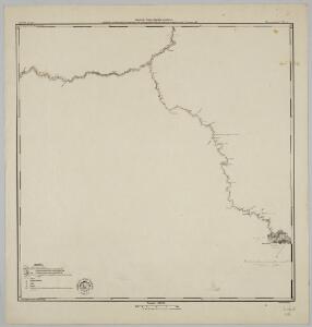
Bladwijzer van Zuider- en ooster Afd[eling] v[an] Borneo
[S.l. : s.n.]
Blad XXIV Boven Serawai, blad a, uit: Residentie Wester-Afdeeling van Borneo : weg- en rivierkaart / Topographisch Bureau
1 : 50000 Annotatie: Voor aanwezige bladen zie overzichtsblad Topographisch Bureau, Batavia Batavia : Topographisch Bureau
Blad IX Soekadana, blad d, uit: Residentie Wester-Afdeeling van Borneo : weg- en rivierkaart / Topographisch Bureau
1 : 50000 Annotatie: Voor aanwezige bladen zie overzichtsblad Topographisch Bureau, Batavia Batavia : Topographisch Bureau
[Peta Kalimantan (Indonesian Borneo)

Nawan / Survey of India
Survey of India [S.l.] : Survey of India
Blad VII Siding, blad b, uit: Residentie Wester-Afdeeling van Borneo : weg- en rivierkaart / Topographisch Bureau
1 : 50000 Annotatie: Voor aanwezige bladen zie overzichtsblad Topographisch Bureau, Batavia Batavia : Topographisch Bureau
Kaart van het oostelijk gedeelte van Borneo : vanaf Mangka Liat tot de Koeran of Berouwrivier
Aardrijkskundig Genootschap Amsterdam : Stemler
Blad XVIII Batang Loepar, blad p, uit: Residentie Wester-Afdeeling van Borneo : weg- en rivierkaart / Topographisch Bureau
1 : 50000 Annotatie: Voor aanwezige bladen zie overzichtsblad Topographisch Bureau, Batavia Batavia : Topographisch Bureau
Tarakan / prepared under the direction of the Chief of Engineers by the Army Map Service, US Army
US Army Washington D.C. . Army Map Service Washington D.C. : Army Map Service, US Army
Tawau / prepared under the direction of the Chief of Engineers by the Army Map Service, US Army
US Army Washington D.C. . Army Map Service Washington D.C. : Army Map Service, US Army
Goenoeng Tjemaroe / Army Map Service
Army Map Service Washington D.C. Washington D.C. : Army Map Service
Eiland Tarakan : Opgenomen door den Topografische Dienst (Luchtfotogrammetrische Sectie) in 1935
Topografische Dienst Batavia Batavia : Reproductiebedrijf Topografische Dienst
Blad XXV Boengan, blad g, uit: Residentie Wester-Afdeeling van Borneo : weg- en rivierkaart / Topographisch Bureau
1 : 50000 Annotatie: Voor aanwezige bladen zie overzichtsblad Topographisch Bureau, Batavia Batavia : Topographisch Bureau
T[angoen]g Simaja / published by Survey Directorate H.Q. SEALF ; prepared under the direction of the Chief of Engineers
Survey Directorate H.Q. SEALF Washington D.C. : Army Map Service
T[angoen]g Batoe / published by Survey Directorate H.Q. SEALF ; prepared under the direction of the Chief of Engineers
Survey Directorate H.Q. SEALF Washington D.C. : Army Map Service
Bt. Puan / compilation: LHQ Cartographic Coy., Aust. Svy. Corps
Australian Survey Corps . LHQ Cartographic Company [S.l.] : LHQ Cartographic Coy
Boeang / published by Survey Directorate H.Q. SEALF ; prepared under the direction of the Chief of Engineers
Survey Directorate H.Q. SEALF Washington D.C. : Army Map Service
Bakatan / published by Survey Directorate H.Q. SEALF ; prepared under the direction of the Chief of Engineers
Survey Directorate H.Q. SEALF Washington D.C. : Army Map Service
Trusan / compilation: LHQ Cartographic Coy., Aust. Svy. Corps
Australian Survey Corps . LHQ Cartographic Company [S.l.] : LHQ Cartographic Coy
P[oelau] Fanny / published by Survey Directorate H.Q. SEALF ; prepared under the direction of the Chief of Engineers
Survey Directorate H.Q. SEALF Washington D.C. : Army Map Service
T[angoen]g Batoe Pasoe / published by Survey Directorate H.Q. SEALF ; prepared under the direction of the Chief of Engineers
Survey Directorate H.Q. SEALF Washington D.C. : Army Map Service
P[oelau] Boeka / published by Survey Directorate H.Q. SEALF ; prepared under the direction of the Chief of Engineers
Survey Directorate H.Q. SEALF Washington D.C. : Army Map Service
Buri / compilation: LHQ Cartographic Coy., Aust. Svy. Corps
Australian Survey Corps . LHQ Cartographic Company [S.l.] : LHQ Cartographic Coy
Labu / compilation: LHQ Cartographic Coy., Aust. Svy. Corps
Australian Survey Corps . LHQ Cartographic Company [S.l.] : LHQ Cartographic Coy
Djoewata / published by Survey Directorate H.Q. SEALF ; prepared under the direction of the Chief of Engineers
Survey Directorate H.Q. SEALF Washington D.C. : Army Map Service
S[oengai] Tenau / published by Survey Directorate H.Q. SEALF ; prepared under the direction of the Chief of Engineers
Survey Directorate H.Q. SEALF Washington D.C. : Army Map Service