Maps of Portugal

Portugalliae et Algarbiae Regna / per Nicolaum Visscher
1 : 1500000 Annotatie: Cum privilegio ordinum Hollandiæ et West-Frisiæ; Origineel is Blad 6 in atlas factice; Annotatie geografische gegevens: Met 3 schaalstokken; Legenda Nicolaes Jansz. Visscher jr. 1649-1702 [Amsterdam : Nicolaes Visscher]
Portugalliæ et Algarbiæ regna
1 Karte : Kupferdruck ; 45 x 55 cm Visscher Nicolaes Visscher
Portugalliæ et Algarbiæ regna
1 Karte : Kupferdruck ; 48 x 56 cm Seutter Matthäus Seutter
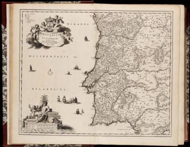
Portugalliæ et Algarbiæ cum finitimis Hispanniæ regnis
1 Karte : Kupferdruck ; 48 x 54 cm Homann Johann Baptist Homann
Portugalliae et Algarbiae Regna
1 : 1500000 per Nicolaum Visscher [Amsterdam] : nunc apud Petrum Schenk Junior
Nova regni Portugalliæ et Algarbiæ descriptio
1 Karte : Kupferdruck ; 49 x 58 cm La Feuille; Ottens; Ottens apud Jaco.m de la Feuille
Hispaniæ, et Portugalliæ maritimi tractus, à S. Andero, ad Malagam
1 Karte : Kupferdruck ; 47 x 56 cm Renard Louis Renard
[132][135] Hispaniae, et Portugalliae Maritimi tractus, uit: Atlas sive Descriptio terrarum orbis
Annotatie: Gedigitaliseerde versie. Amsterdam. Heiloo : Picturae (vervaardiger), 2015. tiff-bestand. Gedigitaliseerd: 07-01-2015; Origineel: Universiteitsbibliotheek Vrije Universiteit (XL.05127.-) ; Netherlands; Titelpagina ontbreekt Wit, Frederik de Amsterdam : Frederick de Wit
Royaume de Portugal
1 Karte : Kupferdruck ; 32 x 42 cm Mentelle; Tardieu E. Mentelle
Carte réduite des costes d'Espagne et de Portugal
1 Karte : Kupferdruck ; 87 x 54 cm Bellin s.n.
Les estats de la couronne de Portugal en Espagne
1 Karte : Kupferdruck ; 41 x 43 cm Sanson; Somer chez l'autheur
Portugall.
from A new systeme of the mathematicks: containing I. Arithmetick, as well natural and decimal, as in species, or the principles of algebra. II. Practical geometry, together with the first six books of Euclid's Elements, as also the eleventh and twelfth, symbo
Regna Portugalliæ et Algarbiæ
1 Karte : Kupferdruck ; 56 x 47 cm Lotter; Lotter Tobias Konrad Lotter
Spain & Portugal - western section.
1 : 2000000 John Bartholomew and Son
Portugallia et Algarbia quae olim Lusitania. [Karte], in: Le théâtre du monde, ou, Nouvel atlas contenant les chartes et descriptions de tous les païs de la terre, Bd. 2, S. 219.
1 Karte aus Atlas Blaeu, Willem Janszoon und Blaeu, Joan Blaeu, Willem Janszoon
Portugalliae et Algarbiae regna
1 : 1740000 Algarve (Portugalsko) Seutter, Matthäus cura et studio Matthaei Seutteri
Novissima regnorum Portugalliæ et Algarbiæ descriptio
1 Karte : Kupferdruck ; 41 x 52 cm Danckerts; Ottens; Ottens R. et I. Ottens
Novissima regnorum Portugalliæ et Algarbiæ descriptio
1 Karte : Kupferdruck ; 41 x 52 cm Danckerts I. Danckerts
Portugallia et Algarbia quae olim Lusitania. [Karte], in: Novus Atlas, das ist, Weltbeschreibung, Bd. 2, S. 228.
1 Karte aus Atlas Blaeu, Joan Blaeu, Willem Janszoon
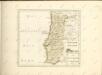
Portugal.
1 : 1400000 Cary, John, ca. 1754-1835
Le Portugal et ses rontieres avec l'Espagne / par ordre de M. le duc de Choiseul par le Sr. Bellin
1 Mapa, b/n. Datació aproximada. Bellin, Jacques Nicolas Dépôt de la Marine
Novissima regnorum Portugalliæ et Algarbiæ descriptio
1 Karte : Kupferdruck ; 57 x 47 cm Wit ex officina J. Cóvens et C. Mortier
Novissima regnorum Portugalliæ et Algarbiæ descriptio
1 Karte : Kupferdruck ; 57 x 47 cm Wit ex officina Frederici De Witt
Portugallia et Algarbia quae olim Lusitania [Karte], in: Gerardi Mercatoris et I. Hondii Newer Atlas, oder, Grosses Weltbuch, Bd. 2, S. 192.
1 Karte aus Atlas Mercator, Gerhard und Hondius, Jodocus Jansson, Jan
Mapa dos reynos de Portugal e Algarve
1 Karte : Kupferdruck ; 58 x 41 cm Lattré; Rizzi-Zannoni; Marillier; Berthault en casa de M. Lattré
Portugal.
1 : 900000 Faden, William, 1750?-1836

Mapa del reyno de Portugal
1 Karte : Kupferdruck ; 39 x 29 cm López Tomás Lopez
Regnum Portugalliæ
1 Karte : Kupferdruck ; 58 x 45 cm Homann Homännische Erben