Maps of Germany

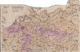
Feuille 24 (C IV), uit: Carte géologique internationale de l'Europe : la carte, votée au congrès géologique international de Bologne en 1881, est exécutée conformément aux décisions d'une commission internationale, avec le concours des gouvernements, sous le dir. de M.M. Beyrich et Hauchecorne
Annotatie: Blad 48 gamme des couleurs; blad 49: bladwijzer en titelblad Heinrich Ernst Beyrich 1815-1896; Wi. Hauchecorne Berlin : Reimer / (Berlin: Institut lithographique)
Dějiště války francouzsko-německé
1 : 2600000 Evropa střední
Dějiště války francouzsko-německé
1 : 2600000 Evropa střední Bedřich Sandtner
Dějiště války francouzské-německé
1 : 2600000 Evropa střední Bedřich Sandtner
Germania
1 : 2500000 Mollova mapová sbírka Delisle, Guillaume Seutter, Matthäus Wolff, Jeremias
L'Allemagne
1 : 2600000 Mollova mapová sbírka Delisle, Guillaume Liébaux, Jean-Baptiste L'Isle, Guillaume de
L'Allemagne
1 : 2500000 Mollova mapová sbírka Delisle, Guillaume Covens, Johannes I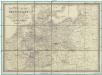
Reise-, Post- und Zoll-Karte von Deutschland
1 : 2220000 Německo Hoffmann, Karl Friedrich Vollrath Erno, E. Carl Hoffmann
Říše německá
1 : 1250000 Evropa střední Machát, František V. Neubert
Říše německá
1 : 1250000 Německo Machát, František V. Neubert
Bojiště francouzsko-německé
Evropa severozápadní Gréger a Ferd. Dattel
Landtaflen
1 Atlas [von Johannes Stumpf] Christoffel Froschower, Zürych
GERMANIA
1 : 2500000 Evropa střední Delisle, Guillaume Lotter, Georg F. Tobiae Conradi Lotter
Germania
1 : 2500000 Evropa střední Delisle, Guillaume Lotter, Georg F. T. C. Lotter
Germania
1 : 2500000 Evropa střední Delisle, Guillaume Brahe, Tycho Tobiae Conradi Lotter
Germania
1 : 2500000 Evropa střední Delisle, Guillaume Brahe, Tycho in officina Tobiae Conradi Lotter
Germania
1 : 2500000 Evropa střední Delisle, Guillaume Brahe, Tycho in officina Tobiae Conradi Lotter
Germania
1 : 2500000 Evropa střední Delisle, Guillaume Brahe, Tycho in officina Tobiae Conradi Lotter
Germania
1 : 2500000 Německo Delisle, Guillaume Lotter, Georg F. T. C. Lotter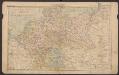
Deutsches Reich
Volksschul-Atlas über alle Teile der Erde Lange, Henry Druck und Verlag von Georg Westermann
L'Allemagne
1 : 2500000 L'Isle, Guillaume de Dezauche
Tabula Germaniae emendata recens
1 : 2800000 Mollova mapová sbírka Visscher, Claes Jansz. Broeck, Abraham van den Visscher, Claes Janszoon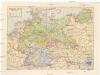
Deutsches Reich
1 : 3250000 Evropa střední Staatliche Verlagsanstalt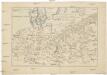
[Střední Evropa]
Evropa střední
Altgermanien, Sud-Donau-Lander, Mitte des Vten jahrhundert's.
1 : 3800000 Spruner von Merz, Karl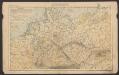
Deutsches Reich
Volksschul-Atlas über alle Teile der Erde Lange, Henry Druck und Verlag von Georg Westermann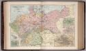
The Germany 21
1 : 2700000 Appleton, D. & Co.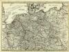
Routes des Postes et des Voitures pour les Marchandises et pour les Voyages par l'Empire dans les Principaux Etats de l'Europe
1 : 2500000 Mollova mapová sbírka Ottens, Reinier Stemmen, Jan Ottens, Josua
Mappa Geographica exhibens Postas