Maps of Seven Seas (Open Ocean)

[Karte vom atlantischen Ocean; Zur Übersicht der Strömungen und Handelsstrassen, der Wärme-Verbreitung, des Seebodens]
Erster Band, enthaltend in vier Abtheilungen die Erscheinungen der anorganischen Natur: 1. Meteorologie und Klimatographie. 2. Hydrologie und Hydrographie. 3. Geologie. 4. Tellurischer Magnetismus Humboldt, Alexander von Verlag von Justus Perthes
Physical Chart of the Atlantic Ocean
The physical atlas Johnston, Alexander Keith William Blackwood & Sons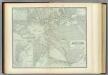
Atlantic Ocean.
1 : 31000000 Johnston, Alexander Keith, 1804-1871
L'Ocean.
1 : 70000000 Buache, Philippe, 1700-1773
Composite: Pacific Ocean.
1 : 25000000 John Bartholomew and Son
Atlantic Ocean.
1 : 49000000 Goodrich, S.G.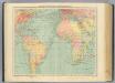
4-5. Linee di comunicazione, Oceano Atlantico.
1 : 30000000 Touring club italiano
Atlantischer Ocean
E. von Sydow's Schul-Atlas in sechs und dreissig Karten Sydow, Emil von bei Justus Perthes
[Die Luftströmungen auf dem Nordatlantischen Ocean; Im westlichen Gebiet der Alten und im Östlichen Theil der neuen Welt]
Erster Band, enthaltend in vier Abtheilungen die Erscheinungen der anorganischen Natur: 1. Meteorologie und Klimatographie. 2. Hydrologie und Hydrographie. 3. Geologie. 4. Tellurischer Magnetismus Humboldt, Alexander von Verlag von Justus Perthes
Calculus Eclipsis Solis Observatae die 19. Novemberis 1816

Carte physique de l'ocean où l'on voit des grandes chaînes de montagnes qui traversent les continents d'Europe, d'Afrique et d'Amérique
1 Karte : Kupferdruck ; 27 x 34 cm, Blattgrösse 47 x 62 cm Buache; Desbruslins Philippe Buache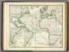
Karte vom Atlantischen Ocean.
1 : 90000000 Berghaus, Heinrich
Isothermal chart.
1 : 95000000 Woodbridge, William C.
Animals - World.
Woodbridge, William C.
Inhabited World.
1 : 93000000 Woodbridge, William C.
Isothermal chart, productions.
1 : 80000000 Woodbridge, William C.
Atlas über die Entwicklung von Industrie und Handel der Schweiz in dem Zeitraume vom Jahr 1770 bis zum Jahr 1870
1 : 45000000 1 Atlas ([3], VIII Bl.) im Auftrage der schweizerischen Commission für die additionellen Ausstellungen in Wien, bearbeitet von Dr. Hermann Wartmann Wurster Randegger & Co., Winterthur
Pacific Ocean : compiled from Admiralty surveys & other official sources
1 : 15000000 India-Rubber, Gutta-Percha & Telegraph Works Co J.D. Potter
A general chart of the West India's [sic] / by John Seller, His Maties. hydrographer.
from Atlas maritimus, or, A book of charts
Oceanica.
1 : 66000000 Mitchell, Samuel Augustus
Die Vulkanischen Erscheinungen Der Atlen Welt.
1 : 65000000 Berghaus, Heinrich
Australien
Austrálie Mollo, Tranquillo bey Tranquillo Mollo
Longueurs du pendule.
1 : 75000000 L'Isle, Guillaume de, 1675-1726
Tabula Terre Nove [Karte], in: Claudii Ptolemei viri Alexandrini mathematice discipline philosophi doctissimi geographie opus [...], S. 233.
1 Karte aus Atlas Waldseemüller, Martin [und Ptolemaeus, Claudius] Übelin, Georg
Afrique : d'après les documents les plus récents et les derniers traitès
1 : 18000000 Giffault, E Le Temps Bureaux
A chart of the discoveries made by the late Capt. Cook, & other European navigators, in the great Pacific Ocean between Asia and America
Kitchin, Thomas Baldwin, Richard
Polynesien Und Der Grosse Ocean (Westliches Blatt).
1 : 40000000 Petermann, A.
Map of Oceanica.
1 : 70000000 Mitchell, Samuel Augustus
Map of Oceanica.
1 : 70000000 Mitchell, Samuel Augustus
![[Karte vom atlantischen Ocean; Zur Übersicht der Strömungen und Handelsstrassen, der Wärme-Verbreitung, des Seebodens]](https://images-2.georeferencer.com/images/iiif/280320050129/full/,300/0/native.jpg)

