Maps of United States

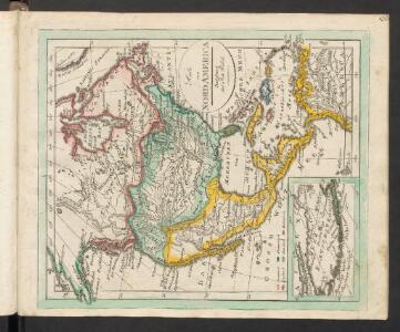
Nordamerica
Neuester Schul-Atlas Walch, Johann im Verlag bei Joh. Walch
Asien.
1 : 28500000 Stein, Christ. Gottfr. Dan.
Bergsystem von Nord-America
Grosser Hand-Atlas über alle Theile der Erde in 170 Karten Meyer, J. Verlag des Bibliographischen Instituts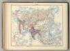
Asie.
1 : 29500000 Jouvet et Cie.
Nord America
Schul-Atlas in 36 Karten Völter, Daniel Verlag der J.M. Dannheimer'schen Buchhandlung
Nord America
Grosser Hand-Atlas über alle Theile der Erde in 170 Karten Meyer, J. Verlag des Bibliographischen Instituts
84-85. Asia fisica.
1 : 25000000 Touring club italiano
86-87. Asia politica.
1 : 25000000 Touring club italiano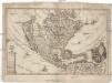
America borealis
1 : 32500000 Severní Amerika Scherer, Heinrich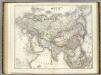
Asien.
1 : 21000000 Kiepert, Heinrich, 1818-1899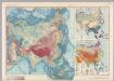
Asia. Pergamon World Atlas.
1 : 30000000 Polish Army Topography Service
North America.
1 : 17500000 Black, Adam & Charles
Asie Physique.
1 : 25000000 Vivien St Martin, L.
Nord-America
Hand-Atlas über alle Theile der Erde und über das Weltgebäude Stieler, Adolf Justus Perthes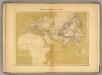
Monde connu au XIIIe. siecle.
1 : 35000000 Vivien de Saint-Martin, M.
Asien u. Europa.
1 : 30000000 Berghaus, Hermann
Zur Uebersicht der verschiedenen Projecte der asiatischen Zukunftsbahnen und der Kohlenvorkommnisse auf dem asiatischen Continent
Asie Hochstetter, Ferdinand von Alfred Hölder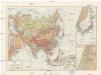
Ázsia
1 : 40000000 Asie Škorpil, František Bohumil Állami kiadóhivatal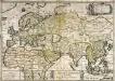
Le grand continent
1 Karte : Kupferdruck ; 40 x 57 cm Duval chez l'autheur en l'isle du Palais sur le quay de l'Orloge proche le coin de la ruë de Harlay

Nord-Amerika
Atlas der Pflanzengeographie über alle Theile der Erde Rudolphi, Ludwig Verlag der Nicolaischen Buchhandlung
Asia / explosis aliorum fabulosis designationibus et narrationibus, adhibitis quoque veterum monumen
1 : 25000000 1 Karte : Kupferdruck ; 46 x 54 cm Haas, Johann Matthias [Homännische Erben]
Nord America
1 : 16000000 entworfen und gezeichnet von C. F. Weiland gest. v. C. Jungmann Weimar : im Verlage des Geograph. Instituts
A new and correct map of North America with the West India Islands : divided according to the last treaty of peace, concluded at Paris, 10th Feby. 1763 ; wherein are particularly distinguished, the several provinces and colonies, which compose the Britis
from Whole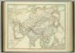
Asia.
1 : 20967600 Johnston, W. & A.K.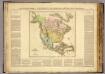
Amer. Septentrionale.
1 : 23500000 Buchon, J. A. C.; Carey, H. C.; Lea, I.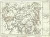
[Asie]
1 : 57400000 Asie
Ethnographische Karte von Nordamerika
Zweiter Band, enthaltend in vier Abtheilungen die Vertheilung der Organismen: 5. Pflanzen-Geographie, 6. Thier-Geographie, 7. Anthropographie, 8. Ethnographie Humboldt, Alexander von Verlag von Justus Perthes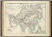
Asia.
1 : 20967600 Johnston, Alexander Keith