Maps of United States
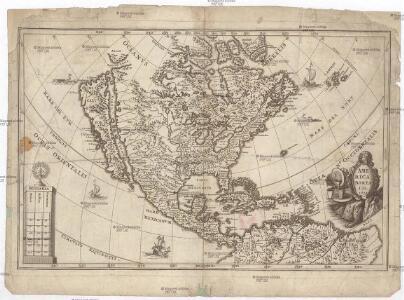
America borealis
1 : 32500000 Severní Amerika Scherer, Heinrich
102-103. Asia, Physical. The World Atlas.
1 : 25000000 USSR (Union of Soviet Socialist Republics).
Homannův atlas světa
1 : 6600000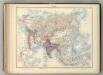
Asie.
1 : 29500000 Jouvet et Cie.
105-106. Asia, Political. The World Atlas.
1 : 25000000 USSR (Union of Soviet Socialist Republics).
Asien.
1 : 28500000 Stein, Christ. Gottfr. Dan.
Nord America
Grosser Hand-Atlas über alle Theile der Erde in 170 Karten Meyer, J. Verlag des Bibliographischen Instituts
84-85. Asia fisica.
1 : 25000000 Touring club italiano
86-87. Asia politica.
1 : 25000000 Touring club italiano
Nordamerica
Neuester Schul-Atlas Walch, Johann im Verlag bei Joh. Walch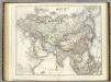
Asien.
1 : 21000000 Kiepert, Heinrich, 1818-1899
Bergsystem von Nord-America
Grosser Hand-Atlas über alle Theile der Erde in 170 Karten Meyer, J. Verlag des Bibliographischen Instituts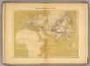
Monde connu au XIIIe. siecle.
1 : 35000000 Vivien de Saint-Martin, M.
Amérique ou Indes occidentales
1 Karte : Kupferdruck ; 52 x 49 cm, Gesamtgrösse 54 x 64 cm Delamarche Delamarche rue du Foin St. Jacques au collège de M.e Gervais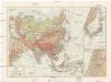
Ázsia
1 : 40000000 Asie Škorpil, František Bohumil Állami kiadóhivatal
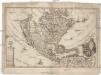
America.
1 : 26500000 Arrowsmith, John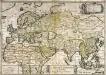
Le grand continent
1 Karte : Kupferdruck ; 40 x 57 cm Duval chez l'autheur en l'isle du Palais sur le quay de l'Orloge proche le coin de la ruë de Harlay
Carte de l'Amérique septentrionale, 1755.
from Charts and maps
Nord America
Schul-Atlas in 36 Karten Völter, Daniel Verlag der J.M. Dannheimer'schen Buchhandlung
America.
1 : 42000000 Wauthier, J. M.
Plain map America.
1 : 42000000 Wauthier, J. M.
A new and correct map of North America with the West India Islands : divided according to the last treaty of peace, concluded at Paris, 10th Feby. 1763 ; wherein are particularly distinguished, the several provinces and colonies, which compose the Britis
from Whole
Ethnographische Karte von Nordamerika
Zweiter Band, enthaltend in vier Abtheilungen die Vertheilung der Organismen: 5. Pflanzen-Geographie, 6. Thier-Geographie, 7. Anthropographie, 8. Ethnographie Humboldt, Alexander von Verlag von Justus Perthes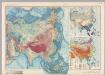
Asia. Pergamon World Atlas.
1 : 30000000 Polish Army Topography Service
Zur Uebersicht der verschiedenen Projecte der asiatischen Zukunftsbahnen und der Kohlenvorkommnisse auf dem asiatischen Continent
Asie Hochstetter, Ferdinand von Alfred Hölder
Asie Physique.
1 : 25000000 Vivien St Martin, L.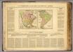
L'Amerique.
1 : 36000000 Buchon, J. A. C.; Carey, H. C.; Lea, I.
Stromgebiet von Nordamerica
Grosser Hand-Atlas über alle Theile der Erde in 170 Karten Meyer, J. Verlag des Bibliographischen Instituts
Asien u. Europa.
1 : 30000000 Berghaus, Hermann