Maps of Balkan Pen.

Europaeische Türkey und Griechenland
Geographischer Atlas über alle Theile der Erde Ziegler, Jakob Melchior Verlag von Joh. Wurster um Comp.
Europaeische Türkey und Griechenland
Geographischer Atlas über alle Theile der Erde Ziegler, Jakob Melchior Verlag von Dietrich Reimer
Granicitě na Ochridskata Archieposkopija [2]
Makedonien Ohrid Patriarchat Ohrid Grenze
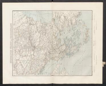
Die Balkan-Halbinsel
1 : 5500000 Balkanhalbinsel
Turkey in Europe.
1 : 6000000 Higgins, W.M.
General-Karte der europäischen Türkey und des Königreichs Griechenland
1 : 1170000 Evropa jihovýchodní Schulz, R. A. Biller, Dominik Artaria
Osman. Europa.
1 : 3000000 Weiland, C. F. (Carl Ferdinand), d. 1847
Turkey in Europe.
1 : 5000000 Tanner, Henry S.
Peninsule de Balkans.
1 : 3800000 Migeon, J.
Granicitě na Ochridskata Archieposkopija
Makedonien Ohrid Patriarchat Ohrid Grenze
Karte von der europäischen Türkey
1 : 4200000 Evropa jihovýchodní Mollo, Tranquillo T. Mollo
Karte von der europäischen Türkey
1 : 4200000 Evropa jihovýchodní Mollo, Tranquillo T. Mollo
Die Staaten der Balkan-Halbinsel
1 : 3000000 Evropa jihovýchodní Kiepert, Heinrich Dietrich Reimer
Turkey in Europe.
1 : 2440000 Pinkerton, John, 1758-1826
Turkey in Europe.
1 : 6000000 Arrowsmith, Aaron
Turkey in Europe.
1 : 6000000 Arrowsmith, Aaron
Das osmanische Europa oder die europaeische Türkey
1 : 3000000 Balkánský poloostrov Weiland, Karl Ferdinand Boué Geographisches Institut
Das osmanische Europa oder die europaeische Türkey
1 : 3000000 Bospor (Turecko : průliv) Weiland, Karl Ferdinand Boué Geographisches Institut
Das osmanische Europa oder die europaeische Türkey
1 : 3000000 Bospor (Turecko : průliv) Weiland, Karl Ferdinand im Verlage des Geograph. Instituts
Das osmanische Europa oder die europaeische Türkey
1 : 3000000 Dardanely (Turecko : průliv) Weiland, Karl Ferdinand im Verlage des Geograph. Instituts
Das osmanische Europa oder die europaeische Türkey
1 : 3000000 Dardanely (Turecko : průliv) Weiland, Karl Ferdinand Geograph. Institut
Das osmanische Europa oder die europaeische Türkey
1 : 3000000 Dardanely (Turecko : průliv) Weiland, Karl Ferdinand Ciliax, L. Geograph. Institut
Ethnographische Übersicht des europäischen Orients
Bospor (Turecko : průliv) Kiepert, Heinrich D. Reimer
[Karte der Balkan-Halbinsel]
Balkánský poloostrov
Turkey in Europe.
1 : 3100000 Hall, S. (Sidney)
Turkey in Europe.
1 : 3850000 Mitchell, Samuel Augustus
Turquie d'Europe, Grece.
1 : 3500000 Andriveau-Goujon, J.
Charte von der europaeischen Türkey mit den anliegenden Republiken der Sieben Inseln u. Ragusa
1 : 4200000 Dubrovník-oblast (Chorvatsko) Kipferling, Karl Joseph J. Riedl's Kunsthandlung
Turquie d'Europe, Grece &c.
1 : 3900000 Garnier, F. A., 1803-1863