Maps of Balkan Pen.

Turquie d'Europe, Grece &c.
1 : 3900000 Garnier, F. A., 1803-1863
Turquie d'Europe, Grece, Roumanie, Servie, Montenegro.
1 : 3600000 Levasseur, E.
Osman. Europa.
1 : 3000000 Weiland, C. F. (Carl Ferdinand), d. 1847
Balkanhalbinsel.
1 : 3000000 Andree, Richard
Turchia Europea con i Principati di Servia, Valachia e Moldavia.
1 : 3540000 Picquet, C.
Turquie d'Europe, Grece.
1 : 3000000 Lapie, M. (Pierre), 1779-1850
Türkei und Griechenland
Neuer Handatlas über alle Theile der Erde Kiepert, Heinrich Verlag von Dietrich Reimer
Turquie d'Europe.
1 : 3500000 Picquet, C.
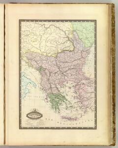
Turkey in Europe.
1 : 3850000 Mitchell, Samuel Augustus
Turquie d'Europe, Grece.
1 : 3500000 Andriveau-Goujon, J.
Turkey in Europe.
1 : 2440000 Pinkerton, John, 1758-1826
Turkey in Europe.
1 : 6000000 Arrowsmith, Aaron
Turkey in Europe.
1 : 6000000 Arrowsmith, Aaron
Turkey in Europe.
1 : 6000000 Higgins, W.M.
Charte von der europaeischen Türkey mit den anliegenden Republiken der Sieben Inseln u. Ragusa
1 : 4110000 Dubrovník-oblast (Chorvatsko) Kipferling, Karl Joseph J. Riedl's Kunsthandlung
General-Karte der europäischen Türkey und des Königreichs Griechenland
1 : 1170000 Evropa jihovýchodní Schulz, R. A. Biller, Dominik Artaria
[Kaart], uit: Ethnographische Übersicht des Europäischen Orients / zsgest. von H. Kiepert
1 : 3000000 titelvariant: Ethnographische Übersichtskarte des Europäischen Orients; Annotatie: Omslagtitel: Ethnographische Übersichtskarte des Europäischen Orients : (untere Donauländer, Turkei und Griechenland); Met toelichting in de omslag (12 p.) Johann Samuel Heinrich Kiepert 1818-1899 Berlin : Reimer
Charte von der europaeischen Türkey mit den anliegenden Republiken der Sieben Inseln u. Ragusa
1 : 4200000 Dubrovník-oblast (Chorvatsko) Kipferling, Karl Joseph J. Riedl's Kunsthandlung
[Ancient] Greece.
1 : 4500000 Lavoisne, M.
Libération et agrandissements successifs des états Balkaniques
1 : 14000000 Balkanhalbinsel Südosteuropa Unabhängigkeitsbewegung
Die Staaten der Balkan-Halbinsel
1 : 3000000 Evropa jihovýchodní Kiepert, Heinrich Dietrich Reimer
75-76. Penisola balcanica.
1 : 3000000 Touring club italiano
Türkisch-Griechische Halbinsel
Balkanhalbinsel
La Turquie d'Europe, La Hongrie, La Transilvanie, La Croatie, La Morlaquie, La Sclavonie et La Dalmatie avec La Rép.que des Sept Iles
1 : 3700000 par J. B. Poirson gravé par Tardieu l'ainé [Paris] : [Mentelle etc.]
Karte von der europäischen Türkey
1 : 4200000 Evropa jihovýchodní Mollo, Tranquillo T. Mollo
Karte von der europäischen Türkey
1 : 4200000 Evropa jihovýchodní Mollo, Tranquillo T. Mollo
Staatenkarte
Balkanhalbinsel
Staaten der Balkan-Halbinsel
Volksschul-Atlas über alle Teile der Erde Lange, Henry Druck und Verlag von Georg Westermann
Europaeische Türkey und Griechenland
Geographischer Atlas über alle Theile der Erde Ziegler, Jakob Melchior Verlag von Joh. Wurster um Comp.