Maps of South America

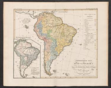
Ethnographische Karte von Süd-Amerika
Zweiter Band, enthaltend in vier Abtheilungen die Vertheilung der Organismen: 5. Pflanzen-Geographie, 6. Thier-Geographie, 7. Anthropographie, 8. Ethnographie Humboldt, Alexander von Verlag von Justus Perthes
[Süd-Amerika]
Atlas der Geologie Zittel, K.v. ; Berghaus, Hermann Justus Perthes
L'Amerique Meridionale divisée en ses principales parties
1 : 16000000
South America
Este mapa, sin fecha y sin autor conocido, probablemente sea de mediados del siglo XVIII. La representación de Islas Malvinas a partir del Estrecho de Falkland, como era común en la primera mitad del siglo XVIII, es un indicio en ese sentido. En enero de 1690 el inglés John Strong navegó entre las dos islas principales y llamó al paso "Falkland Channel" en honor a su mecenas el Vizconde de Falkland que como había financiado la expedición. La cartografía británica adoptaría en el siglo XVIII el nombre del canal, para designar a todo el grupo de islas, que reclamaría para Inglaterra, en contra de España. En 1740 hubo un enfrentamiento naval entre las fuerzas británicas y españolas por las islas, sin un claro vencedor. Las tensiones entre los dos imperios continuaría a lo largo del siglo XVIII.
149-50. America Meridionale fisica.
1 : 20000000 Touring club italiano
South America and the Adjacent Islands.
1 : 3450000 Morse, Jedidiah
L'Amerique meridionale divisée en ses principaux etats
1 : 1
Sud-America.
1 : 27750000 Stulpnagel, F.v.
South America.
1 : 25344000 Carey, Mathew
Map Of South America.
1 : 25344000 Carey, Mathew
South America.
1 : 26000000 Carey, Mathew
Map Of South America.
1 : 25344000 Carey, Mathew
South America.
from A new sett of maps both of antient and present geography : wherein not only the latitude and longitude of many places are corrected according to the latest observations, but also the most remarkable differences of antient and present geography may be quickly discern'd by a bare inspection or comparing of correspondent maps, which seems to be the most natural and easy method to lead young students (for whose use the work is principally intended) unto a competent knowledge of the geographical science : together with a geographical treatise particularly adapted to the use and design of these maps / by Edward Wells, M.A. and student of Christ-Church, Oxon.
Süd-America
Hand-Atlas über alle Theile der Erde und über das Weltgebäude Stieler, Adolf Justus Perthes
Süd-America
Schul-Atlas über alle Theile der Erde nach dem neuesten Zustande, und über das Weltgebäude Stieler, Adolf Justus Perthes
Süd-America
Handatlas über alle Theile der Erde und über das Weltgebäude Stieler, Adolf Justus Perthes
[Süd-Amerika]
E. von Sydow's Schul-Atlas in sechs und dreissig Karten Sydow, Emil von bei Justus Perthes
[Süd-Amerika]
Hypsometrischer Atlas Ziegler, Jakob Melchior Topogr. Anstalt v. J. Wurster u. Comp.
Jižní Amerika
1 : 46500000 Jižní Amerika Merklas, Václav
Süd-America
Schul-Atlas über alle Theile der Erde nach dem neuesten Zustande, und über das Weltgebäude Stieler, Adolf bei Justus Perthes

Süd-Amerika
[Allgemeiner Atlas über alle Theile der Erde in 29 Blättern] Ziegler, Jakob Melchior Top. Anstalt v. J. Wurster u. Comp.
L'Amerique Meridionale.
1 : 31000000 Janvier, Jean
A new & exact map of the coast, countries and islands within ye limits of ye South Sea Company, from ye river Aranoca to Terra del Fuego, and from thence through ye South Sea, to ye north part of California &c. with a view of the general and coasting ...
1 : 32000000
Süd-America
Neuer Handatlas über alle Theile der Erde Kiepert, Heinrich Verlag von Dietrich Reimer
Süd Amerika
Geographischer Atlas über alle Theile der Erde Ziegler, Jakob Melchior Verlag von Dietrich Reimer
Nova & accuratissima totius terrarum orbis tabula nautica, 2
1 Blatt : 51 x 52 cm R. & I. Ottens
Map of Brazil, Bolivia, Paraguay, and Uruguay ; Harbor of Rio Janeiro [inset]; Harbor of Bahia [inset]; Map of Chili ; Island of Juan Fernandez [inset].
from New general atlas.
Vents (Amerique)
1 : 50000000 Vincent