Maps of South America
South America.
from A new sett of maps both of antient and present geography : wherein not only the latitude and longitude of many places are corrected according to the latest observations, but also the most remarkable differences of antient and present geography may be quickly discern'd by a bare inspection or comparing of correspondent maps, which seems to be the most natural and easy method to lead young students (for whose use the work is principally intended) unto a competent knowledge of the geographical science : together with a geographical treatise particularly adapted to the use and design of these maps / by Edward Wells, M.A. and student of Christ-Church, Oxon.
Hospodářská mapa světa - těžba nerostných surovin

A map of South America and the adjacent islands, 1794.
from The American geography; or, A view of the present situation of the United States of America: containing astronomical geography; geographical definitions, discovery, and general description ... By Jedidiah Morse, A.M.
[Süd-Amerika]
E. von Sydow's Schul-Atlas in sechs und dreissig Karten Sydow, Emil von bei Justus Perthes
Rand, McNally & Co.'s new 14 x 21 map of South America
1 : 19008000 Rand McNally and Company Rand, McNally & Co.
[Süd-Amerika]
Atlas der Geologie Zittel, K.v. ; Berghaus, Hermann Justus Perthes
South America and the Adjacent Islands.
1 : 3450000 Morse, Jedidiah
Map of Brazil, Bolivia, Paraguay, and Uruguay ; Harbor of Rio Janeiro [inset]; Harbor of Bahia [inset]; Map of Chili ; Island of Juan Fernandez [inset].
from New general atlas.
South America
Este mapa, sin fecha y sin autor conocido, probablemente sea de mediados del siglo XVIII. La representación de Islas Malvinas a partir del Estrecho de Falkland, como era común en la primera mitad del siglo XVIII, es un indicio en ese sentido. En enero de 1690 el inglés John Strong navegó entre las dos islas principales y llamó al paso "Falkland Channel" en honor a su mecenas el Vizconde de Falkland que como había financiado la expedición. La cartografía británica adoptaría en el siglo XVIII el nombre del canal, para designar a todo el grupo de islas, que reclamaría para Inglaterra, en contra de España. En 1740 hubo un enfrentamiento naval entre las fuerzas británicas y españolas por las islas, sin un claro vencedor. Las tensiones entre los dos imperios continuaría a lo largo del siglo XVIII.
Map of South America, showing its political divisions ; Map showing the proposed Atrato-inter-oceanic canalroutes, for connecting the Atlantic and Pacific oceans [inset].
from New general atlas.
Světová těžba nerostných surovin

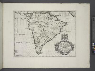
A new & exact map of the coast, countries and islands within ye limits of ye South Sea Company, from ye river Aranoca to Terra del Fuego, and from thence through ye South Sea, to ye north part of California &c. with a view of the general and coasting ...
1 : 32000000
Nova & accuratissima totius terrarum orbis tabula nautica, 2
1 Blatt : 51 x 52 cm R. & I. Ottens
Ethnographische Karte von Süd-Amerika
Zweiter Band, enthaltend in vier Abtheilungen die Vertheilung der Organismen: 5. Pflanzen-Geographie, 6. Thier-Geographie, 7. Anthropographie, 8. Ethnographie Humboldt, Alexander von Verlag von Justus Perthes
149-50. America Meridionale fisica.
1 : 20000000 Touring club italiano
Mapa světa

Carte pour servir a l'histoire philosophique et politique des etablissemens et du commerce des Européens dans les deux Indes
1 Karte : Kupferdruck ; 31 x 45 cm Bonne s.n.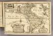
L'Amerique.
1 : 64000000 Fer, Nicolas de, 1646-1720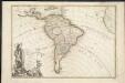
L'Amerique meridionale divisée en ses principaux etats
1 : 1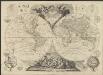
Le globe terrestre divisé en ses deux hémisphères oriental et occidental assujetti aux nouvelles découvertes du XVIIIme siècle
1 : 42700000 par le Sr. Moithey [...] dédié à [...] le Prince de Conty. A Paris : chès Crepy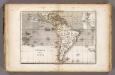
Vents (Amerique)
1 : 50000000 Vincent
South America.
1 : 25344000 Carey, Mathew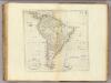
Map Of South America.
1 : 25344000 Carey, Mathew
South America.
1 : 26000000 Carey, Mathew
Map Of South America.
1 : 25344000 Carey, Mathew
Carte de l'Amérique Méridionale
1 : 15000000 Orbigny, Alcide Dessalines d', 1802-1857 Pitois-Levrault et Cie Libraire
La America
1 Karte : Kupferdruck ; 45 x 51 cm s.n.
America.
1 : 75000000 Moll, Herman, d. 1732