Maps of Spain

[Spanien und Portugal]
Historisch-genealogisch-geographischer Atlas von Le Sage Las Cases, Emmanuel Auguste Dieudonné Marius Joseph de Johann Velten, Kunsthändler
Neueste Karte von Spanien und Portugal
1 : 2500000 Portugalsko Cappi, Johann Johann Cappi
Spain and Portugal. Pergamon World Atlas.
1 : 2500000 Polish Army Topography Service
Spain, Portugal.
1 : 2400000 Cary, John, ca. 1754-1835
Spanien u. Portugal.
1 : 2500000 Stein, Christ. Gottfr. Dan.
Hispania
1 : 4830000 Portugalsko Bonne, Rigobert André
L'Espagne 1492 a 1640.
1 : 4800000 Houze, Antoine Philippe
HISPANIAE Delineatio
Španělsko
Peninsule Iberique.
1 : 2500000 Vivien St Martin, L.
L'Espagne et le Portugal
1 : 3000000 par J. B. Poirson gravé par Tardieu L'Ainé [Paris] : [Mentelle etc.]
Novissima et accuratissima regnorum Hispaniae et Portugalliae mappa geographica
1 : 2430000 Portugalsko Seutter, Matthäus sumptibus Matthaei Seutteri

Novissima et accuratißima regnorum Hispaniae et Portugaliae tabella geographica
1 : 6170000 Portugalsko Seutter, Matthäus Lotter, Tobias Conrad Tob. Conr. Lotter
Accuratissima totius regni Hispaniae tabula
1 : 2400000 Portugalsko Danckerts, Justus ex officina Iustii Danckerts
L'Espagne 1027 a 1212.
1 : 4800000 Houze, Antoine Philippe
Mapa general de Espana, dividido en sus actuales provincias, islas adyacentes, y reyno de Portugal
1 : 1400000 compuesto con lo mejor que hay impreso, manuscrito noticias de sus naturales, y sujeto á las observaciones Astronomicas por Tomas Lopez Madrid : [Tomas Lopez]
Carte des Royaumes d'Espagne et de Portugal où l'on a marqué les routes de poste
1 : 320000 dressée d'après les dernieres observations astronomiques et les nouvelles cartes espagnoles gravées ou manuscrites par E. Collin gravé par E. Collin A Paris : chez Jean, rue St. Jean de Beauvais
El reyno de España
1 Karte : Kupferdruck ; 51 x 73 cm Mondhare casa de L. Mondhare calle de st. Tiago

Typus Hispaniae ab Hesselo Gerardo delineata [...] [Karte], in: Novus atlas absolutissimus, Bd. 6, S. 15.
1 Karte aus Atlas Janssonius Offizin
L'Espagne 1212 a 1492.
1 : 4800000 Houze, Antoine Philippe
Espagne et Portugal 1640 a 1840.
1 : 4800000 Houze, Antoine Philippe
Novissima et accuratissima regnorum Hispaniae et Portugalliae mappa geographica
1 : 2467000 Portugalsko Seutter, Matthäus sumptibus Matthaei Seutteri
Spanien und Portugal
1 : 3260000 Portugalsko López, Tomás T. Mollo
Hispania Antiqua
Schul-Atlas der alten Welt bei Justus Perthes
Carte d'Espagne et de Portugal
1 Karte auf 6 Blatt : Kupferdruck ; 73 x 82 cm Brion de la Tour; Jean chez Jean rue Jean de Beauvais. no. 10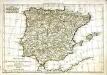
Royaumes d'Espagne et de Portugal
1 Karte : Kupferdruck ; 21 x 31 cm Bonne; Perrier; André s.n.
REGNORVM | HISPANIÆ | nova descriptio
Amsterdami | Apud Guiljelmum Blaeuw
Spanien und Portugal
1 : 1500000 Kanárské ostrovy Vogel, Carl Koffmahn, Otto Justus Perthes
![[Spanien und Portugal]](https://images-0.georeferencer.com/images/iiif/053854629370/full/,300/0/native.jpg)

