Maps of Chotilsko

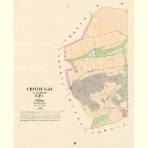
Chotilsko - c2597-1-001 - Kaiserpflichtexemplar der Landkarten des stabilen Katasters
1 : 2880
Chotilsko - c2597-1-002 - Kaiserpflichtexemplar der Landkarten des stabilen Katasters
1 : 2880
Korkin - c3336-1-001 - Kaiserpflichtexemplar der Landkarten des stabilen Katasters
1 : 2880
Korkin - c3336-1-002 - Kaiserpflichtexemplar der Landkarten des stabilen Katasters
1 : 2880
Seytska Lhotta - c6817-1-001 - Kaiserpflichtexemplar der Landkarten des stabilen Katasters
1 : 2880
Seytska Lhotta - c6817-1-002 - Kaiserpflichtexemplar der Landkarten des stabilen Katasters
1 : 2880
Zaborna Lhotta - c9008-1-002 - Kaiserpflichtexemplar der Landkarten des stabilen Katasters
1 : 2880
Zaborna Lhotta - c9008-1-003 - Kaiserpflichtexemplar der Landkarten des stabilen Katasters
1 : 2880
Zaborna Lhotta - c9008-1-001 - Kaiserpflichtexemplar der Landkarten des stabilen Katasters
1 : 2880
Czim (Čjm) - c1020-1-003 - Kaiserpflichtexemplar der Landkarten des stabilen Katasters
1 : 2880
Czim (Čjm) - c1020-1-002 - Kaiserpflichtexemplar der Landkarten des stabilen Katasters
1 : 2880
Czim (Čjm) - c1020-1-001 - Kaiserpflichtexemplar der Landkarten des stabilen Katasters
1 : 2880
Czim (Čjm) - c1020-1-004 - Kaiserpflichtexemplar der Landkarten des stabilen Katasters
1 : 2880
Gradkartenblatt
1 : 25000 Netvořice-oblast (Česko) Albrecht, Julius
III. vojenské mapování 4053/3
1 : 25000
III. vojenské mapování 4053/3
1 : 25000

Karte des Dobřischer Bezirkes im Prager Kreise
1 : 7000 Dobříš-oblast (Česko) Wagner, Jan Eduard Karl André
Karte des Dobřischer Bezirkes im Prager Kreise
1 : 7000 Dobříš-oblast (Česko) Wagner, Jan Eduard Karl André
Přehledná mapa vltavské trati Kamýk-Štěchovice
1 : 25000 Kamýk (Česko : vodní nádrž) Ředitelství pro stavbu vodních cest
Soubor map okresů Pražského kraje

Wotický vikariát
Votice-oblast (Česko)
III. vojenské mapování 4053
1 : 75000
Benešov
1 : 75000 Benešov (Česko : oblast) Vojenský zeměpisný ústav
Podrobná mapa okolí Pražského
1 : 75000 Benešov (Blansko, Česko : oblast) Hevera, Čeněk Klub československých turistů
Mapy plánování ČSR

Königsaal und Beneschau
1 : 75000 Benešov (Česko : oblast) Charlemont K. u. k. Militärgeographisches Institut
Königsaal und Beneschau
1 : 75000 Benešov (Česko : oblast) K. u. k. Militärgeographisches Institut
Příbramer Vicariat
Příbram-oblast (Česko)