Maps of Botosani

Czernowitz
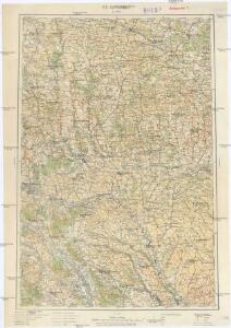
1 : 400000 Instytut wojskowo-geograficzny
[Bodolien, Moldawien]
1 Karte : Kupferdruck ; 18 x 13 cm [Trattner]
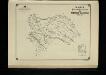
Harta Cailor de Comunicatie din Judetul Dorohoi
Rumänien Judeţ Dorohoi Verkehrsweg

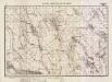
Kamieniec Podolski.
from Spezialkarte der osterreichisch-ungarischen Monarchie.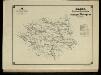
Harta Cailor de Comunicatie din Judetul Botosani
Rumänien Judeţ Botoşani Verkehrsweg

Kamieniec Podolski
1 : 75000 Novakovic K. u. k. Militärgeographisches Institut
Jarmolincy und Gorodok
1 : 75000 K. u. k. Militärgeographisches Institut
Smotrycz
1 : 75000 K. u. k. Militärgeographisches Institut
Uidestie.; Spezialkarte der osterreichisch-ungarischen Monarchie.
from Spezialkarte der osterreichisch-ungarischen Monarchie. Austro-Hungarian Monarchy. Militärgeographisches Institut.,
Lipkany
1 : 75000 Moldávie (historické území) Karl, E. K. u. k. Militärgeographisches Institut
Borszczów
1 : 75000 Ukrajina Kraupa, G. K. u. k. Militärgeographisches Institut
Zu Bildner des Heeres Beilage 22
Suceava (Rumunsko) K.k. Schulbücher-Verschleiss-Administration
Plan sraženīja na r. Prutě 9 Ījulja 1711 g.
Moldawien Pruth-Gebiet Nordischer Krieg <1700-1721>
Radautz.; Spezialkarte der osterreichisch-ungarischen Monarchie.
from Spezialkarte der osterreichisch-ungarischen Monarchie. Austro-Hungarian Monarchy. Militärgeographisches Institut.,
Hliboka.; Spezialkarte der osterreichisch-ungarischen Monarchie.
from Spezialkarte der osterreichisch-ungarischen Monarchie. Austro-Hungarian Monarchy. Militärgeographisches Institut.,
Kopyczynce.; Spezialkarte der osterreichisch-ungarischen Monarchie.
from Spezialkarte der osterreichisch-ungarischen Monarchie. Austro-Hungarian Monarchy. Militärgeographisches Institut.,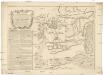
Plan batalii pri Stavučanach v Moldavii, meždu imperatorskoju rossiskoju glavnoju armějeju pod komandoju generala feldtmaršala grafa fon Minicha i meždu tureckoju armějeju, pod komandoju Seraskera trech bunčužnago Veli paši i saltana Islam Girěi, byvšen 17/28 augusta 1739 godu
1 : 40000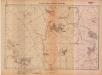
Lambert-Cholesky sheet 4784 (Brinzeni)
1 : 20000 Romanian military topographic map sheet under Lambert-Cholensky projection Serviciul Geografic al Armatei geo-spatial.org Serviciul Geografic al Armatei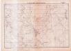
Lambert-Cholesky sheet 4880 (Dămideni)
1 : 20000 Romanian military topographic map sheet under Lambert-Cholensky projection Serviciul Geografic al Armatei geo-spatial.org Serviciul Geografic al Armatei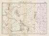
Lambert-Cholesky sheet 4783 (Ripiceni)
1 : 20000 Romanian military topographic map sheet under Lambert-Cholensky projection Institutul Geografic Militar geo-spatial.org Institutul Geografic Militar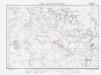
Lambert-Cholesky sheet 4879 (S-ta Maria)
1 : 20000 Romanian military topographic map sheet under Lambert-Cholensky projection Institutul Geografic Militar geo-spatial.org Institutul Geografic Militar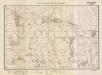
Lambert-Cholesky sheet 4782 (Movila Ruptă)
1 : 20000 Romanian military topographic map sheet under Lambert-Cholensky projection Institutul Geografic Militar geo-spatial.org Institutul Geografic Militar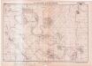
Lambert-Cholesky sheet 4685 (Crasnaleuca)
1 : 20000 Romanian military topographic map sheet under Lambert-Cholensky projection Serviciul Geografic al Armatei geo-spatial.org Serviciul Geografic al Armatei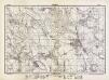
Lambert-Cholesky sheet 4781 (Ştefăneşti)
1 : 20000 Romanian military topographic map sheet under Lambert-Cholensky projection Direcția Topografică Militară geo-spatial.org Direcția Topografică Militară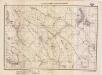
Lambert-Cholesky sheet 4684 (Mitocul)
1 : 20000 Romanian military topographic map sheet under Lambert-Cholensky projection Institutul Geografic al Armatei geo-spatial.org Institutul Geografic al Armatei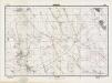
Lambert-Cholesky sheet 4780 (Buimăceni)
1 : 20000 Romanian military topographic map sheet under Lambert-Cholensky projection Direcția Topografică Militară geo-spatial.org Direcția Topografică Militară