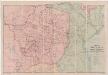
Maps of Orientale
Routenkarte der Expedition zum Entsatze Emin Pascha's vom Kongo bis zum Victoria-Njasa
1 : 2267200 Afrika střední Stanley, Henry Morton F.A. Brockhaus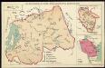
The mission areas of the Evangelical Mission Society for German East Africa [Bethel Mission]. Ruanda

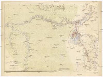
A map of the Albert N'yanza : and of the routes leading to its discovery
1 : 2100000 Baker, Samuel White, Sir, 1821-1893 Macmillan & Co
Aequatorial-Ost-Afrika
1 : 3000000 Geographische Verlagshandlung Dietrich Reimer
Triangulations principales du Congo Belge
1 : 4000000 Ministére des colonies, Service cartographique
Der Congo-Staat nach seiner Districts-Eintheilung
1 : 8000000 Kongo (Kinshasa) A. Hartleben
Congo Belge
1 : 5000000 Kongo (Kinshasa) Institut cartographique militaire
Carte de l'Etat indépendant du Congo [et] Carte du Bassin du Congo
1 : 8000000 Wauters, A.-J. 1845-1916; Institut national de géographie. Belgique Bruxelles : Institut national de géographie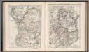
Central Africa (West). Central Africa (East).
1 : 10383000 W. & A.K. Johnston Limited
Stanley's Discoveries in Africa.
1 : 17500000 Colton, G.W.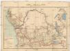
Carte du bassin du Congo
1 : 4000000 Kongo (Kinshasa) Kiepert, Richard Droysen, Wilhelm Dietrich Reimer
Carte du Congo Belge
1 : 4000000 Belgie Falk fils
Originalkarte von Burton's und Speke's Entdeckungen in Innerafrika 1857 u. 1858

Evangelische Mission im Kwango, Rep ZaireUebersichtsplan der Gemeinden und Aussenposten im Bezug zur Siedlungsdichte

[Recto], uit: Congo physique, économique et administratif / dressé par A. Michiels
1 : 6000000 titelvariant: Nouvelle carte du Congo au 1:6.000.000; Notre colonie; Annotatie: Omslagtitel: Nouvelle carte du Congo au 1:6.000.000; Suppl. bij: Notre colonie : géographie et notice historique / Albert Michiels. - 4e éd. - Bruxelles : Mertens ; [etc.], 1913 Michiels, Albert Bruxelles : Mertens [etc.]
Congo Belge
1 : 4000000 Afrika střední I.C.M.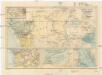
Central-Afrika mit dem internationalen Kongo-Gebiet
1 : 13000000 Afrika střední A. Hartleben
Congo Belge / comp. at the Royal Geographical Society under the dir. of the Geographical Section, General Staff ; drawn at the War Office
1 : 4000000 Royal Geographical Society, Verenigd Koninkrijk; General Staff, Verenigd Koninkrijk. Geographical Section; War Office, Verenigd Koninkrijk [S.l. : s.n.] / ([Bruxelles : I.C.M.])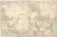
Central-Afrika
1 : 5000000 Afrika střední Chavanne, Joseph A. Hartleben's Verlag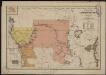
Carte politique de l'Afrique centrale
1 : 10000000 Institut national de géographie. Belgique Bruxelles : Institut national de géographie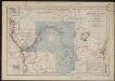
Croquis hydrographique de l'Afrique centrale
1 : 10000000 Institut national de géographie. Belgique Bruxelles : Institut national de géographie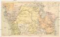
Übersichtskarte zum Zuge der Emin Pascha - Entsatzexpedition quer durch Afrika
1 : 5800000 Afrika střední F.A. Brockhaus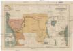
Carte politique de l'Afrique centrale
1 : 10000000 Afrika střední Institut National de géographie
Inner-Afrika
Afrika střední Riemer, C. Geographisches Institut
Mapa Afriky střední
1 : 12500000 Afrika střední
Carte des missions catholiques du centre africain
1 : 4000000 Vuillot, Paul 18..-19.. [Lyon : Oeuvre de la propagation de la foi]
Inner-Afrika und der Kongo-Staat
1 : 8000000 Afrika střední Kettler, I. J. Geographisches Institut
Central Africa - eastern section.
1 : 5000000 John Bartholomew and Son
Charte von Nieder Guinea und den angrenzenden ländern Sud Afrika's : nach den neuesten und besten Hülfsmitteln
1 : 6750000 Reinecke, J. C. M. (Johann Christoph Matthias), 1770-1818 Im Verlage des Industrie Comptoirs