Maps of Smíchov

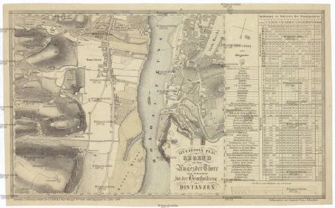
Situations Plan der Gegend vor dem Augezder Thore zum Gebrauche bei der Beurtheilung der Distanzen
1 : 12600 Praha (Česko) Situations-Zeichnungs-Schule des k. k. G.F.M.L. Graf Kunigl 1.ten Feld-Artill. Regiments Schwihlik, Franz Situations-Zeichnungs-Schule des k. k. G.F.M.L. Graf Kunigl 1.ten Feld-Artill. Regiments
PLAN DE PRAG
1 : 8000 Praha (Česko) Bailleul, Nicolas chez Bailleul le jeune
Prag - c6068-1-002 - Kaiserpflichtexemplar der Landkarten des stabilen Katasters
1 : 2880
Prag - c6068-1-006 - Kaiserpflichtexemplar der Landkarten des stabilen Katasters
1 : 2880
Prag - c6068-1-003 - Kaiserpflichtexemplar der Landkarten des stabilen Katasters
1 : 2880
Prag - c6068-1-001 - Kaiserpflichtexemplar der Landkarten des stabilen Katasters
1 : 2880
Prag - c6068-1-004 - Kaiserpflichtexemplar der Landkarten des stabilen Katasters
1 : 2880
Prag - c6068-1-005 - Kaiserpflichtexemplar der Landkarten des stabilen Katasters
1 : 2880
Grundriss von Prag, nach den besten Hülfsmitteln dargestellt
1 : 125000 gestochen von W. Schuldes Prag : J. G. Calve'sche Buchhandlung
Plan von Prag

Praha. Mapy staré Prahy k letům 1200, 1348 a 1419

[Smíchov a Košíře]
Košíře (Praha, Česko)
Plán výstavy
Košíře (Praha, Česko) Schulz, R. A. Medau, Karel Vilém
Polohopisný plán Smíchova a Košířů

Polohopisný plán Smíchova a Košířů
1 : 4000 Košíře (Praha, Česko) Hurtig, Alfred F. Kytka
[Smíchov]
Smíchov (Praha, Česko)
Polohopisný plán Smíchova a Košíř
1 : 4000
Orientační plán král. Hl. města Prahy

Orientační plán Prahy a obcí sousedních List 15.
1 : 5000
Monumentální plán královského města Prahy

Smíchov : předměstí král. hlavního města Prahy

Polohopisný plán Hořejšího Nového města (II.) a Královského Vyšehradu (VI.)
1 : 4000 Nové Město (Praha, Česko) Hurtig, Alfred F. Kytka
Plán hlavního města království českého Praha

Praha, hlavní město ČSR : Fastrův obrázkový plán a průvodce
1 : 10000
Polohopisný plán Hořejšího Nového města (II.) a Královského Vyšehradu (VI.)

Polohopisný plán Hořejšího Nového města (II.) a Královského Vyšehradu (VI.)

Situations-Plan Oberen Neustadt (II.) und Vyšehrad (VI.)

Polohopisný plán Hořejšího Nového města (II.) a Královského Vyšehradu (VI.)
1 : 4000